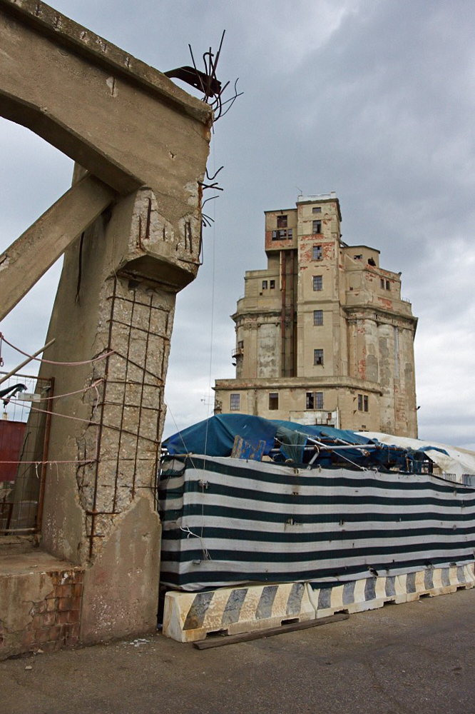
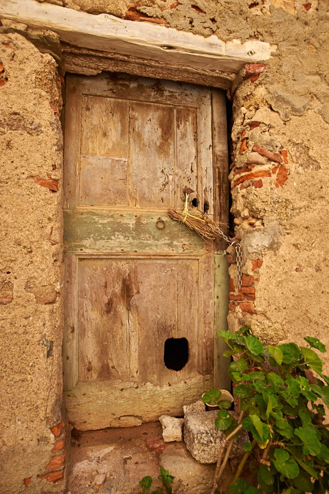
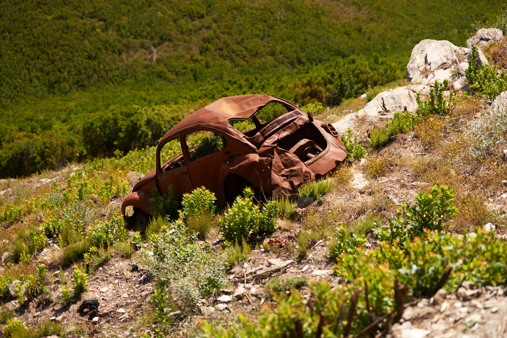
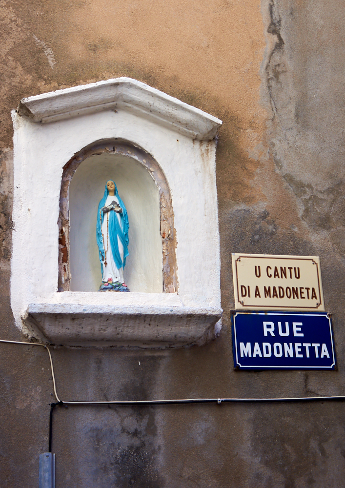
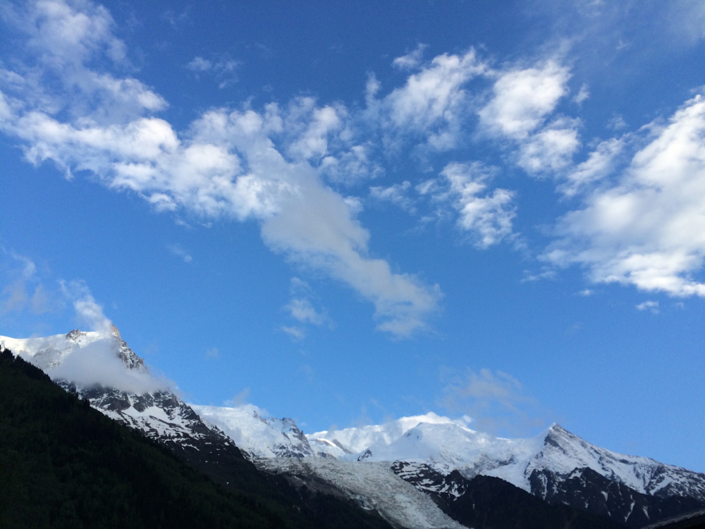
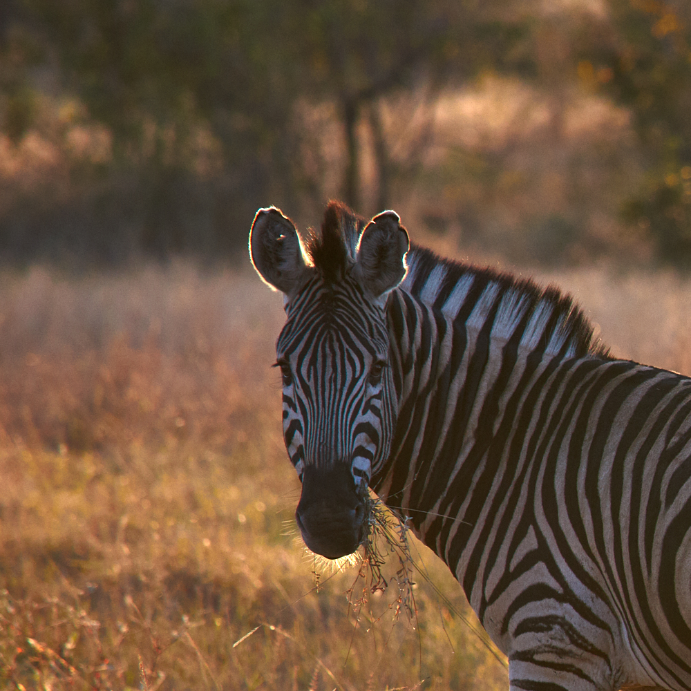
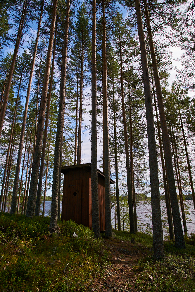
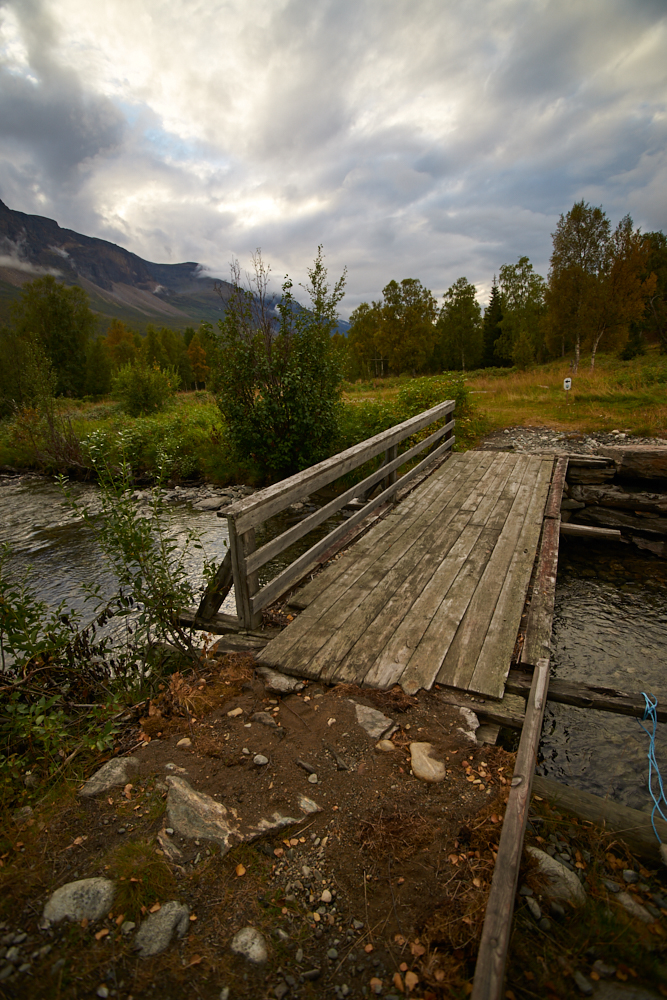
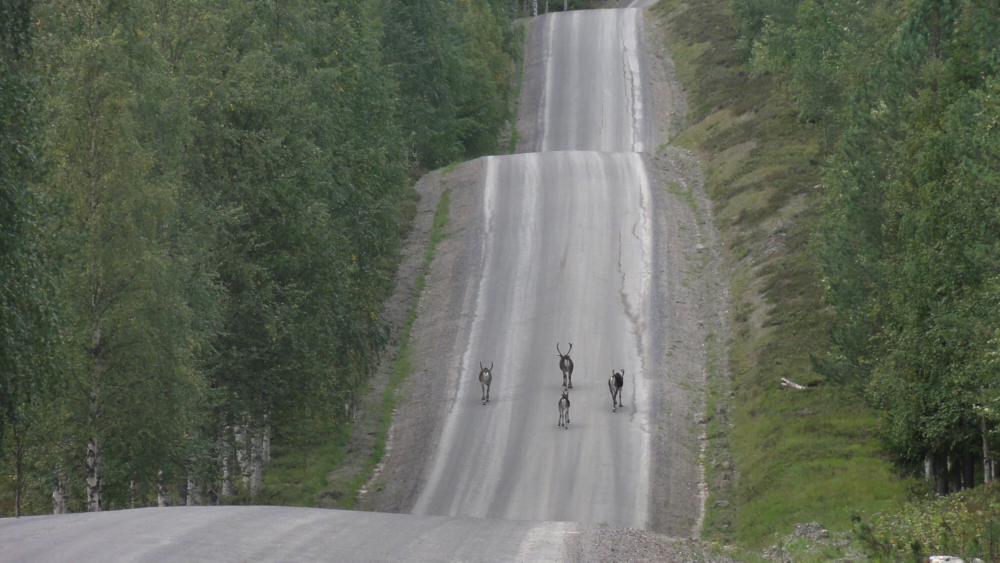
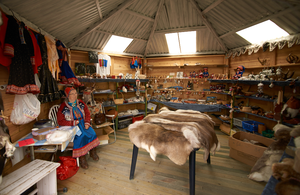
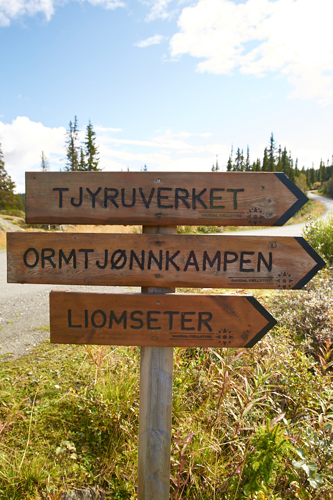
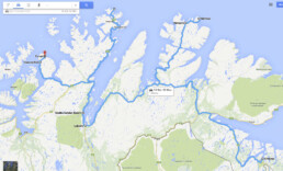
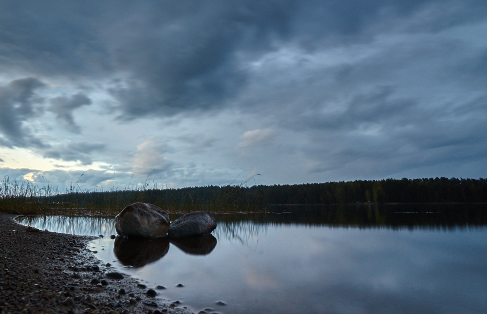
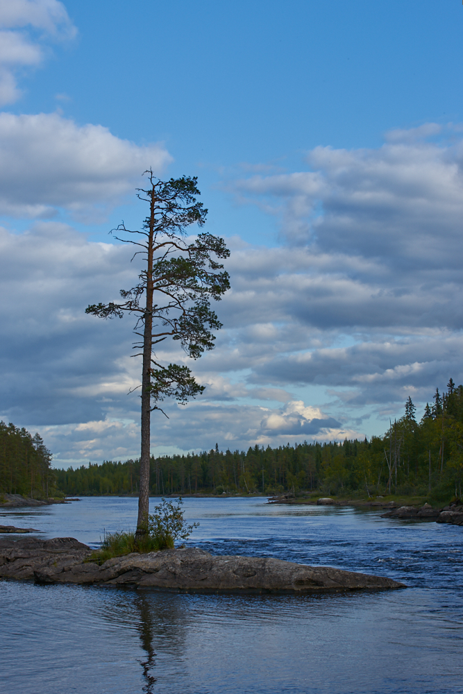
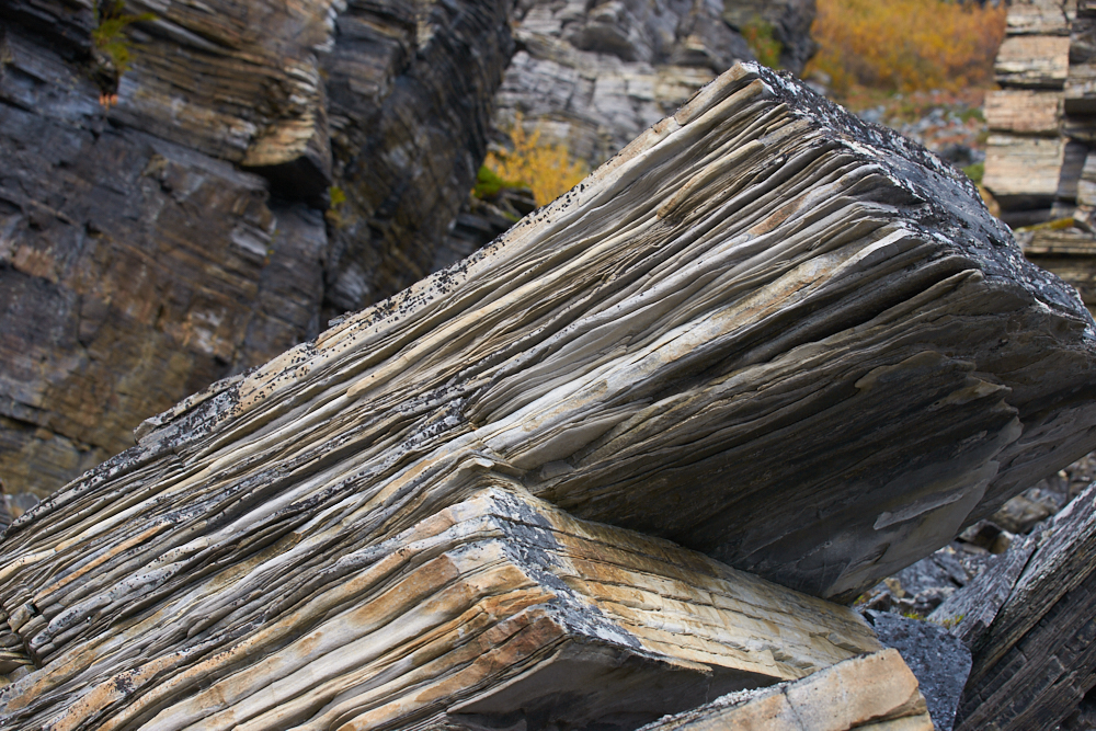
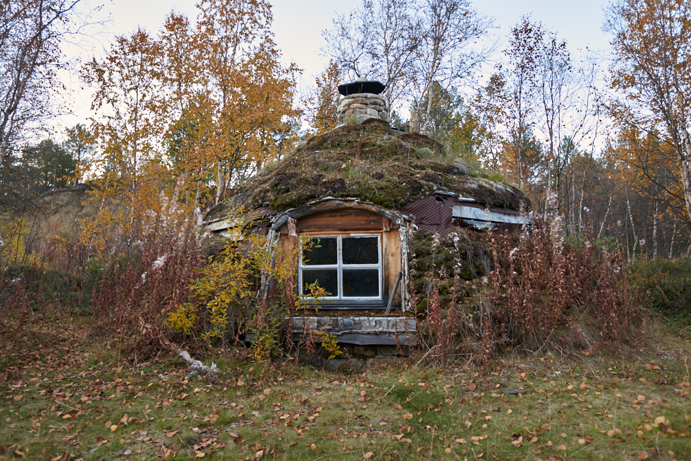
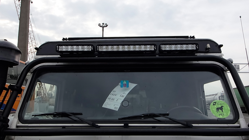
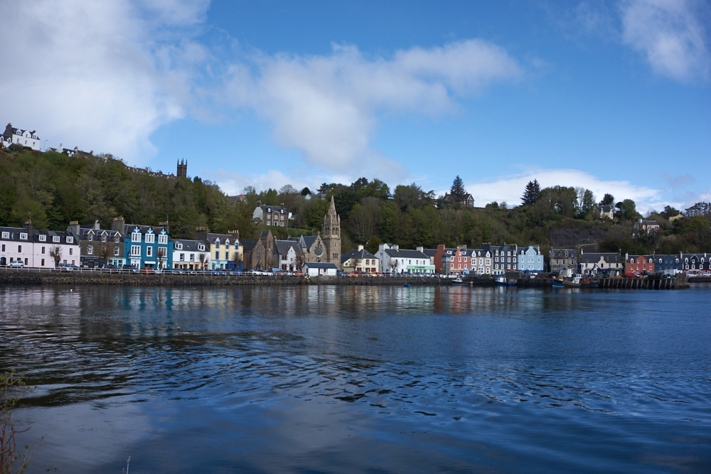
Occitania
Occitania
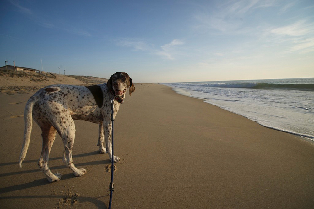
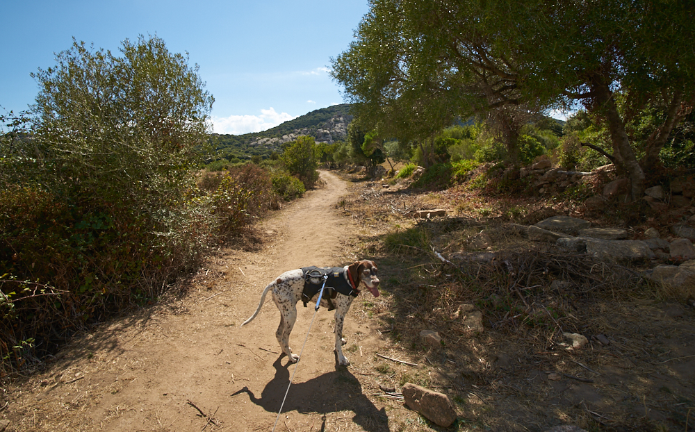
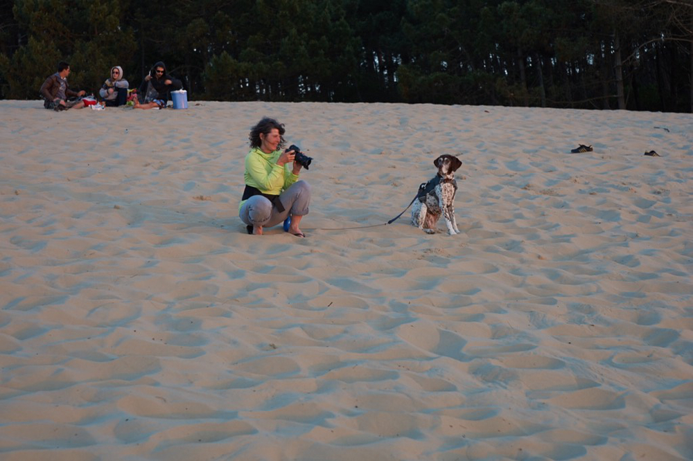
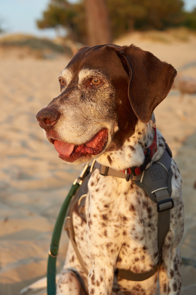
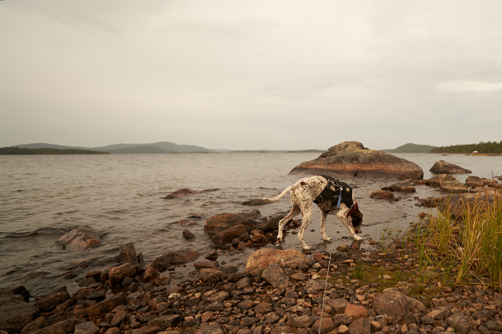
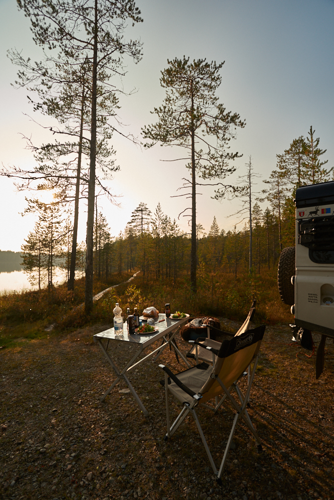
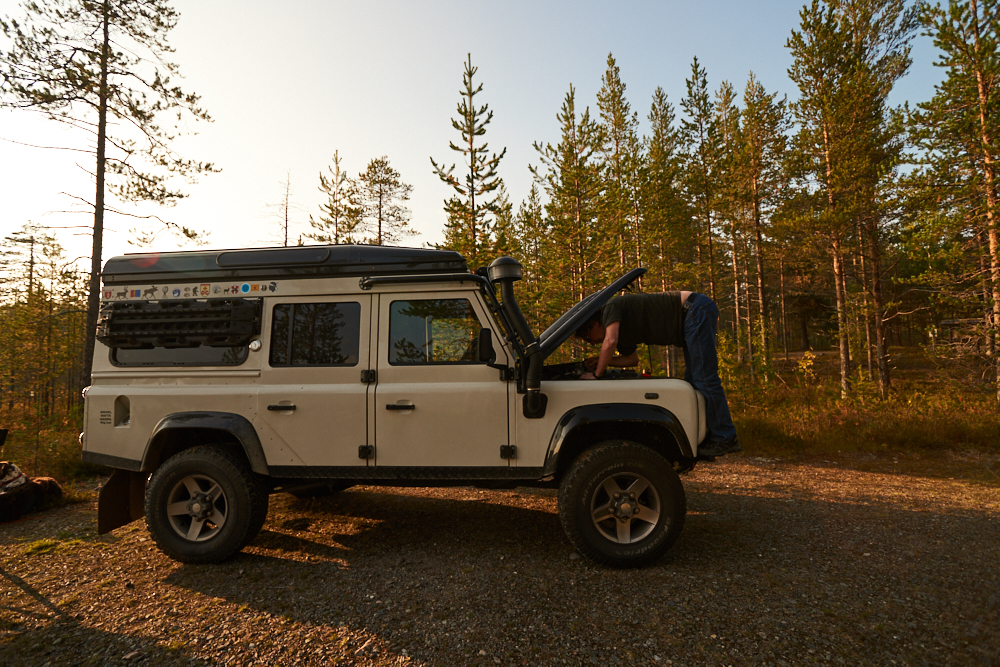
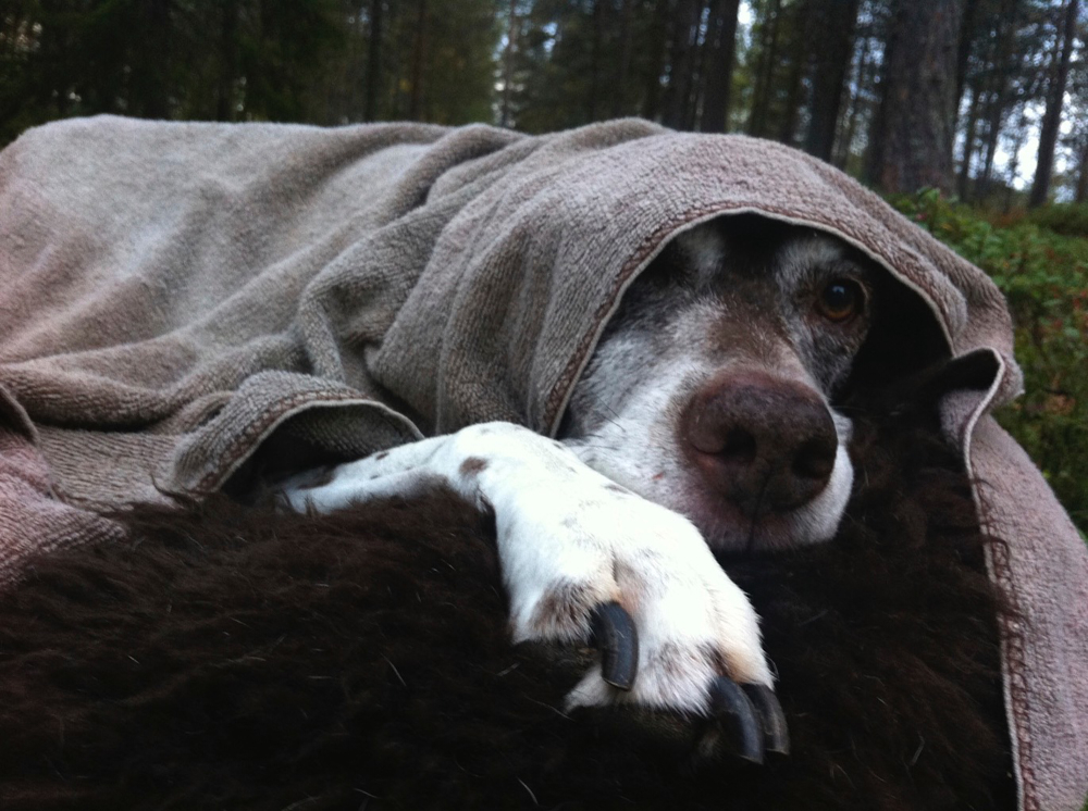
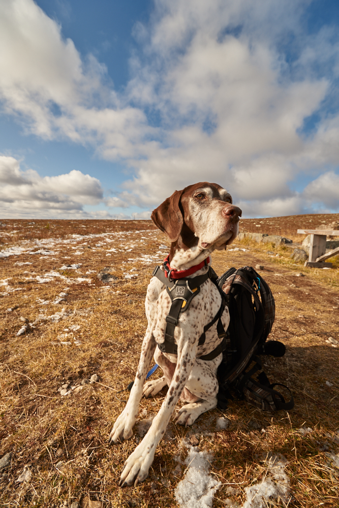
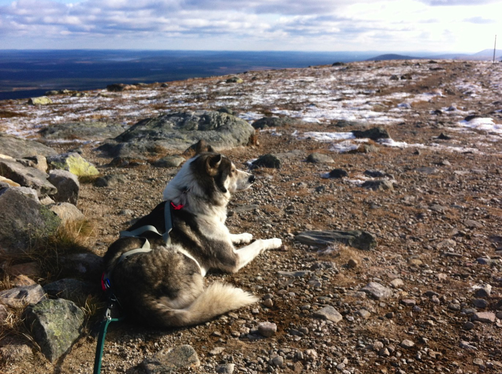
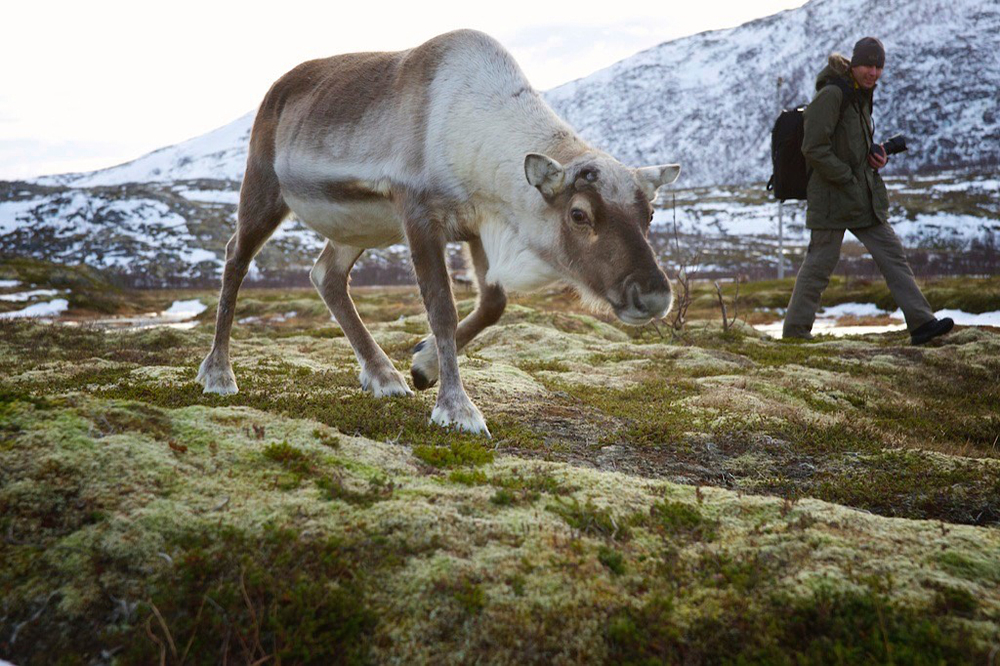
We just wanted to find out if our dog Jade -called „Sause“ would be happy to travel with us in the Land Rover.
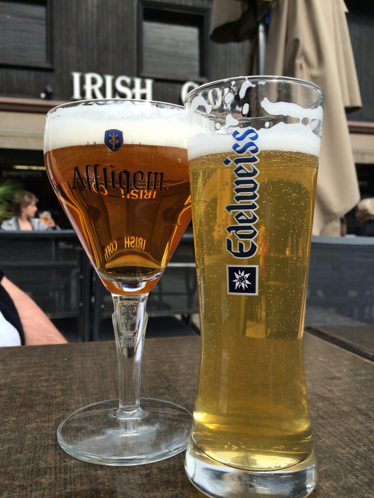
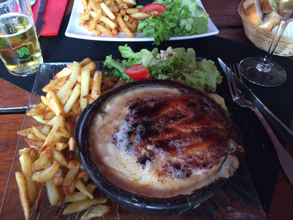
„Oceansausen“…. cause Sause has never seen the ocean and we have never seen Carcassonne and then there also is the wine….. How can you do this in five days?
With a trip through: OCCITANIA
In 5 stages we did about 1‘680 miles
Stage 1:
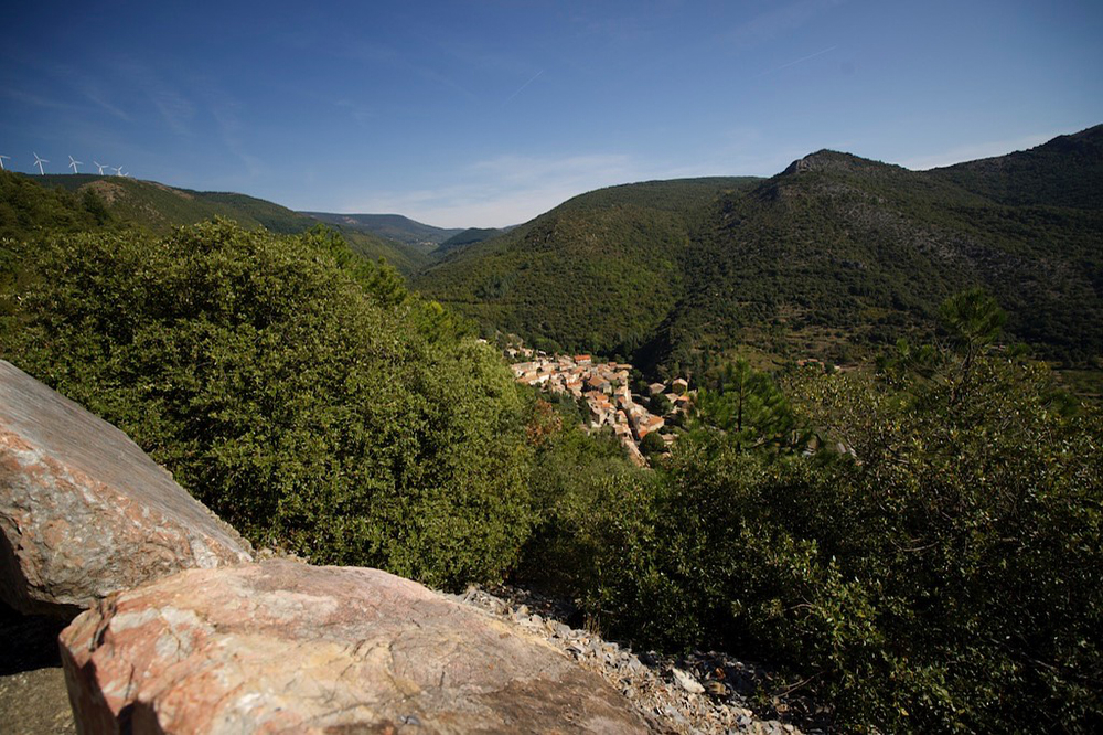
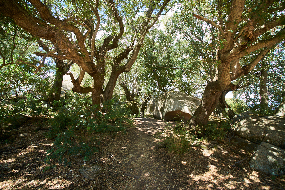
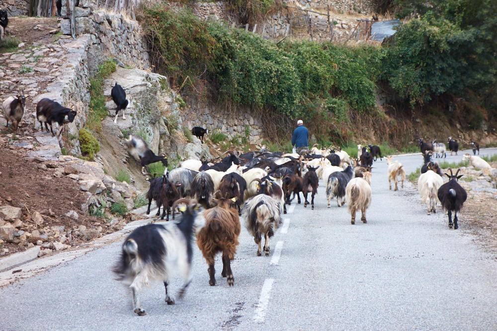
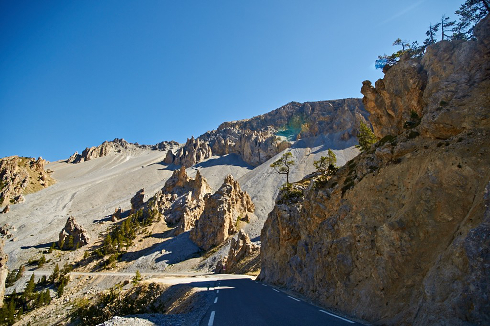
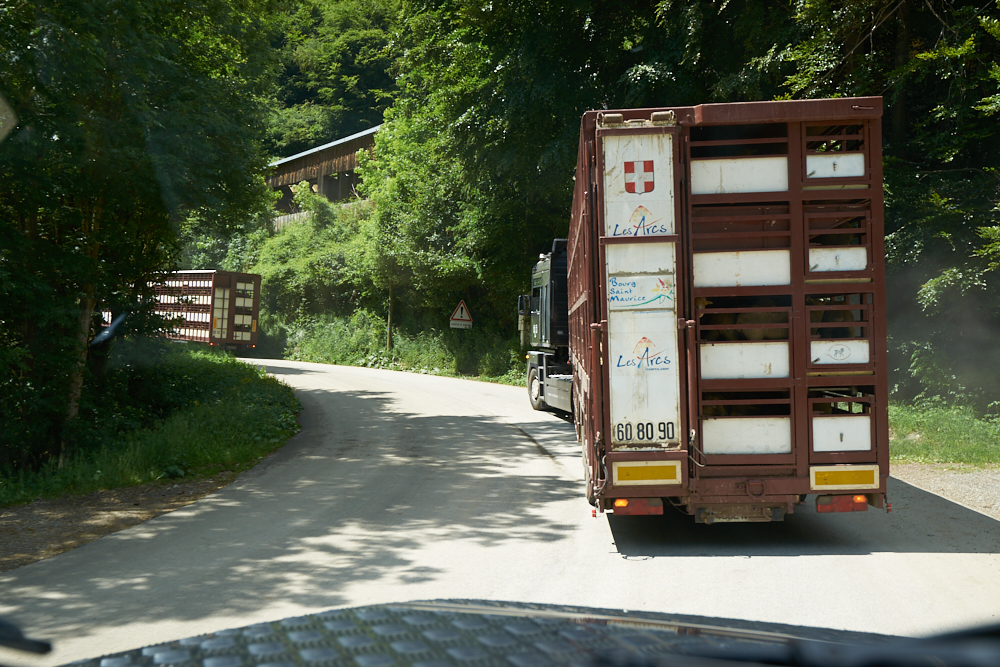
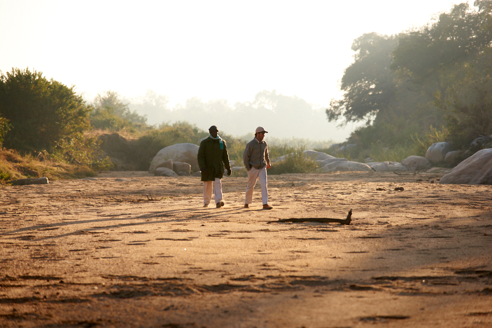
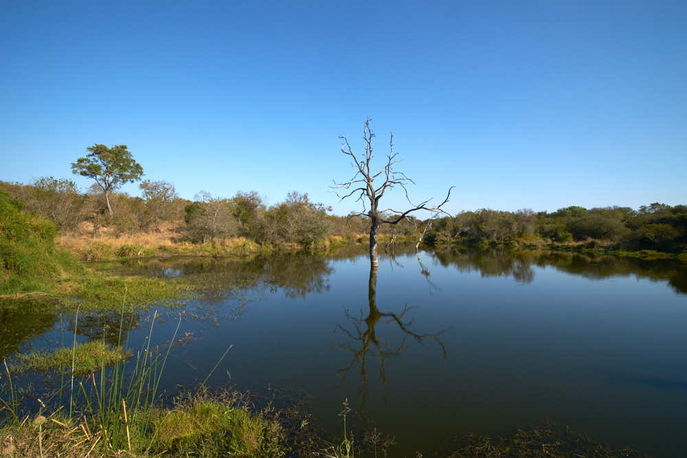
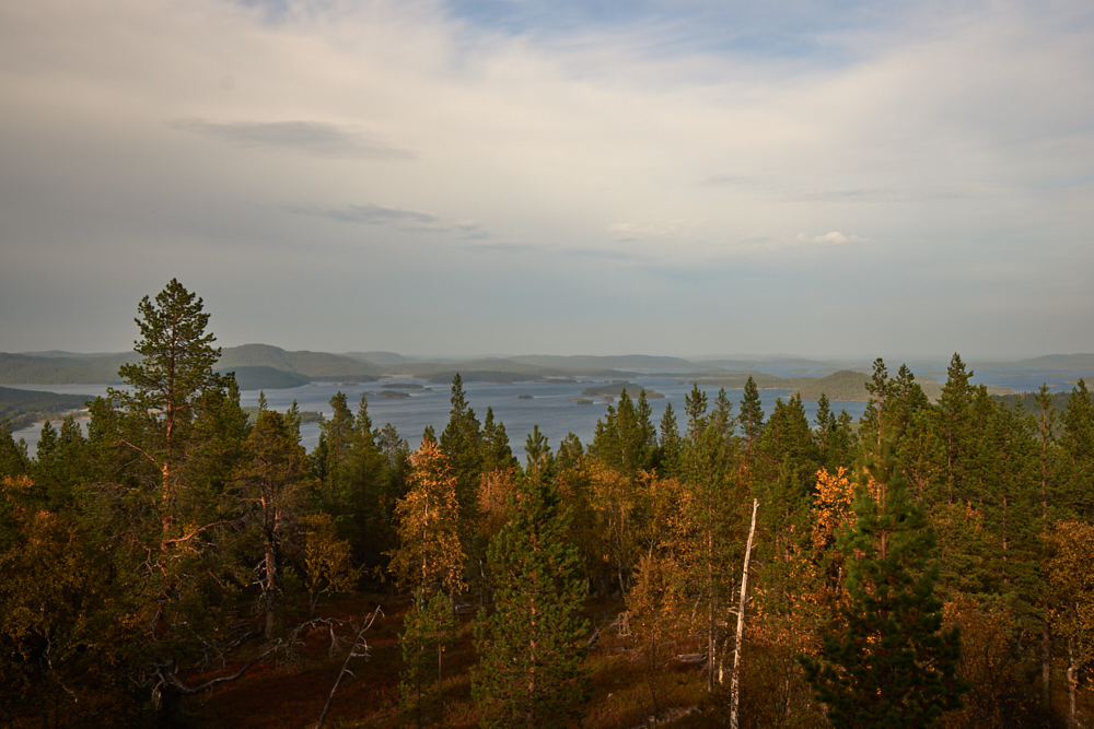
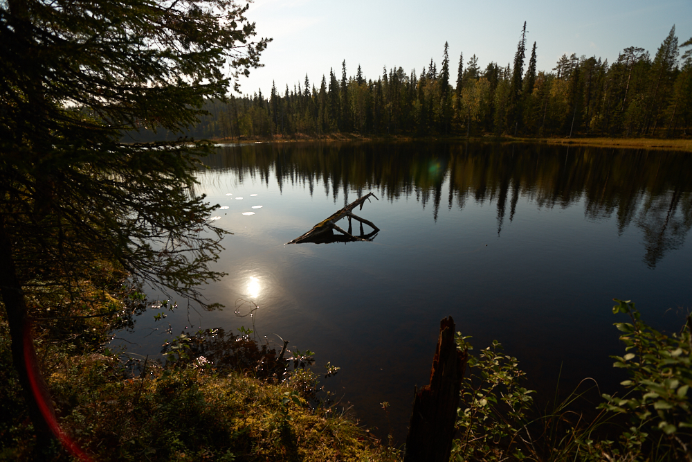
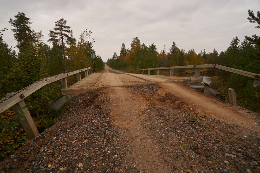
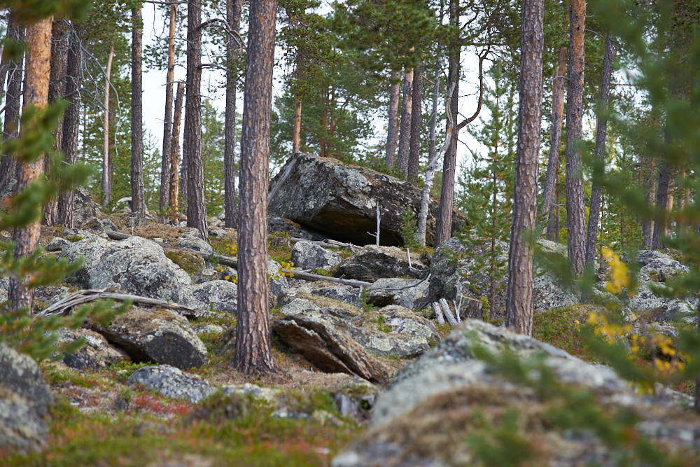
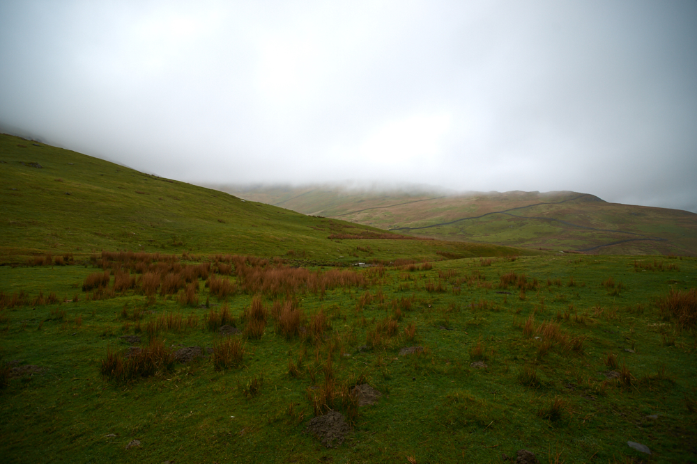
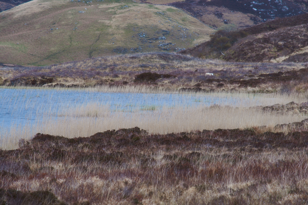
From home on the FWY – Narbonne-Sud, road N° D 6009 direction Perpignan – D 611 into the hills of Corbières (wine county)
Stage 2:
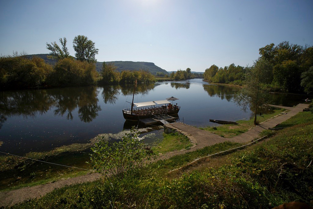
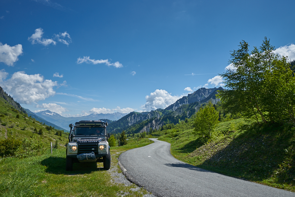
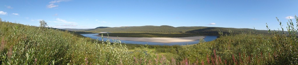
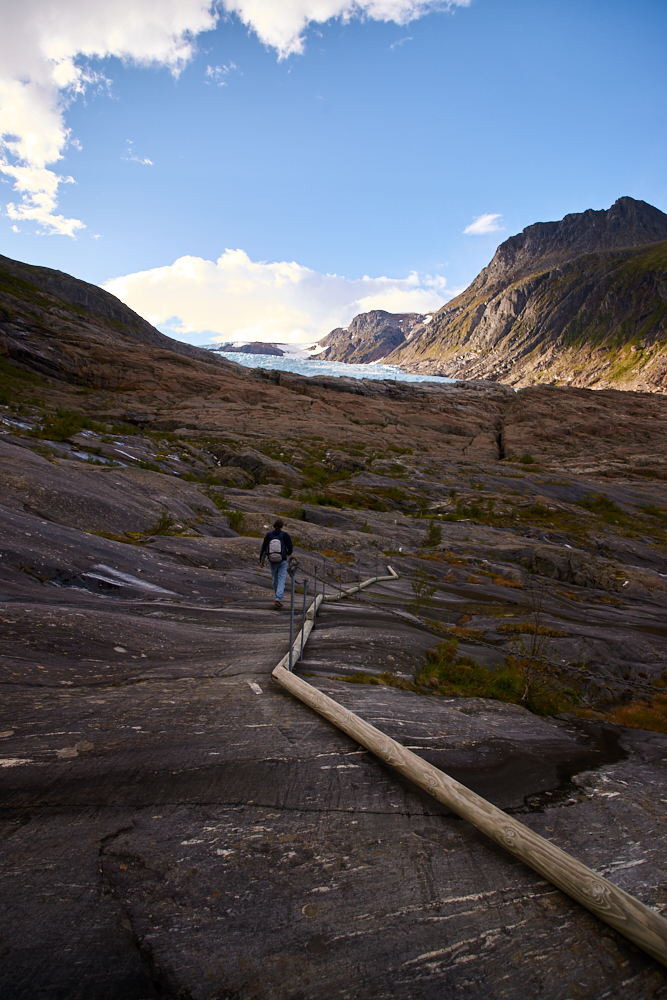
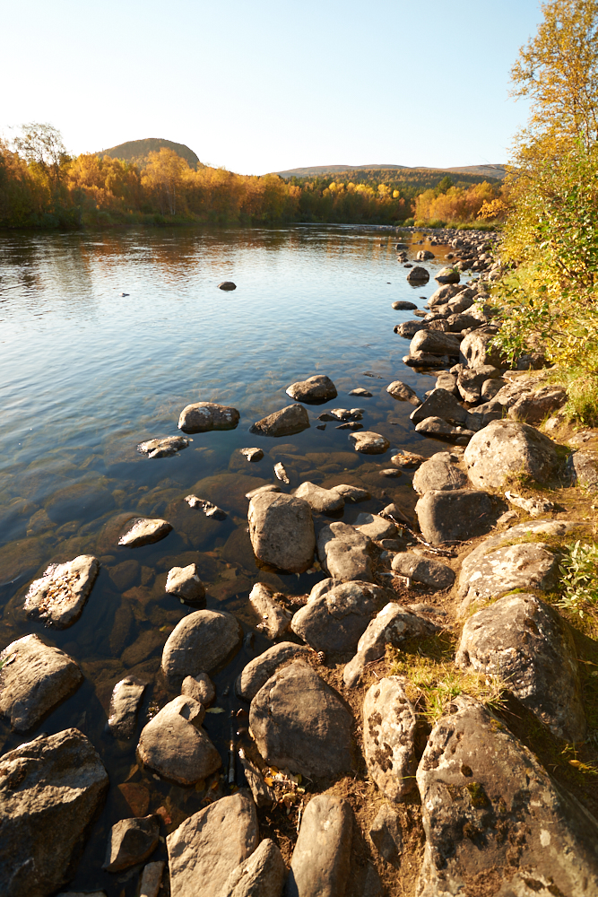
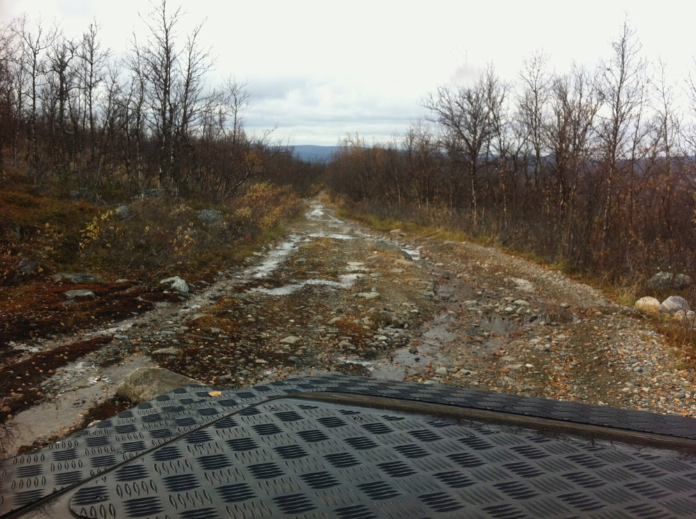
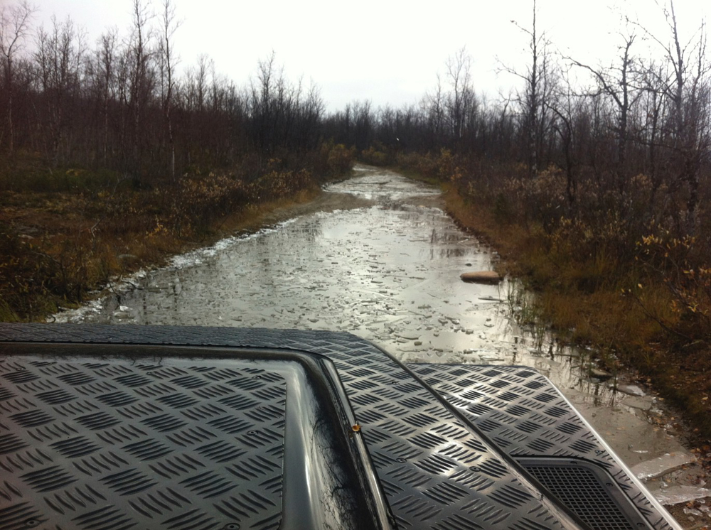
Through the hills to Carcassonne – D112 into the Minervois wine county and the Montagne Noire (black mountains) – Mazamet – Albi – south of Figeac into the Val de Lot till St-Cirq-Lapopie
Stage3:
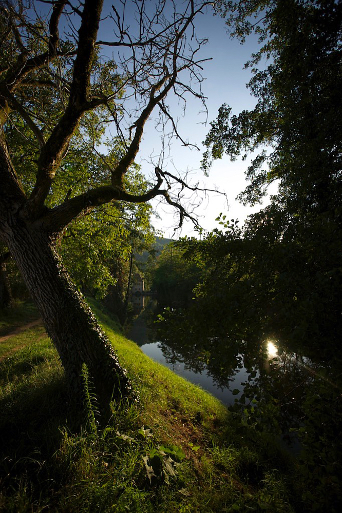
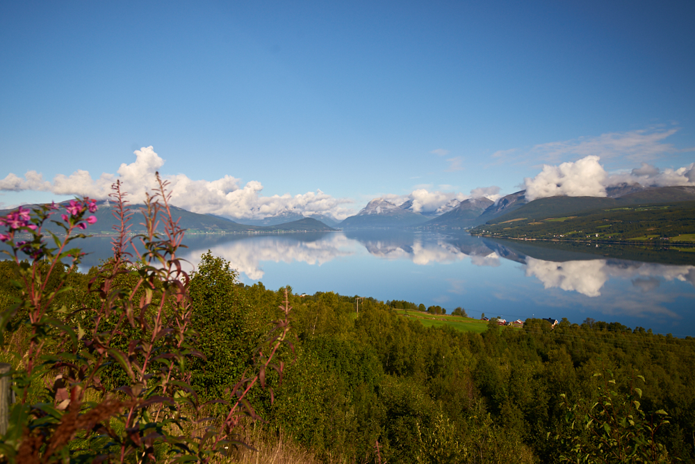
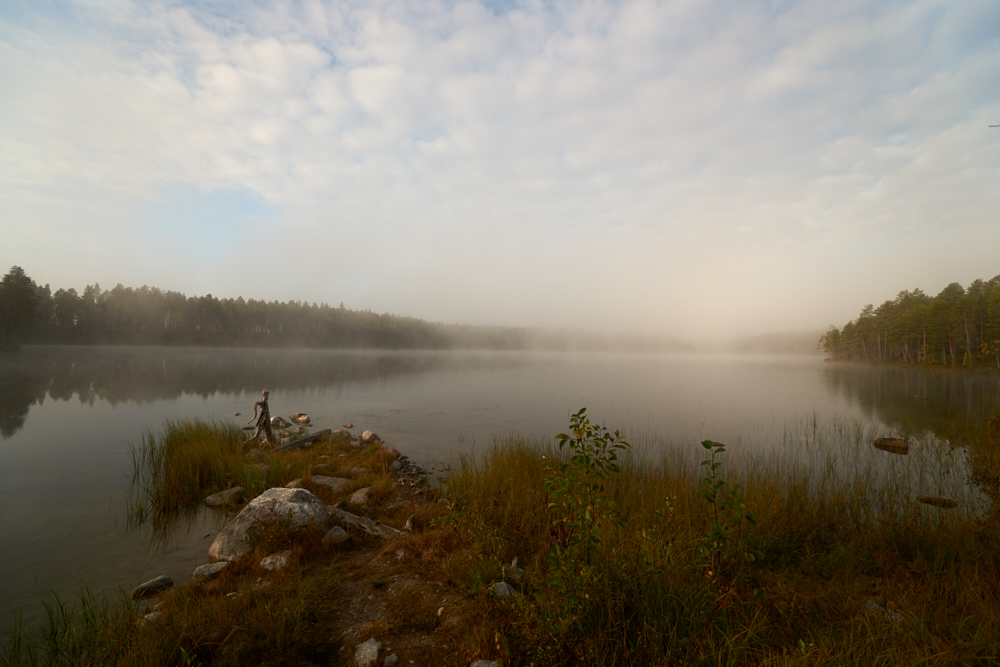
Along the Lot river – Cahors – Crayssac – D9 – D8 – Fumuel – Eymet (Dordogne) – via D16 – into the Bergerac wine county and its villages Monestier, Thénac, Saussignac –
St. Foy-la-Grande – FWY via Bordeaux to Carcans-Plage (Oceanside)
Stage 4:
FWY to St-Foy-la-Grande – Montbazillac – Bergérac – along the Dordogne river passing the „Périgord Noire“ – Beynac-et-Gazenac – Souillac – FWY A20 north – A89 east – Eglétons till Domaine du Mialaret (Camping)
Stage 5:
straight home on the FWY
Places of interest:
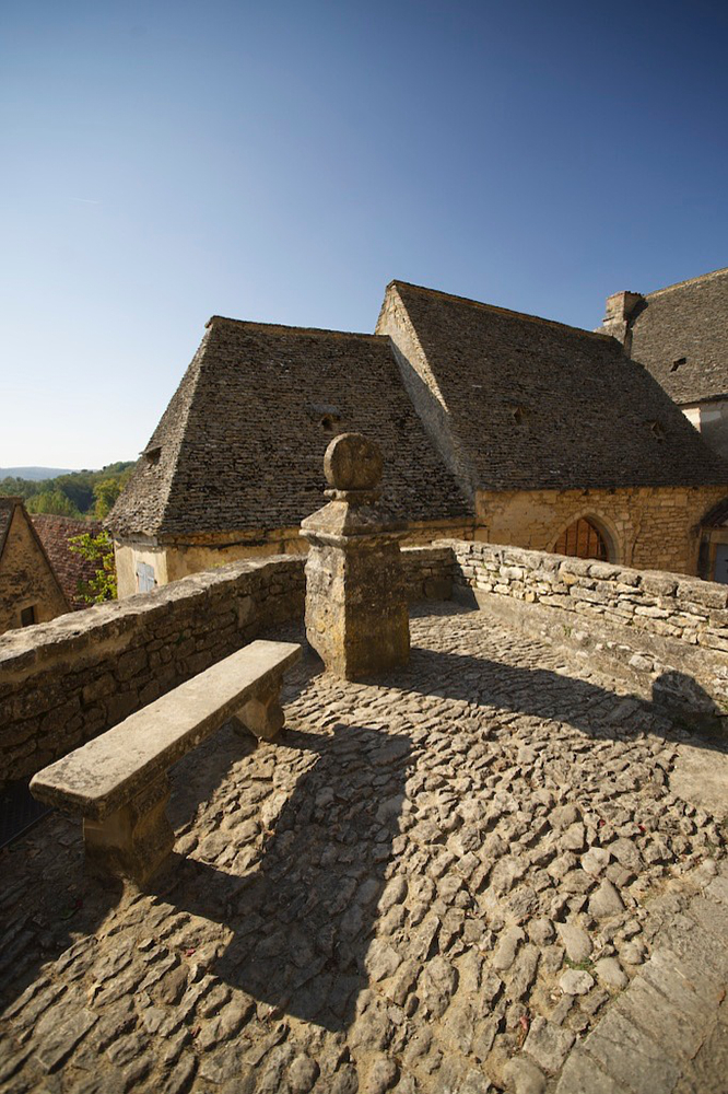
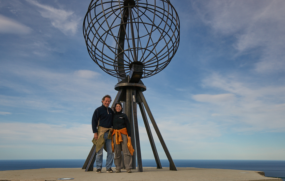
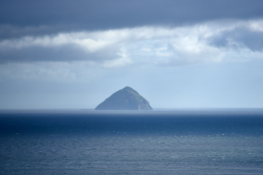
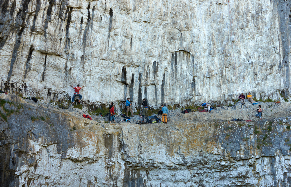
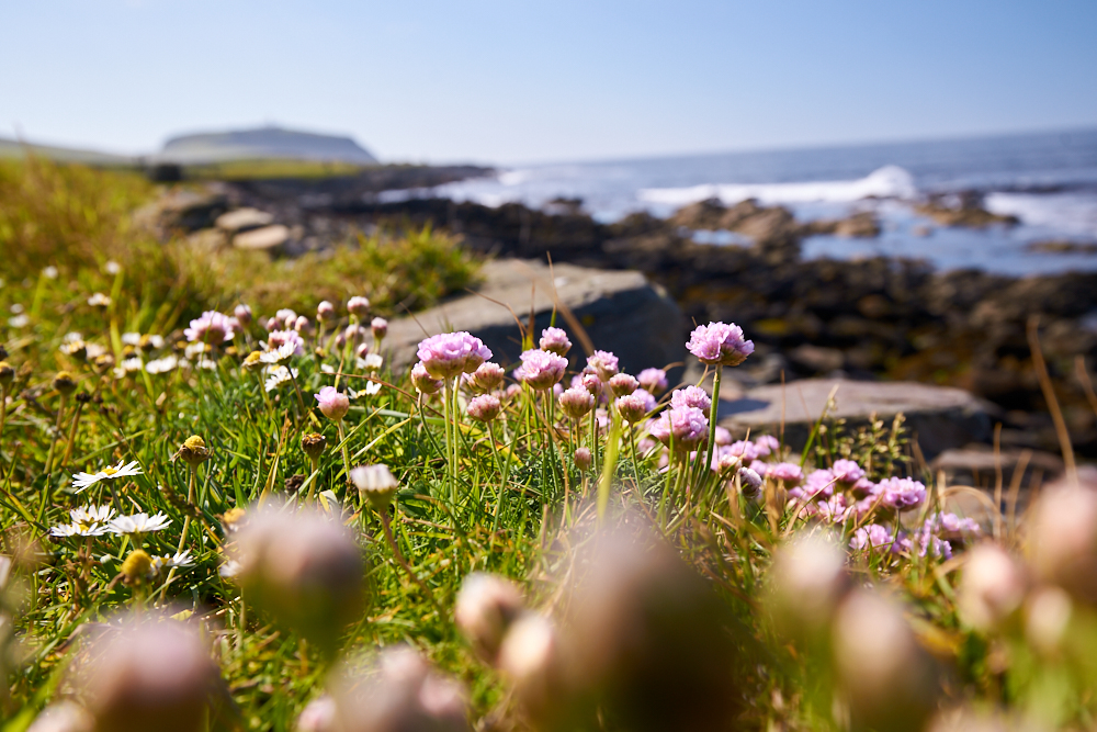
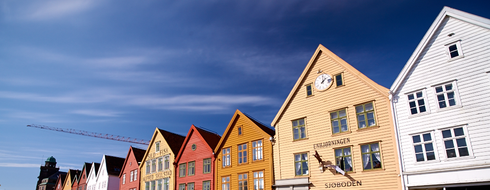
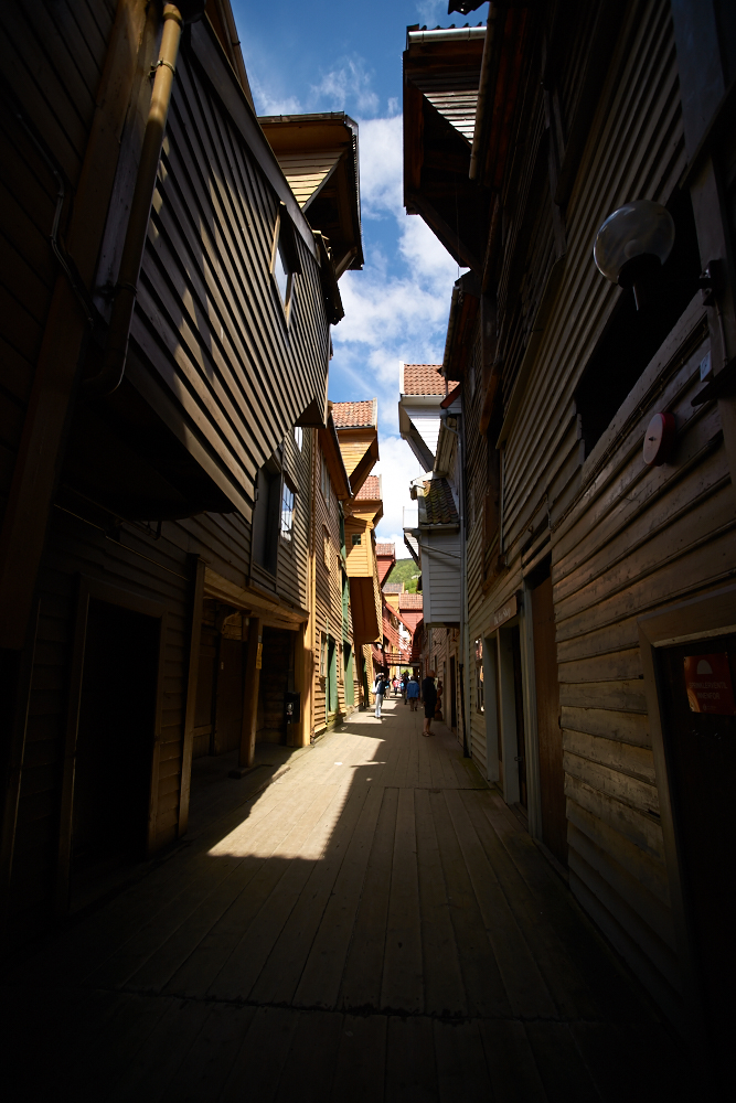
- Carcassonne in the morning before the tourists arrive. There is no problem to park with over height off roaders or campers on the parkings outside the old town (only 5 min. walking distance)
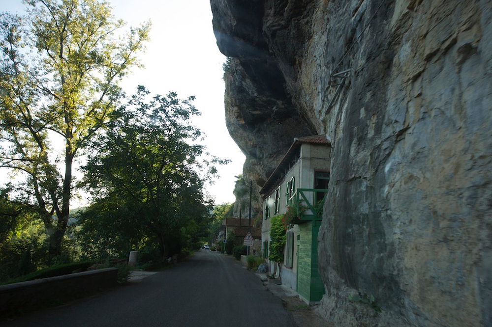
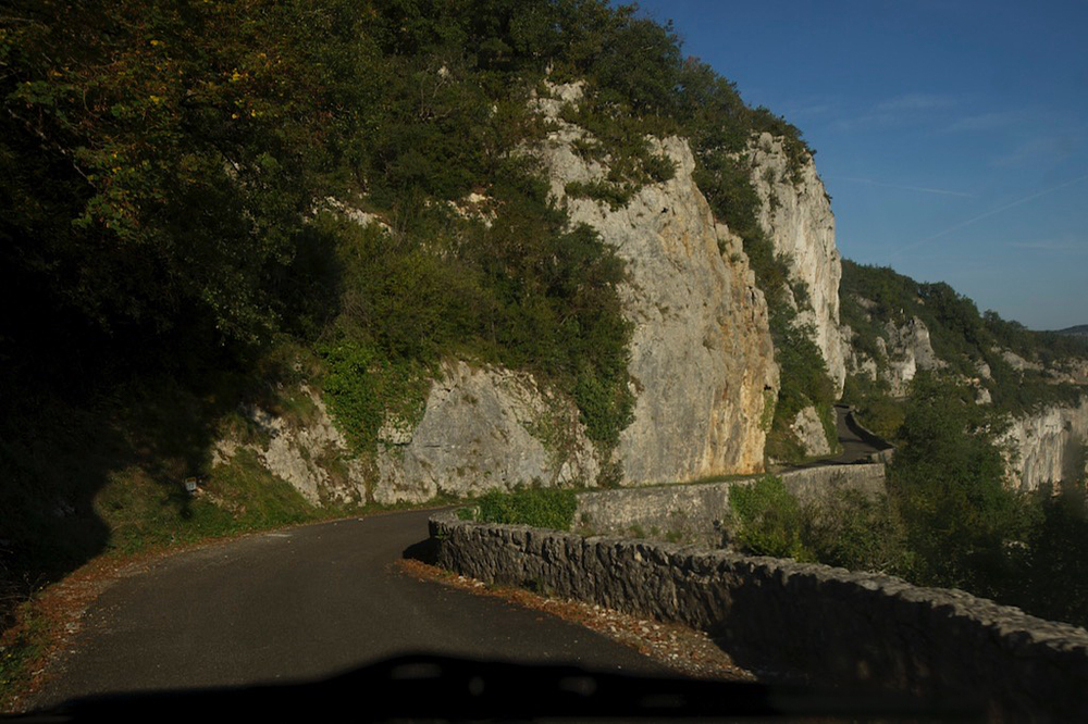
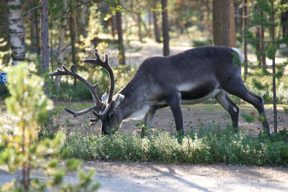
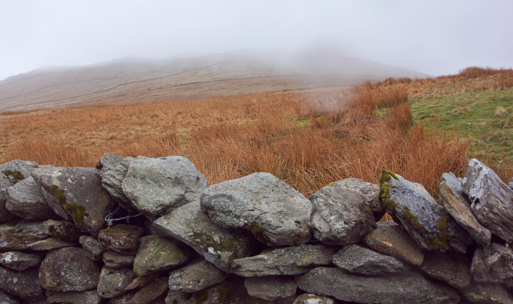
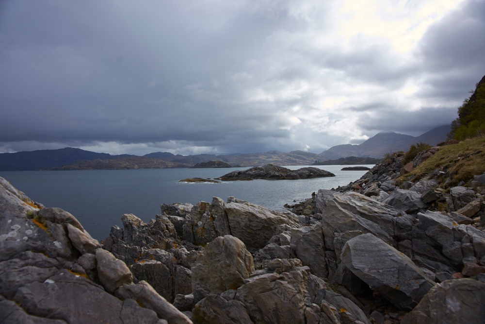
- The „black mountains“ – prolongation of the Cevennes mountains west. Very narrow roads!
- Along the Lot river between Figeac and Fumuel. (D9 sometimes max. 6.5 ft wide – D8 the bridges over the Lot river are very narrow and there is a weight limit. NO problem with the Land Rover – bigger YES!)
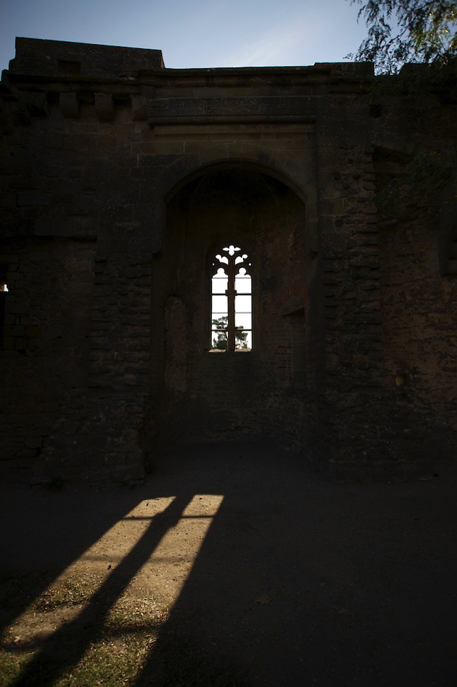
- Along the Dordogne river and the Périgord Noir. This region was not unknown to us and we didn‘t visit Sarlat this time. But Sarlat is a place to see, specially the old town with its gas lights at night and its excellent restaurants and bars. This town kicks you back into the middle age!
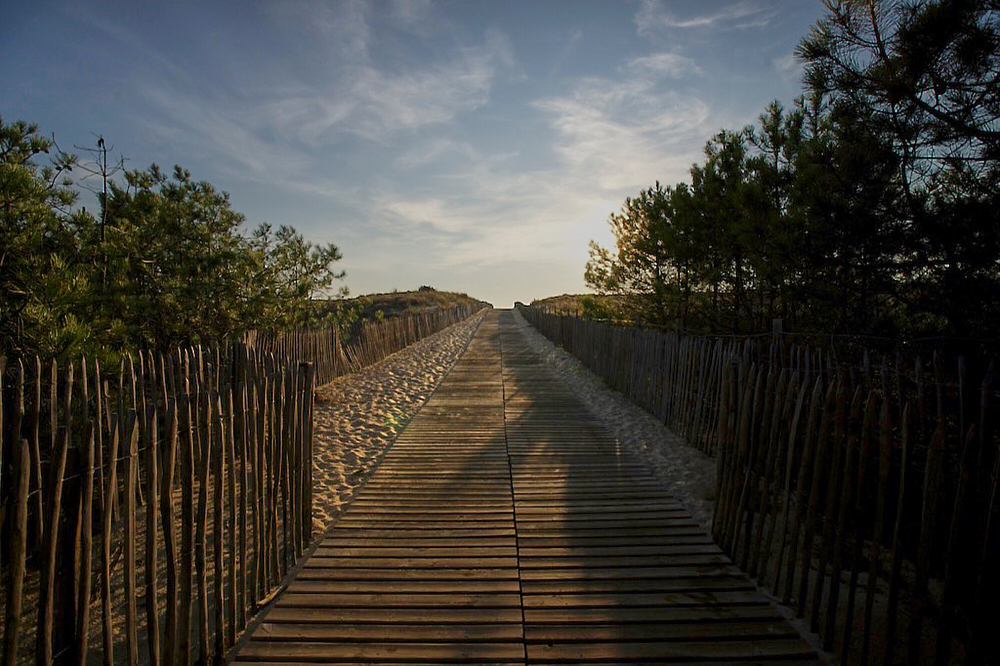
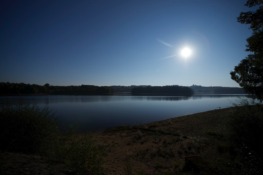
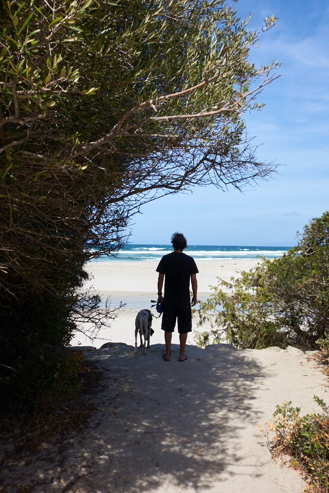
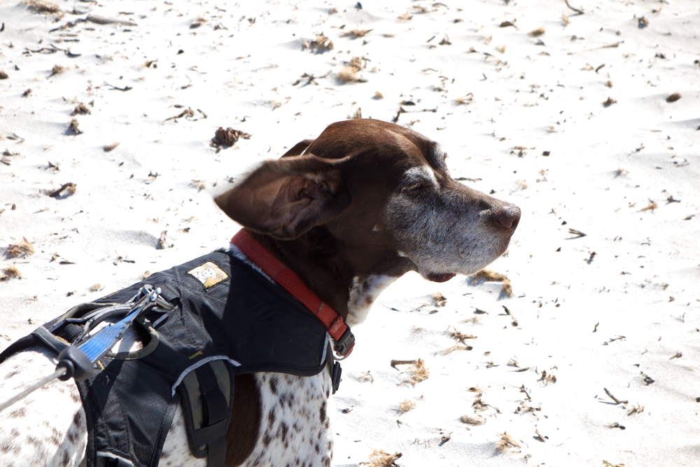
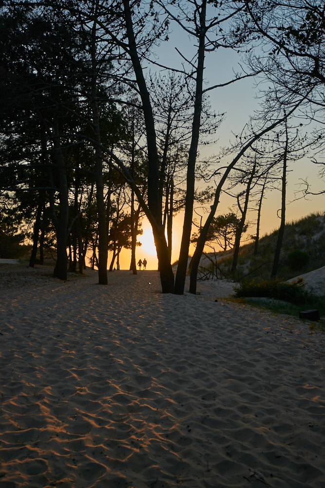
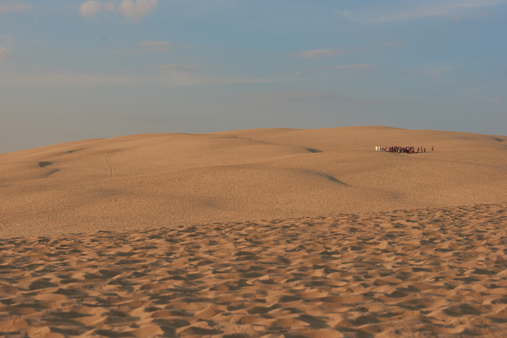
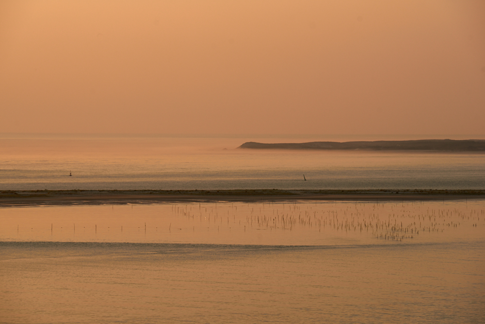
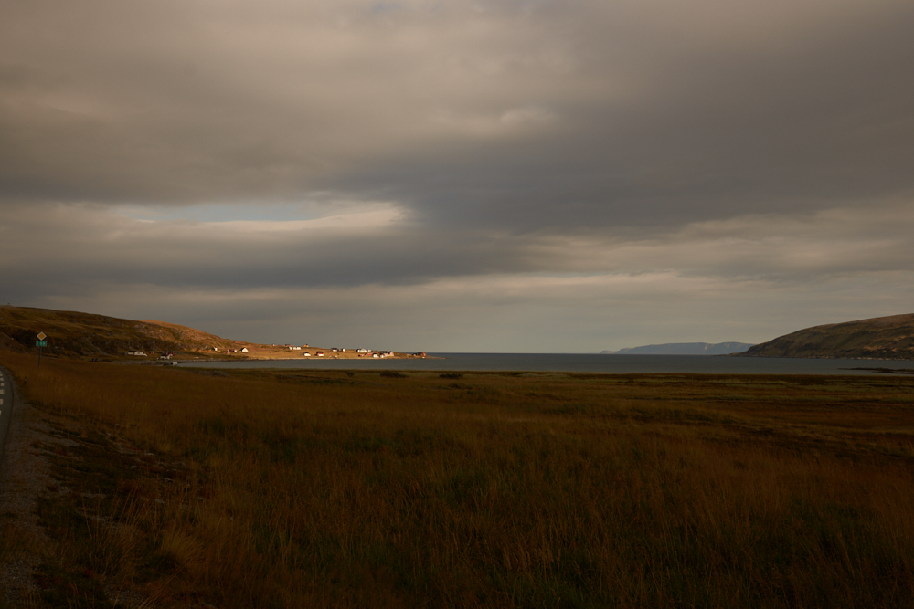
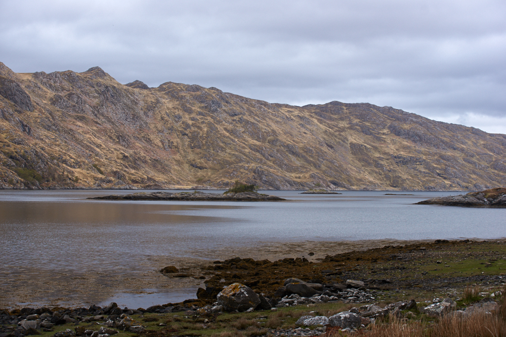
Carcans-Plage:
off season = Restaurants closed. Beach empty!
Camping ok – no fires outside – no barbecue = at this time of the year with sunny weather means cold kitchen……
„Oceansausen“: Sause thought she could eat sand like snow…..
Conclusion:
We come back to Occitania, heading south, passing the „land of Cathars with its castles“ criss-cross through the „Basque Country“ destination Biarriz .
click on the pic


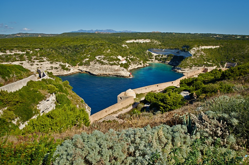
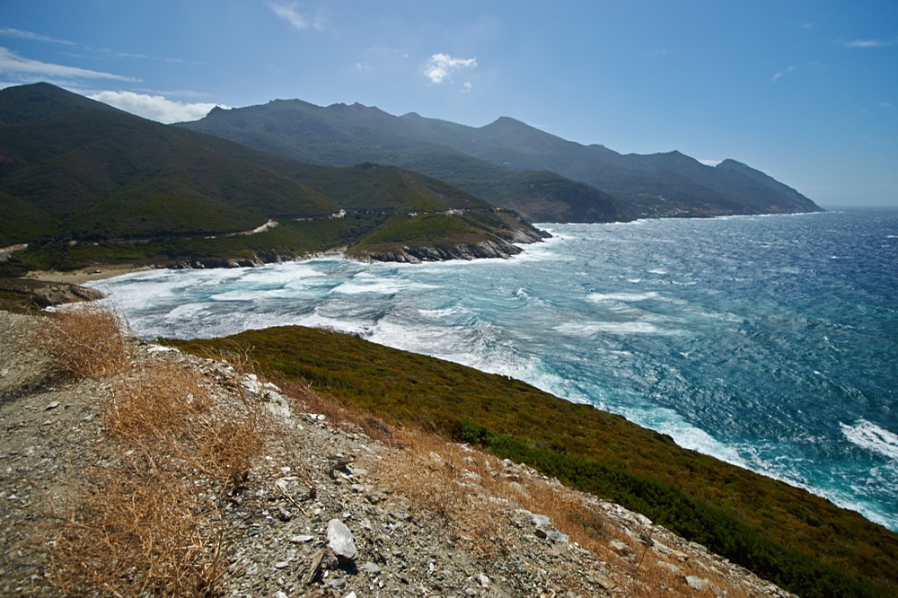
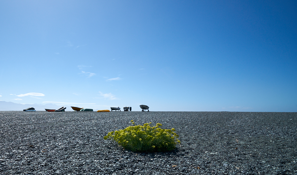
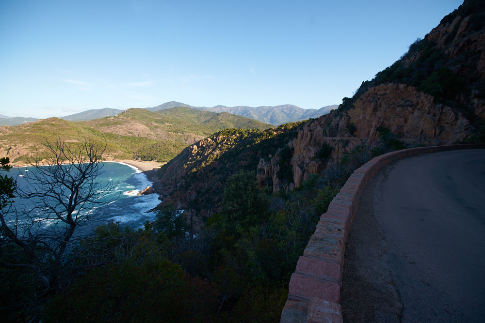
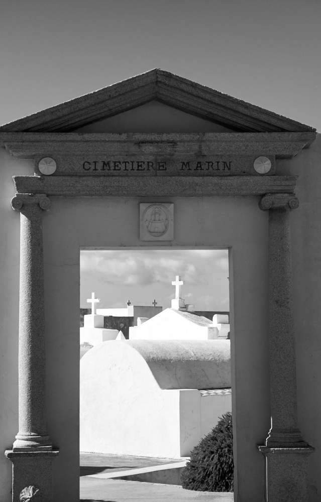
Corsica
Corsica
It was time to take the Land Rover out for a drive again.
Corsica was scheduled – 8 days on the island and back home through the French Alps. As always, everything was planned at home, incl. different tracks (thanks to www) . As always, things came a little different….
In 12 days we drove (only) 2’720 km , that’s Corsica.
Day 1:
HWY to Livorno and ferry to Bastia. Overnight stay on the lovely Camping La Pietra at Pietracorbara ( D80 north direction Cap Corse).
Day 2:
As a little Appetizer the “Sisco Track” via Saint Jean to the west coast of Cap Corse was planned. Then further on to the Desert des Agirats. We started at Pietracorbara on D80 south, just a few km, then on D32 into the mountains to Sisco where we missed the entrance to the Track. A little further, D32 mutates into a mountain footpath. Good to have a maneuverable vehicle…. We found the junction to the track on the way back but it was closed with a chain and a sign: “piste fermée”. The view was magnificent. We lost 1 hour but it was worth! So we changed our plan for the first time: D80 round Cap Corse – Plage d’Albo – Nonza – D81 direction “Saleccia Track” for camping. Unfortunately the entire Desert des Agirats was closed due to heavy winds and fire hazard so we had to stay at St. Florent – Camping Kallista.
Day 3:
Because of the strong wind, we decided to round the island in the opposite direction as originally planned. Means east coast first. This is not a bad idea for co-drivers suffering from vertigo ; ) On D81 – D264 to the Etang de Bigulia – N 198 south to the Camping Riva Bella. A very beautiful site, directly on the beach, far from streets and other noise. The only thing about this site: you might “leave your hat on” (Joe Cocker).
Day 4:
Track day today ! On the beach as well as inland – N198 to Aléria – south of Aristone on D144 to D444 (track) – howee, the entrance to the track between sea and N198 was restricted to 2.20m height with a barrier (couldn’t drive around it ) – think positive – there was more on the daily schedule. N198 south to Favone – D168 – Tagliu Rossu – D168A cascades of Cavu. The entry to the “Fôret Hospedale” was plastered with prohibitive signs and the track along the Cavu river was closed with barriers. The lovely plunge spots were crowded like “Sundays on the beach” – shit happens! – let’s go to Porto Vecchio – Sta Giulia – Rondaria – Camping La Chiappa. The places around Porto Vecchio are very touristic built up areas.
Day 5:
N198 to Bonifacio – what a nice place! On N196 – D48 – D48A to the “standing stones tour” – wild boars included. – back via Sartène – Propriano – D157 – D155 to the Plage di Cupabbia – no camping! – D155 and D55 to the simple but lovely Camping La Vallée Verghia near the beach “Plage de Verghia” – art of corsican food in the evening at the little place on the beach.
Day 6:
D55 – N196 – D3 – D27 – Bastelica – Col de Scalella – N193 – Corte (no dogs at the Citadelle) – rain! – further on to the Restonica Valley – D623 end of the road at the “Bergerie” and back. We canceled our hike to Lac Melo because of the weather. D18 – D84 – Calacuccia – Col de Vergiu – Evisa – to Porto, Camping Funtana a l’Oro.
Day 7:
D81 north along the west coast to Galéria – D351 into the Fango Valley. We hiked from the end of the road to a lovely plunge spot in the river ( about 3 hours). Then D81 – D81B to Calvi. Camping La Pinède – Storm!
Day 8:
Track day today! N197 – Lumino – D71 – D113 – our location: Track near Lac de Codole – “sous peine de……” barred to traffic – D83 Ille Rousse – N197 – D81 – 2nd attempt to the Desert des Agirats – the Saleccia track was open cool! One understands La France – today there is more wind than on our first attempt…. We don’t talk about Ghignu, we are just happy. Due to the wind, we didn’t stay on the beach overnigth (there is a camping at Saleccia) so just a breath and back to St. Florent, Camping Kallista, we know that place.
Day 9:
Our last day on the island. D81direction Casta – D62 San Pietro di Tenda (chasse à la corse) – D162 – D5 – D82 – Défilée de Lancome – N193 – Bastia – D80 – we found a track: Pietracorbara – Cagnano on D32 ( yes, the mountain footpath from the 2nd day mutates again back to street – track – street) – D180 Col de Sta Lucia – D80 round Cap Corse from west to east -a stopover at the butcher’s shop at Macinaggio was planned but the timing was wrong….Camping La Pietra at Pietracorbara.
Day 10: (French Alps)
Bastia – Nizza – Mercantour – Col de la Bonette – D900 east – Col du Vars (attention! Marmots on the road in the evening ) – Camping La Rochette at Guillestre.
Day 11:
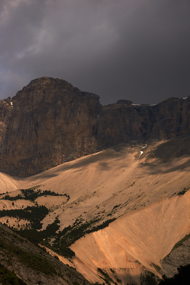
Guillestre – D902 – Combe du Queyras – Col d’Izoard – Briançon – N91 Col du Lautaret – D902 – Col du Galibier – D 1006 – D902 – Col d’Iseran ( Marmots on the road ) – Bourg St. Maurice, Camping Le Reclus
Day 12:
Col du Petit St. Bernard – D1090 – Courmayeur (Italia) – Chamonix Mt. Blanc – D1506 – Col de la Forclaz – Martigny -HWY back home
Roads & Tracks:
We’ve found the roads at Corsica as often described: narrow, bumpy, no or simple side rails but therefore with breathtaking views to the sea, to the depth of canyons, to the mountains. One exception is the N196 along the east coast between Bastia and Bonifacio (appropriate traffic). The Corsicans are quite excited on the roads but thankfull with a double honk, when one let them pass.
We found out that many tracks or forrest roads described on the internet, as well as tracks we have seen on site are closed to traffic by barriers, chains stones or signs. We respect these bans because we think that the result in “non respect”, contributes to more bans and restricitons.
Saleccia Track: A Sunday walk for the Landi – limited suitable for SUV’s ( washed out ) but it is possible to park a Land Rover in an “unconvenient position” on this track…..No, not our’s…..
Pietracorbara – Cagnano track from Lapedino: narrow track, SUV suitable, great view.
Travel season & Weather:
To avoid: July / August. Still now in September many tourists are on the road especially in towns. Nevertheless we always found a spot on campgrounds. Temperatures are nice warm but we had strong winds at this time of the year.
Flora & Fauna:
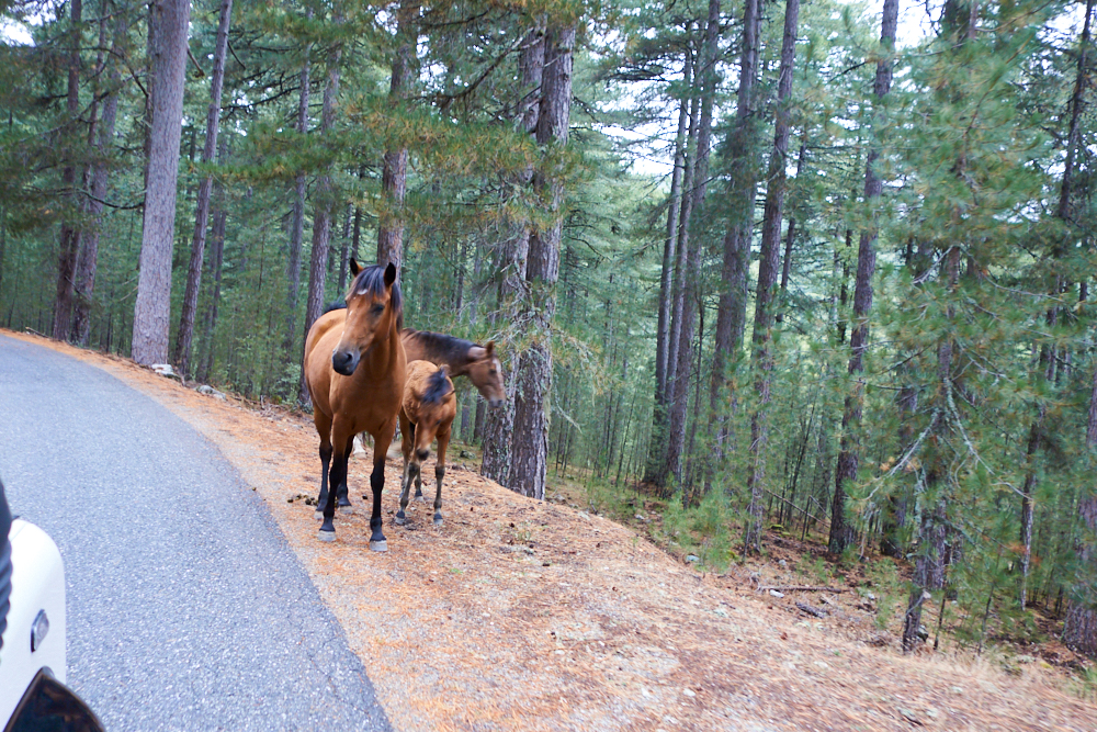
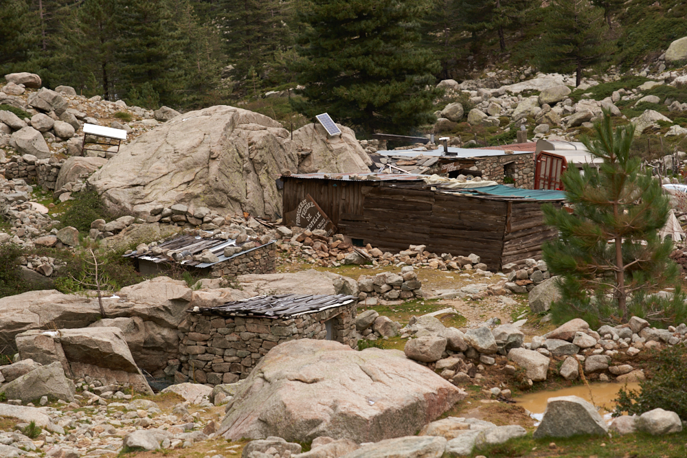
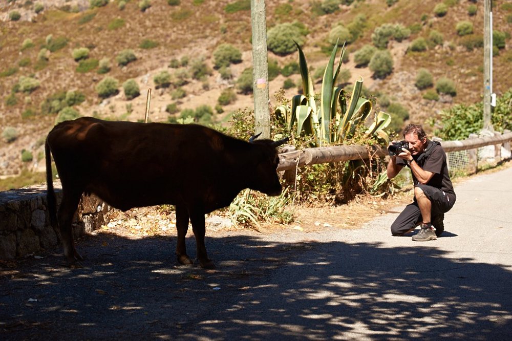
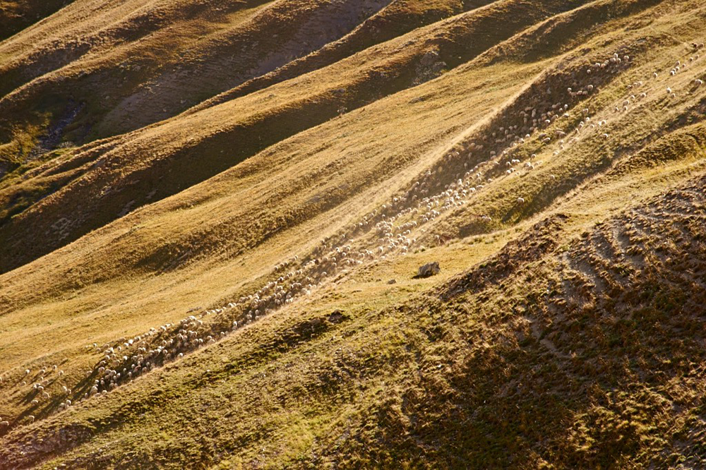
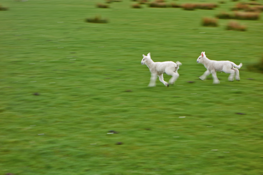
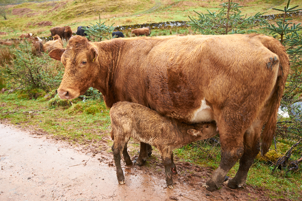
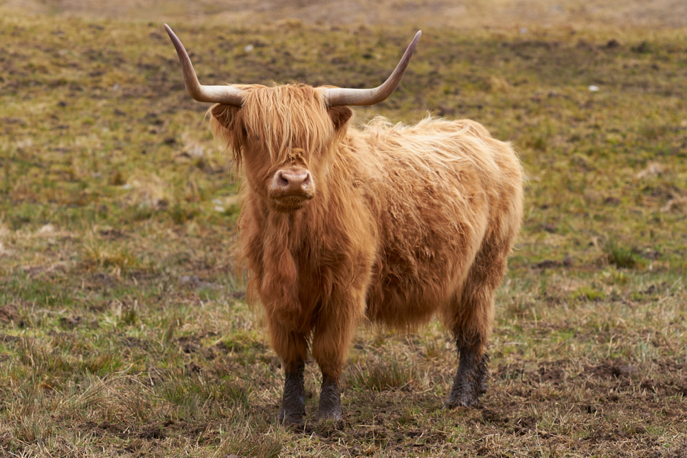
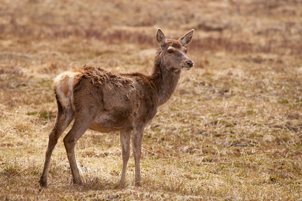
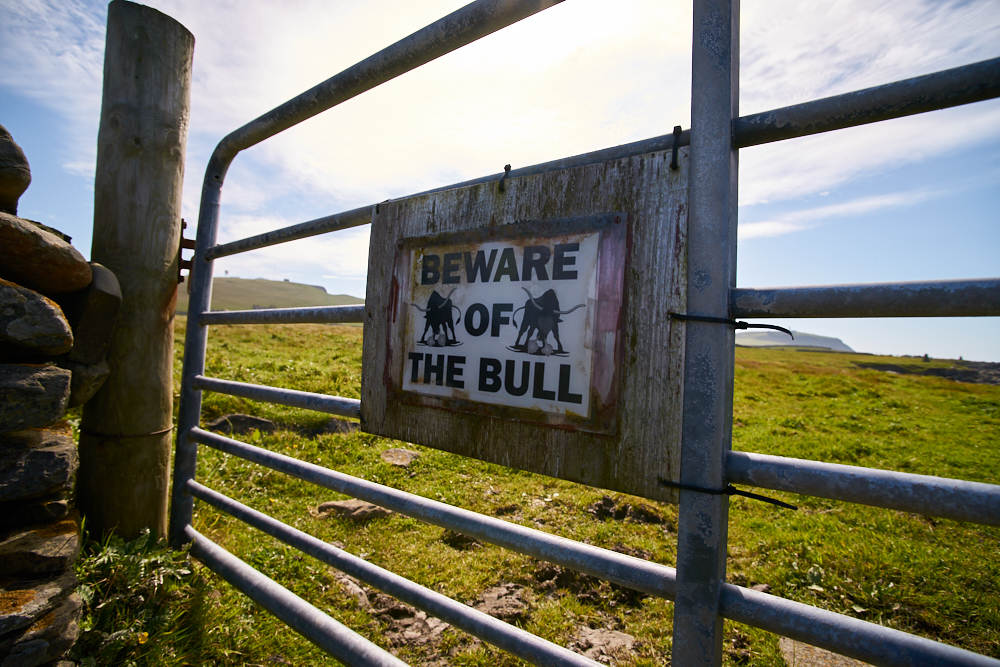
It was extremely dry even in the mountains. Therefore fire was strictly forbidden. That means you can leave your BBQ grill at home. The shy wild boars can be seen best while hiking. We could see one on our “standing stone tour”. The corsican black piggies can be seen mainly in the inland – on the roads or in the woods near Bocca de Verghiu. Same for cattle, sheep, goats and horses. Cattle sometimes on the beaches. The animals live in great freedom.
To see:
- Drive round Cap Corse ( from east to west ) . Less tourists, great landscape, adventurous roads, original villages.
- Restonica Valley. The very narrow road brings you along the canyon up into a fantastic mountain scenery and to a alpine lodge where you can buy cheese, honey and something to drink. Starting point for different hikes.
- Bonifacio pure corsican savoir vivre!
Good hosts:
- Camping La Pietra in Pietracorbara with a little restaurant
Restaurant Mare e Sole on the beach of Verghia, Coti-Chiavari (west coast)
Overall I can say that the campgrounds we stayed on were all nice and clean. In general you have to bring your own toilet paper. There is mostly a little grocery store or a bar/restaurant on the site. Reception was always friendly even though it was end of the season.
Conclusion:
Get to know the island, this was our aim of the trip. More is not possible within 8 days. One needs time at Corsica . Specially on the narrow roads where the average speed is somewhere between 40 – 50 km/h. Next time, and there will be a next time, we would take 2 or 3 places as initial points for day tours. We also would book a local guide for maybe 1 day off road or track driving. They know where to go. The nice thing about Corsica from our point of view: We get there within 1 day, so less is more but therefore more frequently….
Travel with dogs:
No problem! Jade was always welcome, even in restaurants.
Corsica Ferries is somehow specialized on guests with dogs. It’s good to have a muzzle in your pocket – just in case. It was written in the general conditions that dogs must wear a muzzle while on board but we didn’t need it. For extra € 28.- we booked a day 2-bed cabin with a window for both trips (from Livorno there was a dog blanket, chewing sticks and dog shampoo in the cabin…)
click on the pic


France
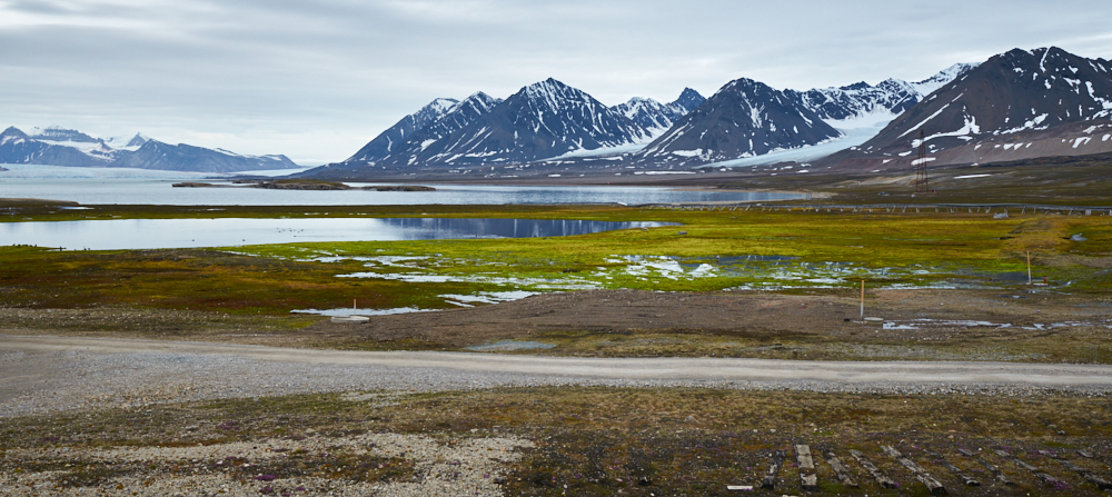
Western France
On holiday with the Land Rover…..
advantage: flexibility – disadvantage: flexibility this represents exactly our late spring trip to France .
We initially planned to drive through the northern part of Sardinia. But were heading towards the western Pyrenees, then finally landed at the French Atlantic Coast, close to Bordeaux resp. at Dordogne – just call it flexibility……
Had a 10 day frame of time and wanted to drive over the French Alps towards south/west into the Pyrenees. Although not driving on dirt tracks this time, we had to realize after only 2 days that time was simply to short. Furthermore a heat wave brought us tempreatures close to 100°F and our good old doggie girl Jade was not happy about this. So we adapted our stages to the circumstances.
On tour: 7 Days Distance: 2’770 km
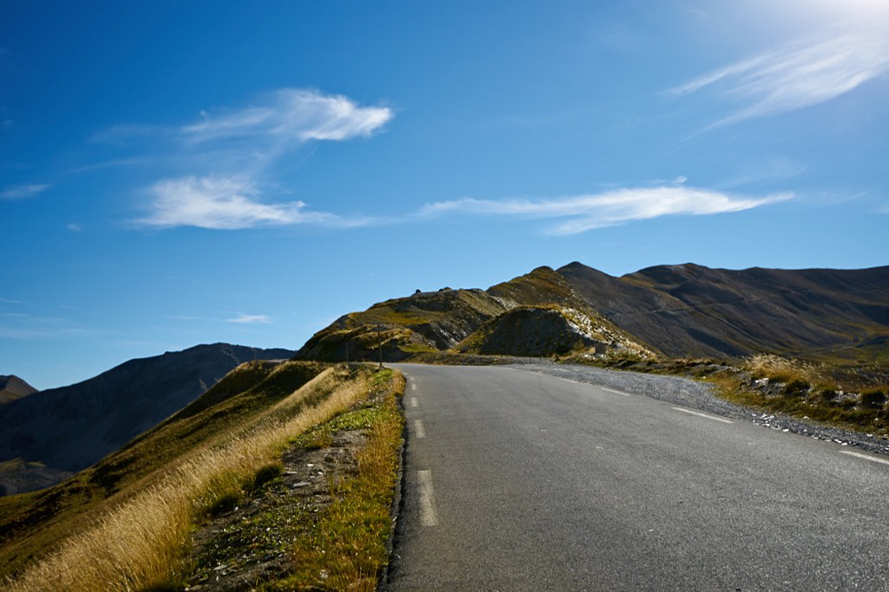
Alpine passes:
- Col du Pillon, CH
- Col de la Forclaz, CH-F
- Col du Glandon und Col de la Croix de Fer (Rhône-Alpes) Alpentour
- Col d’Ornon (Rhône-Alpes) ! popular with cyclists….
- Col du Festre und Valle du Buech ( Hautes-Alpes). D994 and D94 S/W is very nice for bikes
- Col de la Forclaz bei Annecy ! narrow and popular with cyclists
- Col du Marais (Haute-Savoie)
- Col de la Colombières (Haute-Savoie) ,nice for bikes ! popular with cyclists
- Morzine (F) – Monthey (CH), nice for bikes, partially narrow
- Grimselpass (CH)
Nice to see and good Campsites:
- Camping Ile des Barrats atChamonix-Mont Blanc. A small family business, in walking distance from the center, dog friendly
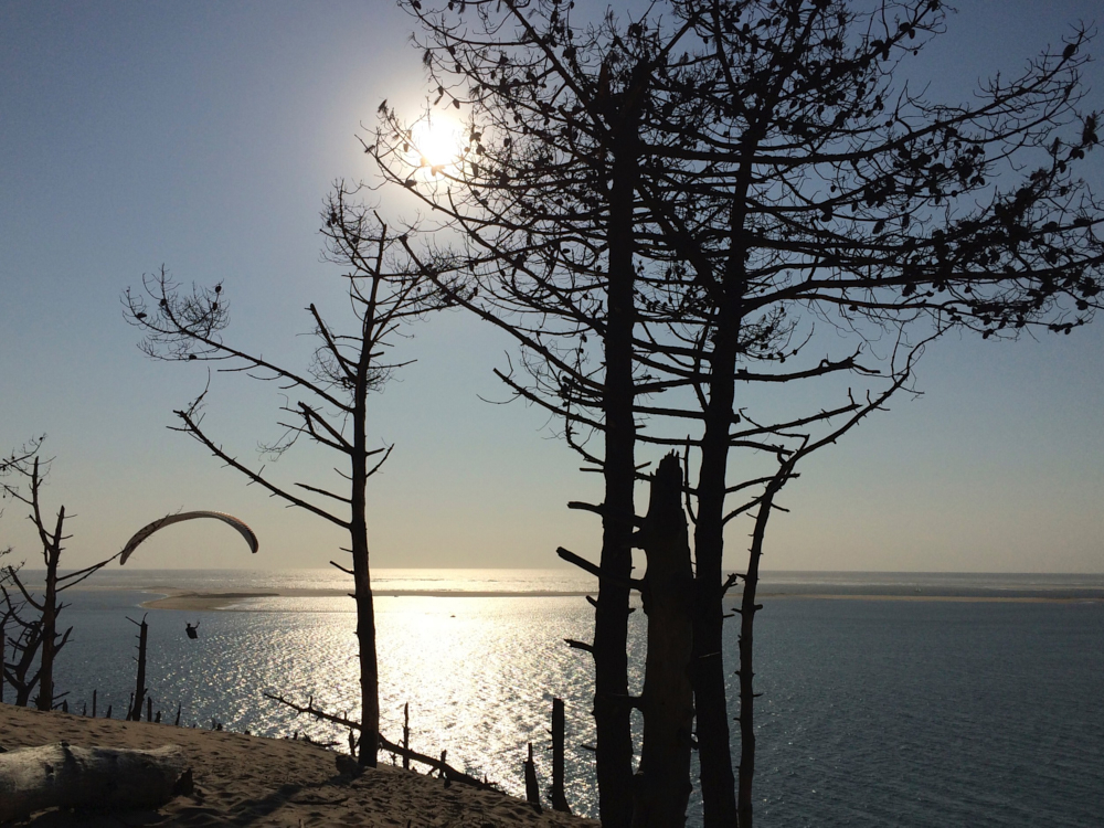
- Dune du Pyla (Bassin d’Arcachon, French Atlantik Coast), better not during high season
- Pyla Camping, just a minute walk from the dune, surrounded from pine woods. Dogfriendly .
- Issigeac (Perigord). A lovely medieval village and its sunday market.
- Beynac et Cazenac (Dordogne). Camping Le Capeyrou is situated next to the village right on the banks of the Dordogne river.
- Parc nat. régional des Volcans, Auvergne. N 122 from Aurillac, nice road for bikes
Conclusion:
Juni is a good time to travel in this region. In general, pass roads are open and most of the attractive places are not yet flooded by tourists. Including the Pyrenees would need at least two weeks of time. The „ big heat“ was rather unusual for this time of the year and has turned some of our plans upside down. A walk during the day over the dune down to the shore was impossible. Poor Jade didn’t know on which paw she should walk…..no go! We also had to drop our canoe tour on the Dordogne River. Can you imagine Jade with a little sun hat…..? I felt a bit sorry because the Dordonge River and its side arms is very beautiful to explore with canoes or kajaks.
click on the pic


Africa
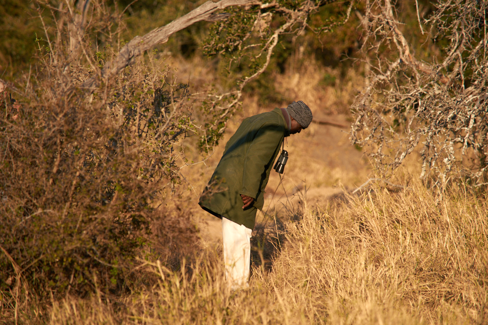
Londolozi - South Africa
click to the pics
Big birthday was comming up, that’s why we decided to go away ….. far away!
Some time ago, a young leopard smiled at me from a photo website. The image was labeled with „Londolozi“. When I found out what Londolozi was, we both knew it would be the place to visit. We thought that now a days it is quite complicated to reach our chosen destination, South Africa by Land Rover, not only because of time but also due to the political situation in several states on the African continent. So we travelled the short and easy way.
On tour : 18. – 22. June 2014:
Destination:
Londolozi Private Game Reserve Tree Camp, Sparta Farm, Sabi Sand Mpumalanga ZA
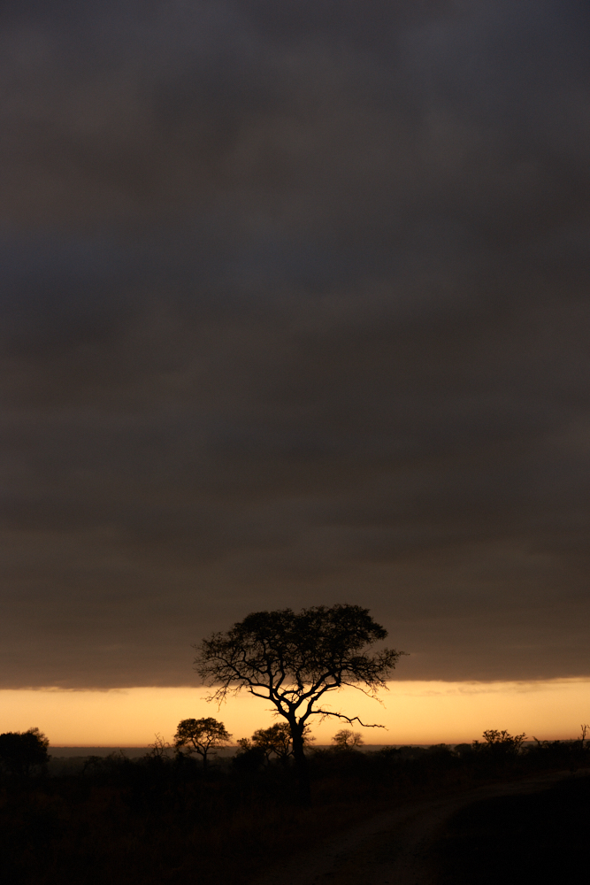
June is wintertime in South Africa
Sunrise: ca. 06:40 am Sunset: ca. 05:15 pm
Daily schedule:
5:45 / 6:00 am wake up and coffee
6:15 / 6:30 am morning game drive incl. sunrise
scheduled breakfast at camp: 9:00 – 10:00 am – well, usually we were not back before 11 am….
ca. 2:30 pm lunchtime (we used to skip after late breakfast)
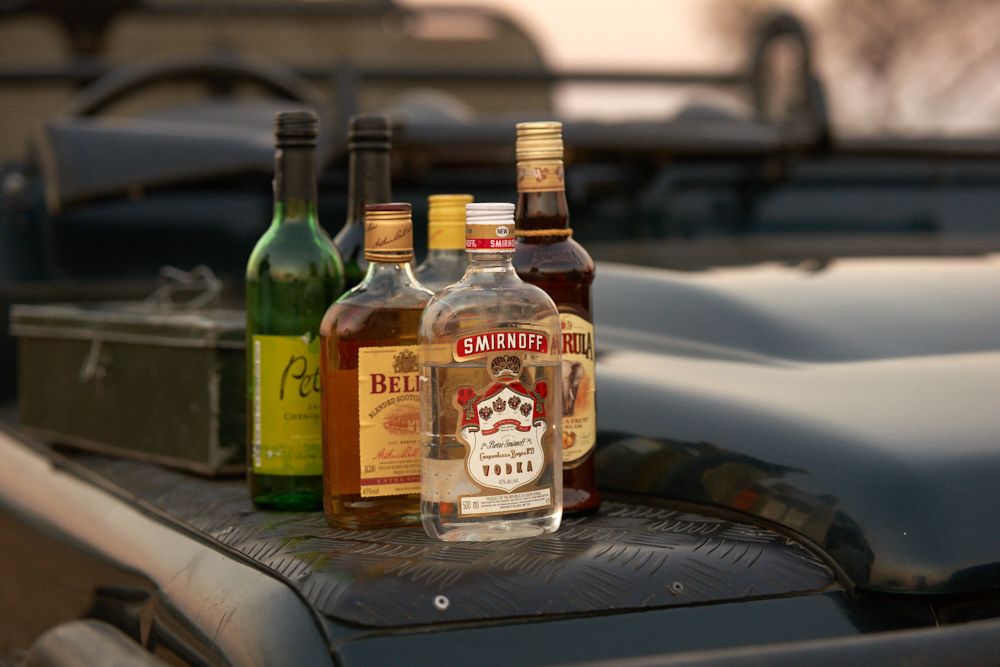
3:00 pm evening game drive incl. happy „bush“ hour from the pic nic basket at sunset
7:00 pm candlelight dinner round open fire
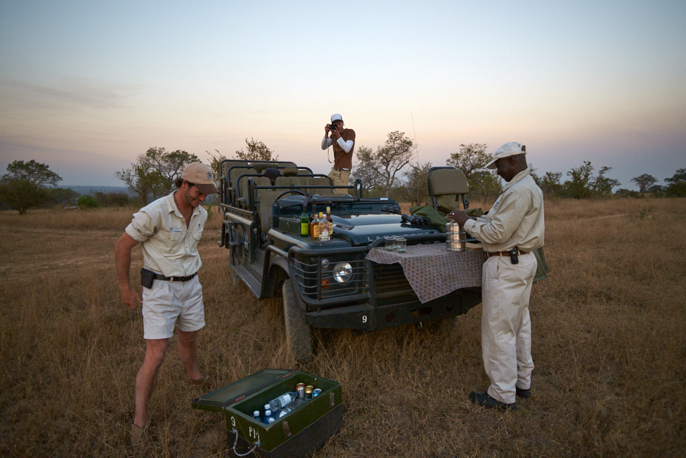
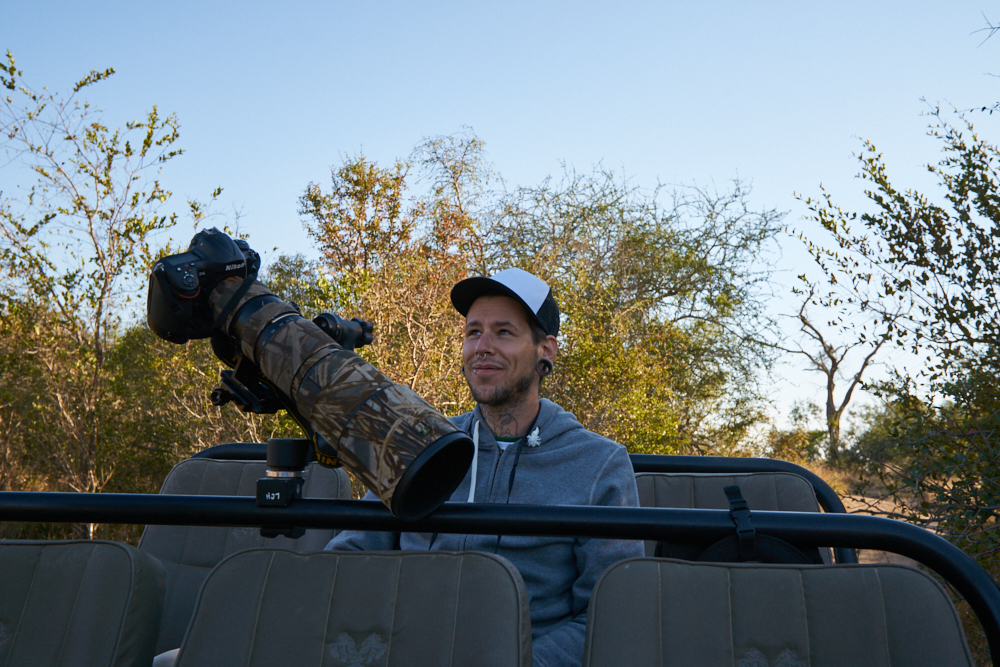
We booked an open customized Land Rover TD4 and were accompanied by young ranger/driver Mark Nisbet and Elmon Mhlongo, tracker with more than 40 years of experience. Together they built a real dream team, both photo enthusiasts and confirmed „off roaders“ – thumb up for us at 100% …..
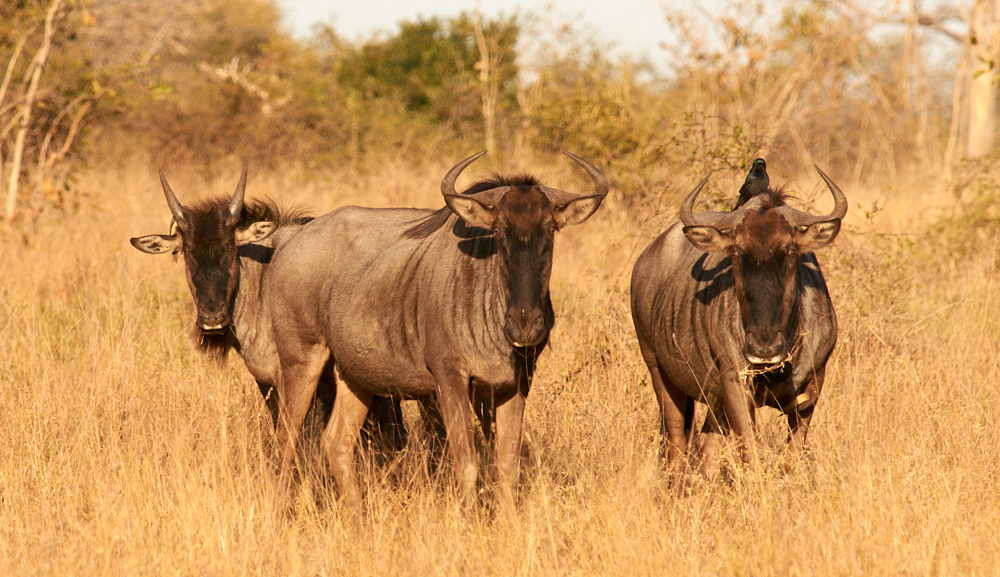
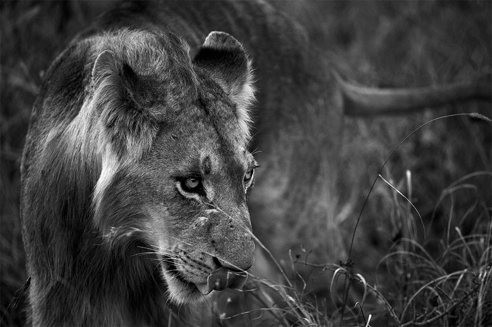
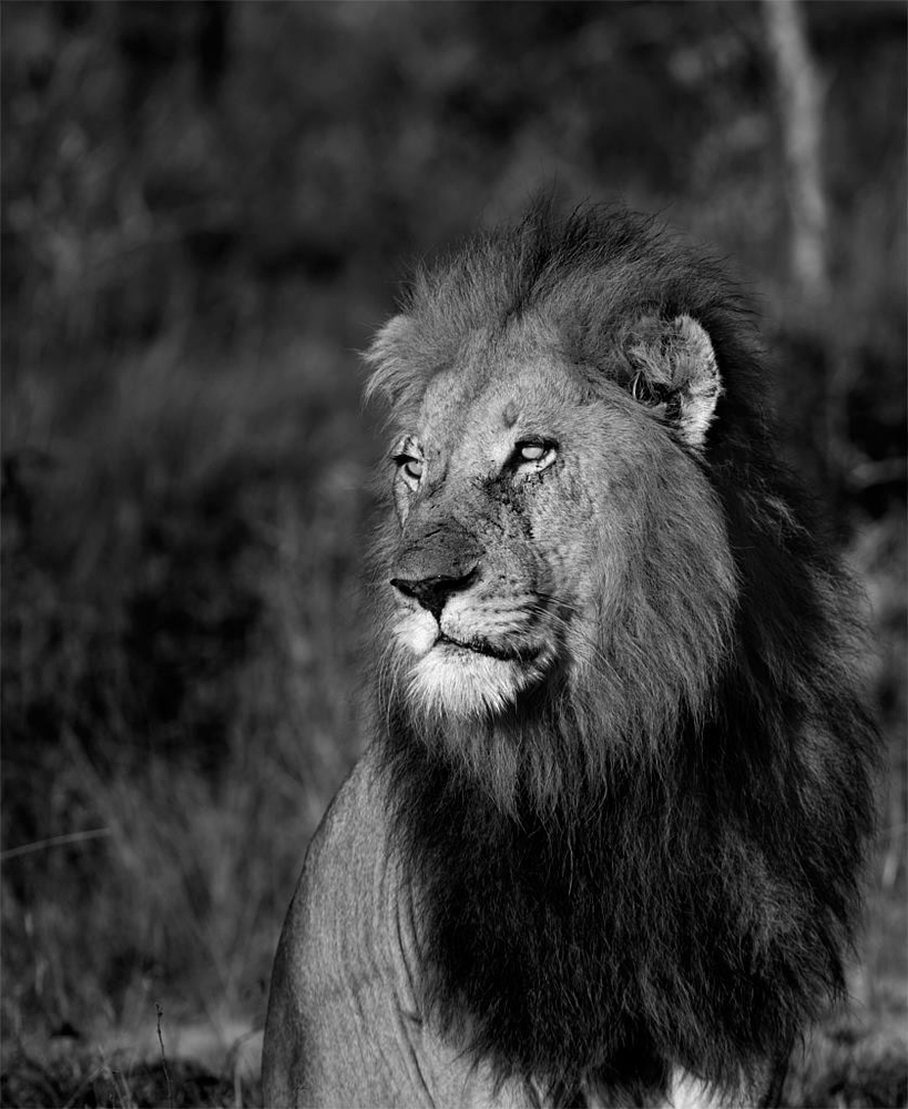
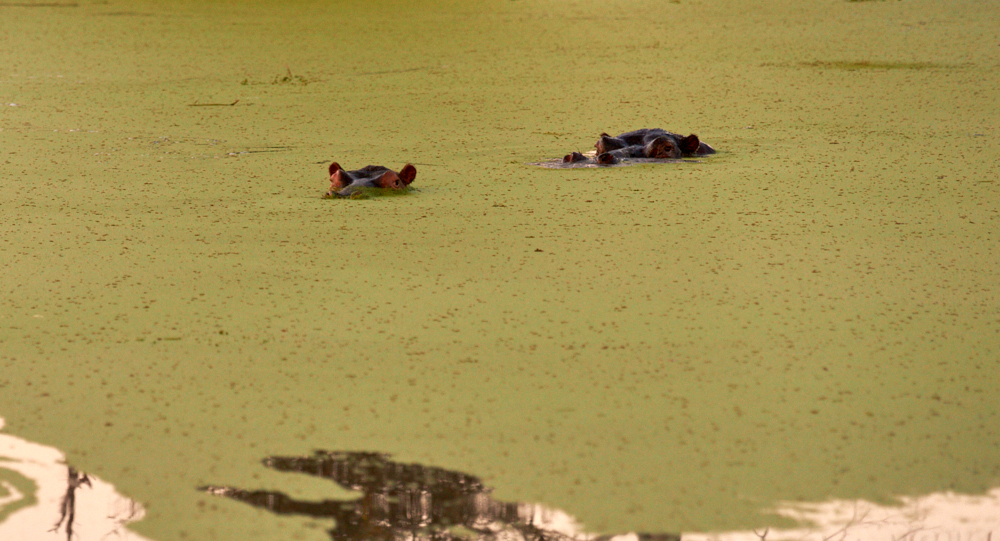
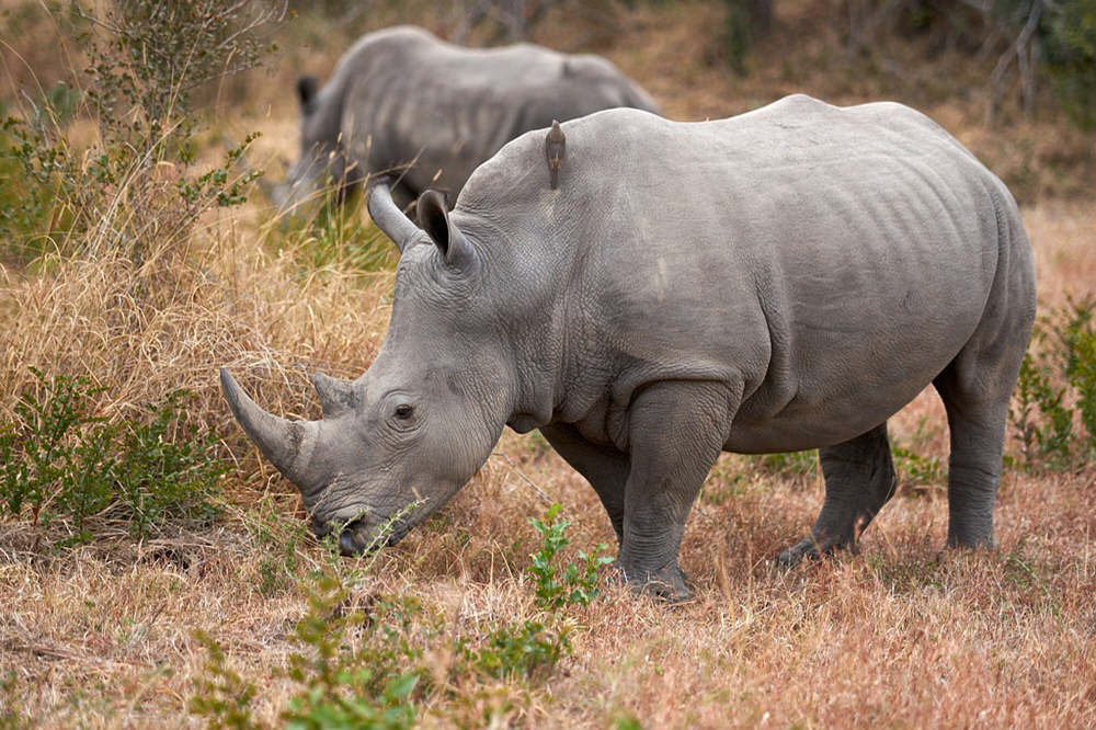
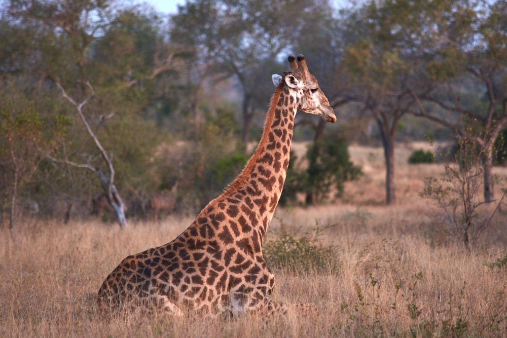
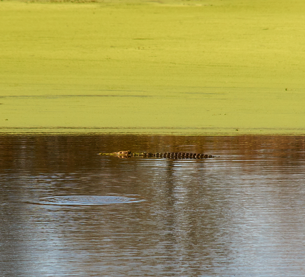
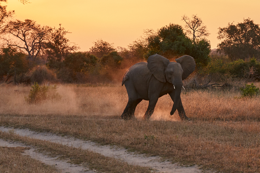
In 5-days (incl. day of arrival and departure) we had 8 game drives. Got stuck once in Sand River (yes it’s winter and therefore sand, not water….) and got out without the help of MaxTrax or other newTech stuff but with all what nature offers. And thanks to Elmons experience were able to spot the following animals:
- Stenboks
- Impalas (herds of…)
- Nyalas
- Kudus
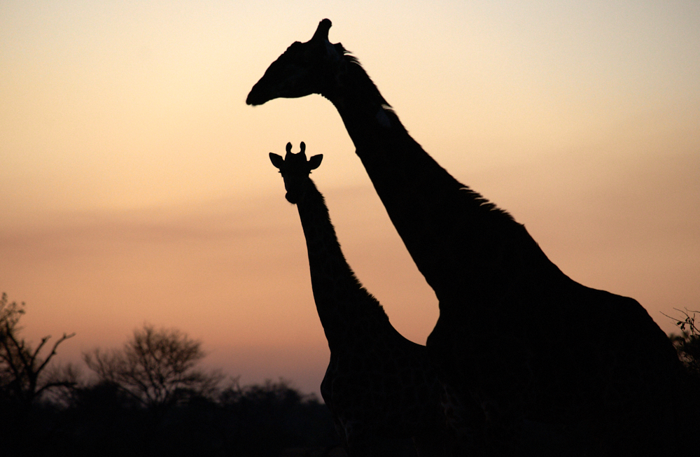
- Giraffes
- Plains Zebras
- African Elephants
- White Rhinos ( with pup)
- Hippopotamus
- Nil Crocodile
- Warthog
- Blue Wildebeest
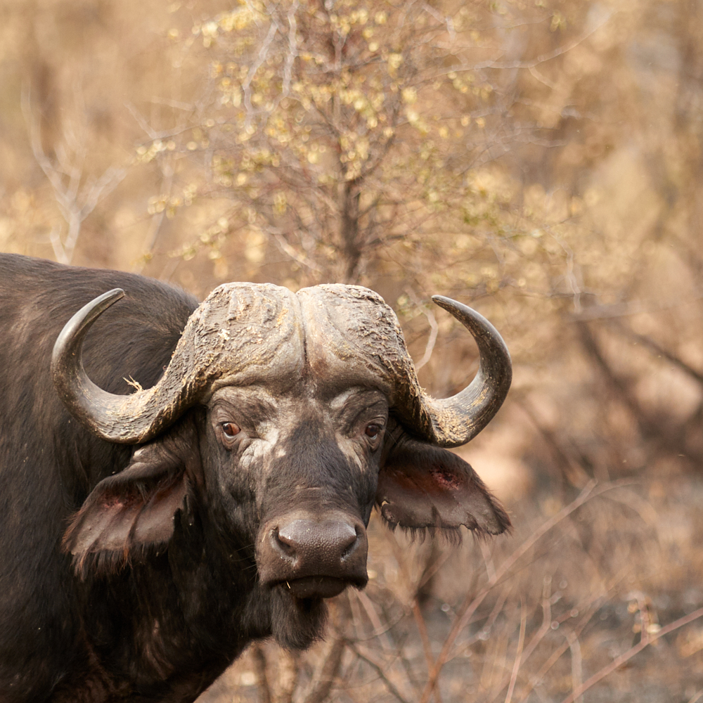
- African Buffalos (a big herd)
- White-tailed Mongoose
- Side-striped Jackal
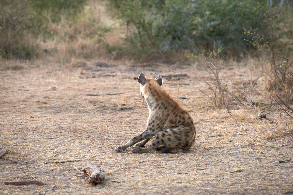
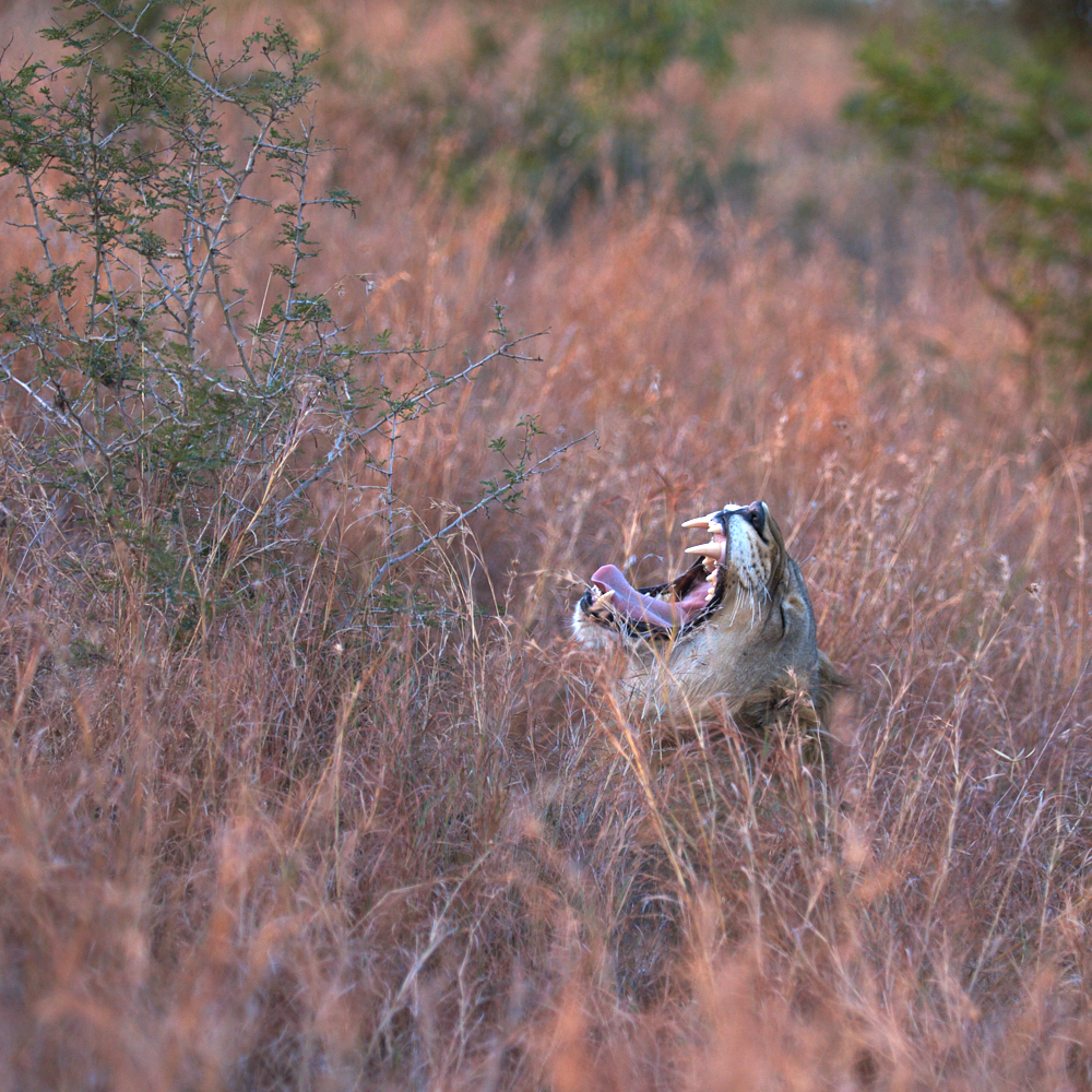
- Spotted Hyenas (with cubs)
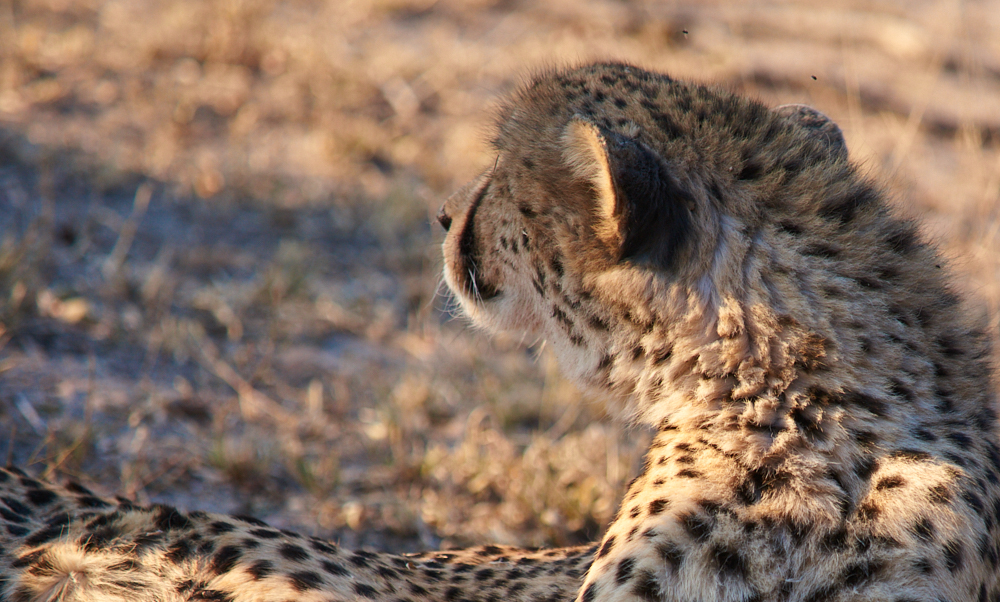
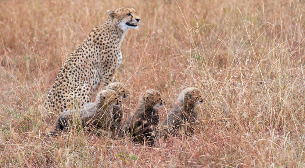
- Cheetahs (with cubs)
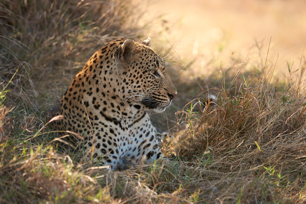
- Leopards ( namend „ To Tone“ and „Vomba“ )
- Lions ( „Sparta“ pride and, „Tsalala“ pride, both with cubs and whippersnappers as well as two „Majingalane“ males)
- Baboons around the camp
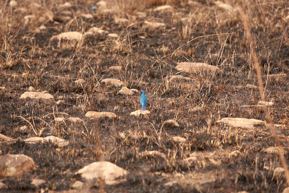
- different birds incl. Vultures and Eagles
- several small mammals like tree squirrels and others
It was beautiful to see all these wild animals in their natural habitat especially when considering how many of them are endangered. Londolozi emphasizes on the well-being of wildlife. 15’000 ha of bushland is not fenced and therefore allows migration within the whole territory of Krüger-and Transfrontier Park. Anti poaching programms are under way and a patrol station is near by. One has the impression that there is kind of „soft tourism“ in consideration and with respect to all what nature has to give.
Highlights:
Whole day tracking of the Sparta Pride Lions with successful sighting on„ birthday’s evening“. The Rhino with pup. Our car surrounded by whippersnapper and other Elephants . Cheetahs with cubs. The Hyena Cubs Den. The Majingalane Lions.
Malaria:
Although Londolozi is located within Malaria zone, the risk is rather low in winter. Upon recommendaton of the Swiss Tropical Institute, there was no need for prophylaxis during our short stay. We used anti-Mosquito spray and light colored outfit. For longer stay in winter, the Institute would recommend to have ICE medics „in the pocket“.
To arrive:
Flight to Johannesburg OT, then connecting flight with FedAir (bush taxi like with stop overs), booked through the camp.
click on the pic


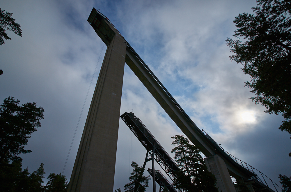
North Cape
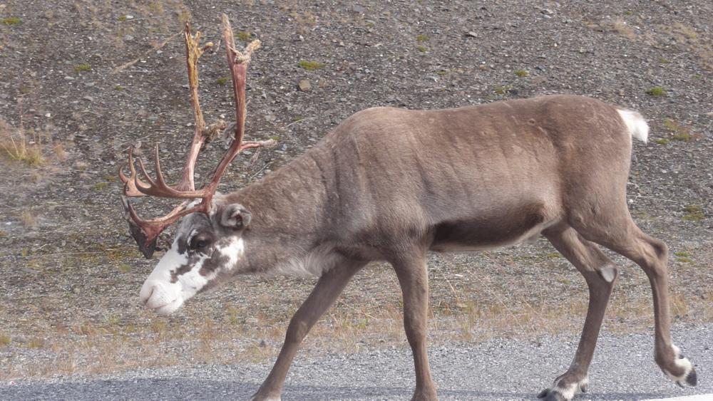
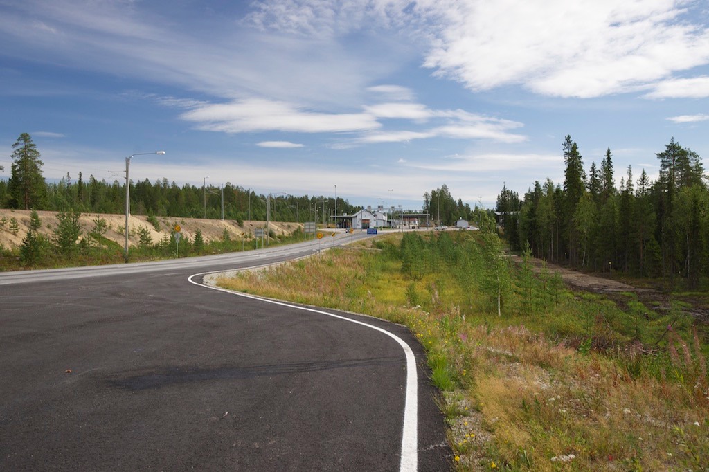
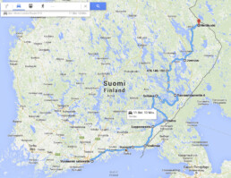
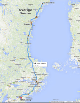
The Big Scandinavia Tour
The first trip with our new converted Land Rover went up north. One says: the mosquitos arrive with the tourists – the mosquitos leave with the tourists and the tourists leave in mid-August. So we started the engine on August 14th heading towards Travemünde to take the ferry boat. Our destination was the North Cape through Finland and back home through Norway. Needless to say that I‘ve planned everything at home – roads, stages and things we had to see. But the good thing about individual traveling is the fact that today you turn to the right – tomorrow you turn to the left and above all you never really follow your plans……
All in all we made approx. 5‘900 miles in 3 1/2 weeks – with no break downs of course!
Route:
From home to the Ferryboat: Travemünde – Helsinki
Stage 1:
From Helsinki – Lahti – straight on to Mikkeli (Saimaa Basin) – road 62 – Anttola – on gravel to Juva
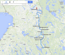
Stage 2:
via Kuopio – Isalmi – to Manamansalo (Oulujärvi).
Stage 3: (1. change….back to the east….)
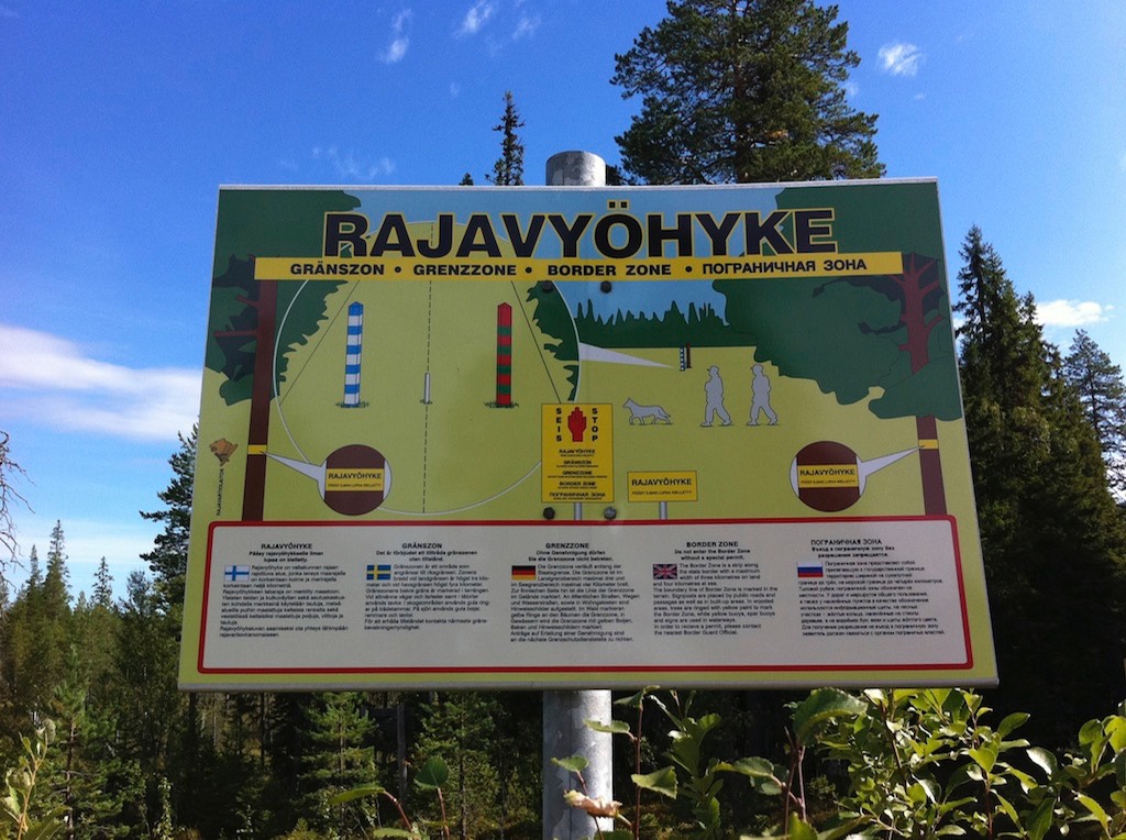
Sotkamo – Kuhmo – on „Via Karelia“ – Lentira – no stage without „Pampa“ (mud or gravel), so further east – Vartius – along the russian boarder – Hietajärvi – Suomssalmi – Kuusamo till Kiutaköngäs at the Oulanka National Park
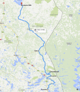
Stage 3: (2. change…..)
along Via Karelia (950) – Kotala – Sodankylä – then along the E75 to Ukonjärvi (Lake Inari)
Stage 4:
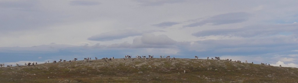
Inari – Karasjok – Lakselv (Norway) – Stabbursdalen National Park
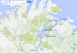
Stage 5:
Cape North – Gjesvær – Kirkeporten
Stage 6:
E6 – Kronstad – Tverrelvdalen (Alta Canyon) – Øvre Alta
Stage 7:
E6 to Skibotn – side trip to the Skibotndalen – Kilpisjärvi (FI) – Saarikoski – and back to Skibotn
Stage 8:
E6 – Andselv – Rv851 – Rv84 – Tennevoll – Lund – Bones – Wolfscamp Bardu – Tennevoll
Stage 9:
E6 – Fauske – Løding – Rv17 (coastal road) – Saltstraumen – till Holand
Stage 10:
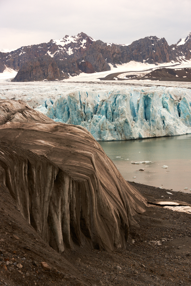
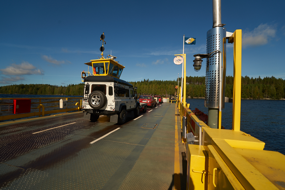
Crossing Holandfjord by ferry (without the car) – hike to Svartisen Glacier – back to the car – and along Rv17 to Sandnessjøen
Stage 11:
Rv17 to Namsos.
Stage 12:
Rv17 till Steinkjer – E6 – Trondheim – city tour, good parking possibility for off roaders and campers at the train station – further on E6 to Kongsvoll.
overnight stay at Kongsvold Fjellstue (Dovrefjell)
Stage 13:
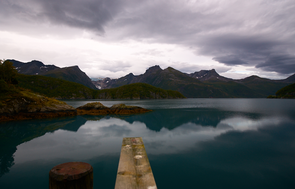
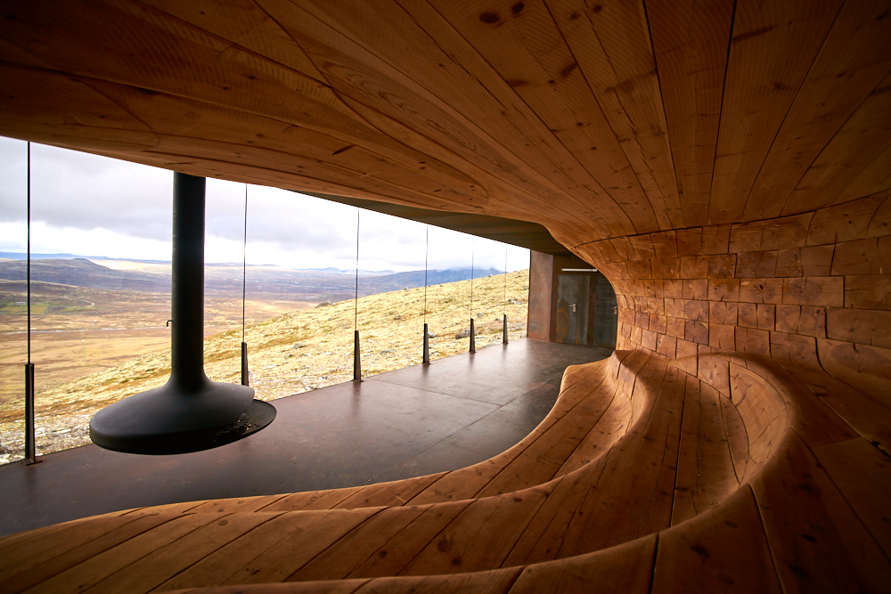
E6 (10km) to Hjerkinn – short walk to the new mountain lodge at Dovrefiell National Park. Was great, we have seen two musk ox! – back on E6 – Oppdal – E70 – Rv62 – Rv660 – Åndalsnes – Rv63 – Trollstigenveien – Linge – ferry till Eidsdalen
Stage 14
Rv63 – Geiranger – side trip to Dalsnibba – Rv15 – Videseter – Rv285 also named „Gamle Strynefiellveien“ – Grotli – Lom – Rv55 Sognefjell – Turtago – Øvre Ardal – Rv 252 till Eidsbugarden
Stage 15:
back on Rv252 – E16 – Rv360 – Borgund Stavkirkje – Lærdalsøyri – Aurlands-or Snøveien – Rv50 – Hol – Rv7 – Ål – Fv to Leveld – toll road to Hemsedal – Fv to Lykkia – Nosi – till Fagernes
Fv = Farvegen are small – mostly gravel roads and often unmarked
Stage 16:
Rv51 – Bygdin – Jothunheimsveien – Rv255 – Skåbu – Vinstra – Peer Gyntveien – Forset – Synfjellveien – 251 – 33 – E16 – Begnadalen – Rv243 – Hedalen – Fv via Buvasskoia to Sokna – E7 – E16 till Oslo/Holmenkollen
Bad luck in Oslo:
Holmenkollen-Tower closed due to stroke by lightning…..
Edvard Munch Museum closed due to change of exhibition…..
and on the 2nd day rain…. rain…. rain….
Ok – no ferry boat to Germany but on the road further south!
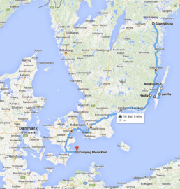
Stage 17: (from here on nothing was planned!!)
E6 – Uddevalla (Sweden) – Mollösund – Göteborg – Helsingborg – ferry to Helsingør – 237 till Gilleleje (Dennmark)
Stage 18:
237 – 211 – Fredrikssund – via 53 – 23 – 57 – to E20 – bridge to Nyborg – E20 to Esbjerg – ferry to Fanø – round trip on the island.
Well, in fact we wanted to stay on the island for another day but dark clouds, strong winds and the weather forecast which announced heavy rain and hurricanes for the next days just made us driving on!
So back to Esbjerg – E20 to Kølding – E45 – Flensburg (Germany) – A7 till Bad Bramsted / near Hamburg (a „monster stage“)
Stage 19:
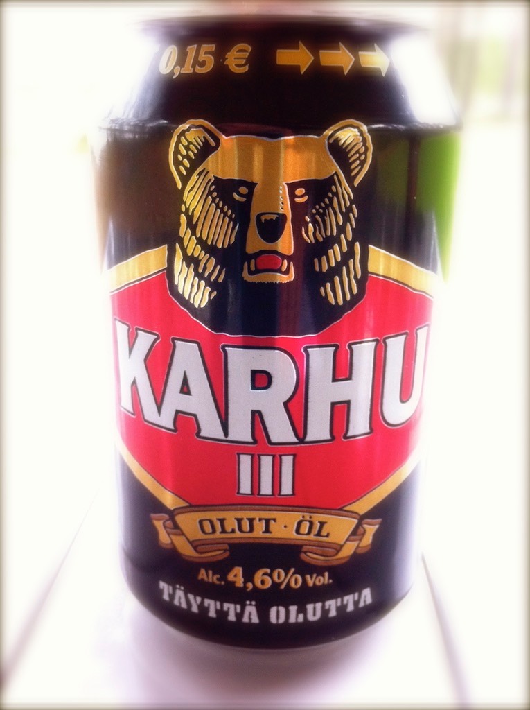
A short phone call to Switzerland: sunshine 82.5°F – in the evening, with our last Karhu‘s, we had a big cheers in the garden – at home!
Finland
Beautiful places:
Landscape and villages along the „Via Karelia“, Lake Inari. In the eastern part of Finland, most side roads are gravel roads. Good road sings on junctions. Mostly the name of a village following „-mentie or -ventie“ (for example Ahvenammentie) nevertheless it is recommended to have a detailed road map because along the Russian boarder you cannot trust in your navigation system. Tom Tom wanted to send us straight into the ditch!
If you like wide landscapes and solitude you will be happy in east Finland.
Norway
Beautiful places:
- Stabbursdalen National Park – most northern pine forrest with trees up to 500 years – take the entrance east from the Camping (approx. 5 miles on a small unmarked gravel road)
- Svartisen Glacier – approx. 3 1/2 hour hike to reach the ice from the ferry and back. Good hiking boots. If you don‘t take a guided tour (as we did) look after the ropes because the trail is not very good marked. You have to walk the same way back! There are guided glacier tours and ice climbing tours available.
- Dovrefjell National Park and its musk ox.
- Even you have your own bed, we strongly recommend a stay at the „Kongsvold Fjellstue“ – an old mountain Lodge at the E6, in the middle of „muskland“. They have good food and good wine!
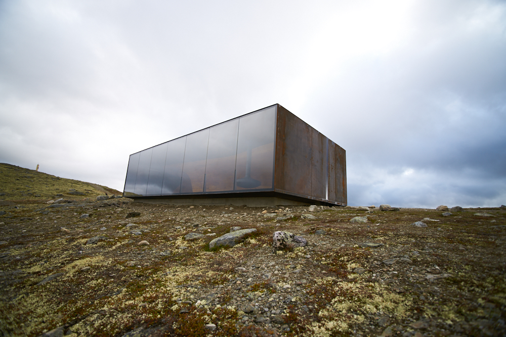
- The new mountain cabin at Dovrefjell with view to the Mt.Snøhetta. This building was designed by „ Snøhetta Architects“ (Oslo Opera/ Alexandria Library) and is only accessible by feet.
It would be to much to describe all the wonderful small gravel roads. Some were tollroads, some were free but all have been perfect to test the construction and interior of the car – JUST FUN!!!!!
If you decide to drive through norwegians „Pampa“ (Farvegens) we strongly recommend a detailed road map.
Wolfscamp in Bardu will get its own article
Season:
Specially in the northern parts, from mid-august on most tourists (and mosquitos) are gone. At Lake Inari it was cold and freezing at night. If you take the coastal road in Norway (Rv17) allow a bit more time because most ferry boats have already changed to winter schedule so you might wait a little longer (up to 1 hour). Many highland roads and farvegens are closed in winter. So from late September on you have to expect to change the route.
You will find more tourists on the road from Trondheim south along the well known places of interest.
click on the pic


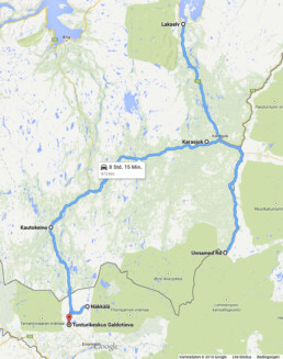
Karelia & Arctic Road
Finnish Karelia & Arctic Road
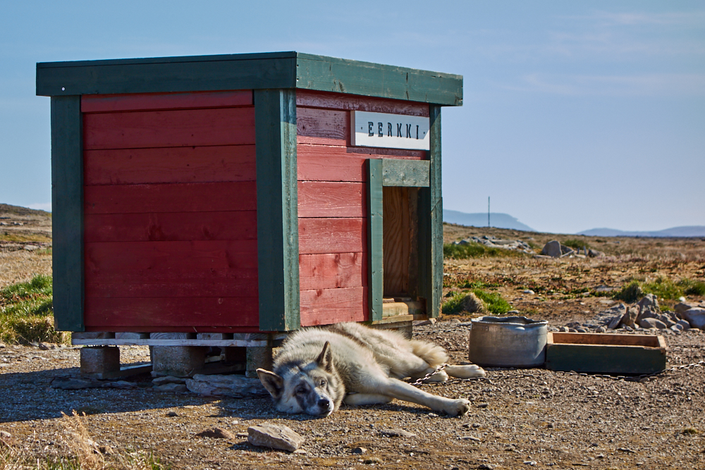
Slowly but surely, our Land Rover was collecting dust and we had to do something against it. So one more time we decided to head up north, accompained by our lovely“ doggiesoul” Jade.
Route:
North Kareliea – Øvre Pasvik – Arctic Road – Tunturi-Lappi (visit to Hetta Huskies)
30 days on the road driving 10’084 km / 6’266 miles in total
Travelogue:
Many of the small roads in Finland don’t have numbers but names (mostly from nearby settlements). I made some maps to keep my description short. But don’t pay attention to the numbers behind the road names – Google map has delivered them for free 😉 Our main road through Finland from south to north was „ Via Karelia“ . All side trips out in the sticks „ pampa“ were east of this road.
Day 1: Punkaharjun Camping, Tuunaansaari at Saimaa
Day 2: Hike on and round the Ridge close to Punkaharjun
Day 3: Camping at Neitikoski close to Ruunaa (Nature Reserve)
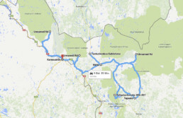
Day 4: „Pampaday“ (out in the sticks) without destination for the dayl. Overnight stay at a lake’s shore (Unnamed Rd), what a silence…..
Day 5: „Pampaday“ to destination Kuusamo Holiday Village. Shower, laundry and shopping was on the list.
Day 6: Short drive to the Oulanka National Park resp. Juuma Camping and a short hike to the old mill.
Day 7: Morning hike at Oulanka NP starting from Kiutaköngäs resp. Visitor Center. Destination of the day was Lokka tekojärvi. Overnight stay at the lake.
Day 8: „Pampa“ W this connection from Lokka to E75 north of Peurasuvanto can not be seen on Google Maps. Side trip to a nice viewing point at Saariselka – destination of the day was Ukonjärvi Camping.
Day 9: „Pampaday“. Roundtrip from Ukonjärvi to the russian border with different side trips and back to Ukonjärvi Camping for another night.
Day 10: Search for a photogenic overnight place on the N/E shore of lake Inari (Aurora forecast KP7 means solar storm meets earth). It was cold but the clouds decided to stay all night….
Day 11: Norway, destination Grense Jakobselv, overnight stay on the beach with view to the windy Barent sea.
Day 12: Pasvik Valley and Øvre Pasvik National Park.
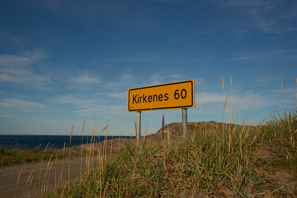
Note in the roadbook: „ Wind became storm and at 6 a.m. we had enough – roof down before it was blown away! Back on Rd 886. We could just follow the Russians, performing a morning drill on the other side of the river….. Kirkenes 60 km and hope to get a nice warm coffee! However, to find an open coffee shop on a Sunday morning in Norway is almost impossible. Rd 855 S to the Pasvik Valley – a camping, a coffee – „Pampa“ to the Øvre Pasvik NP, we got nice hiking tips from some hunters so „ off by feet into bear land” – back to Kirkenes and overnight stay in a hotel (storm).“
Day 13: Mehamn. Because of the ongoing storm, we stayed at Adventure Camp Mehamn.
Tag 14: Gamvik and Seltnes fyr – our car shows 50’000 km just before Gamvik. Short hike to Silfar Canyon off Rd 98 . Evening hike at Stabbursdalen NP. Destination of the day Stabbursdalen camping.
Day 15: Drive to the North Cape
Note in the roadbook:: „ Storm and no chance to reach „ the bowl“ by feet, we didn’t even manage to make a selfie with dog….so no time to loose and back over the Fjells because the wind was still rising! At Skarsvag: camping closed, hotel – no dogs! Nevertheless lucky to find some doggie friends, we could stay in a cabin at North Cape Camping Skipsfjorden.“
Day 16: It was not scheduled but we drove to Hammerfest and Forsøl (spotted a white tailed eagle) and back to Lakselv – overnight stay at the shore of Porsanger Fjord with Auroras at night.
Day 17: From Karasjok „Pampa-drive“ along the Tana River and back (approx. 2 h for 60 km in „Samiland“ pure) – overnight in a cabin at Karasjok Camping (night temp. -7°C / 19.4°F).
Tag 18: Tunturi-Lappi. Side trip to Näkkälä and camping at Galdotjeva on the shore of Palojärvi. We have been there in winter with the Hetta Huskies.
Day 19: Destination of the day (and unwritten travel destination for the whole trip) was Hetta and a visit to Anna, Pasi and the Hetta Huskies (Eka & Petteri). We bunk for 2 nights in the well known Hetan Majatalo but before that, we head out for a round trip with some side trips. 1. to Vuontispirtti at the foot of Pallastunturi, snow! 2. Pallas Nature Park Center via 9571 – short hike ca. 4 km in the snow along the Pallas-Hetta trail (54 km). 3. „Pampa-drive“ N/E close to Nunnanen.
Day 20: “Hello Doggies“ 🙂 morning drive 2 km with 3 teams of dogs (with quad and cart), followed by a ca. 3-hour hike along the Hetta-Pallas Trail to the top of Pyhäkero and back.
Day 21 (part 1): Short Ghee/Haw walk with Jade, Eka, Princess und Charlotte a guide on the farm. Two more excursions were on schedule before we set off for home via Karesuando and Sweden. 1. A discret glimpse to a farm that was former managed by Anna & Pasi and that we didn’t visit while it was under their responsability. 2. Upon Pasi’s suggestion we drove one of the old military roads with fantastic view (ca. 40 km / 25 miles to a cabin). Our average speed was somewere between 5 – 10 km/h / 3 – 6.2 miles/hour and as it started to snow, we decided to make a u-turn.
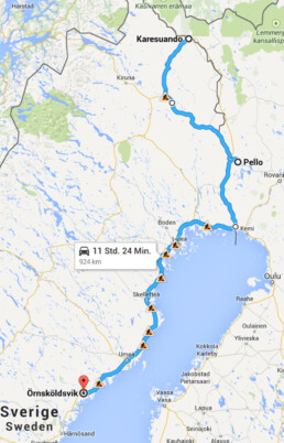
Day 21 (part 2): Driving through Sweden turned out to be boring. Beside one single wood grouse we saw only road works and trucks….A cold snap was announced as well so we stayed in a hotel at Pello, Finland.
Day 22: Winter! No destination for the day, just as far as we got. Camping close to Örnsköldsvik.
Day 23: After early departure it took quite long to find a coffee shop – no comment on our motivation…. A nice change was the road called „Küstvägen“ , the village Galström and a warning sing „beware of bears“. Our target of the day was to leave Stockholm behind so we made a „monster stage“ and our stopover site was a lovely historic hotel at Soderköping /Gota Channel.
Day 24: Destination of the day was isle of Öland and the plan was to stay 2 days. We just didn’t know that there was the Skördefest (harvest festival) on that weekend. Overcrowded campings, blocked roads – we left the place in a hurry and found a nice camping at Hagby.
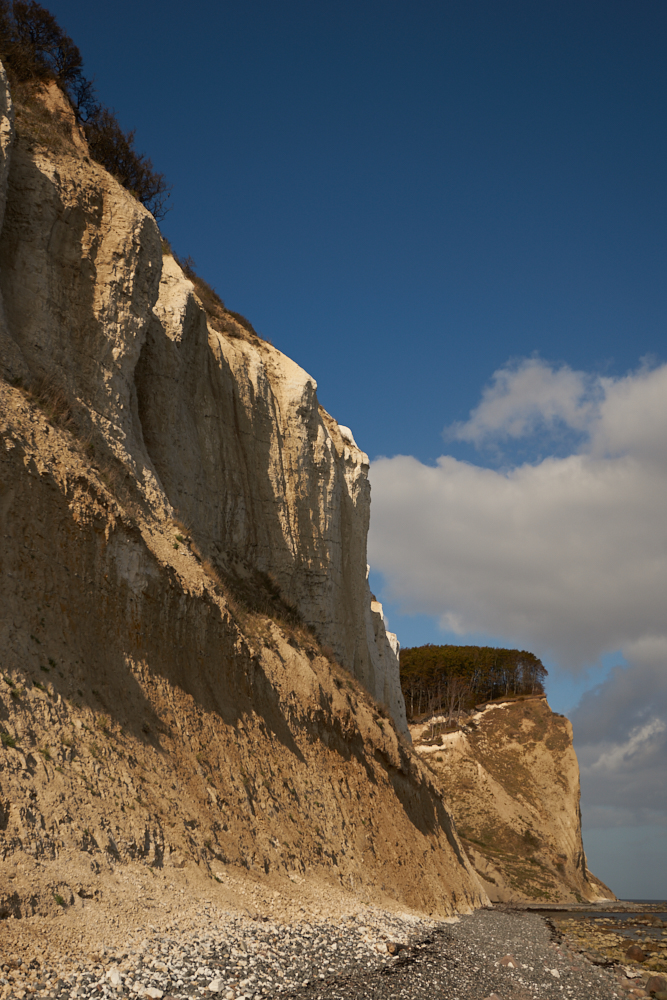
Day 25: at 6:30 a.m. wakening call from some trigger-happy hunters and confused geese. So there was another early departure that brought us straight to our destination Camping Møns Klint on the danish isle of Møn. Hike to the famous chalk cliffs.
From day 26 on, we head back home to Switzerland with stopovers at Cologne and Aschaffenburg in Germany.
- Navigation / Maps:
In all countries TomTom was in use – mainly to determine current location.
Finland:
- GT Tiekartta Itä-Suomi 1:250 000 (für den S/E)
- GT Tiekartta Pohjois-Suomi 1:400 000 (für den gesammten Norden)
available at Karttakeskus
Norway:
- Nord-Troms og Finnmark 1:400 000 by Cappelen Damm Kart 5 available in bookstores or gas stations
Travel time & weather:
Above the polar circle it is „Ruska“ (Indian Summer) in September. The short time of intense colors, berries and mushrooms. Sun is still able to warm up a little during daytime but nights are getting freezing cold. Mosquitos said goodbye and here and there winter is knocking at the door. Autumn storms are coming up in coastal areas .
During our trip we had temperatures from + 22°C / 71°F (Saimaa) to – 7°C / 19.4°F (Karasjok). Says everything….and you find out that a warm sleeping bag, good shoes, warm/active layers, beanies and gloves should be part of your luggage….
Flora & Fauna:
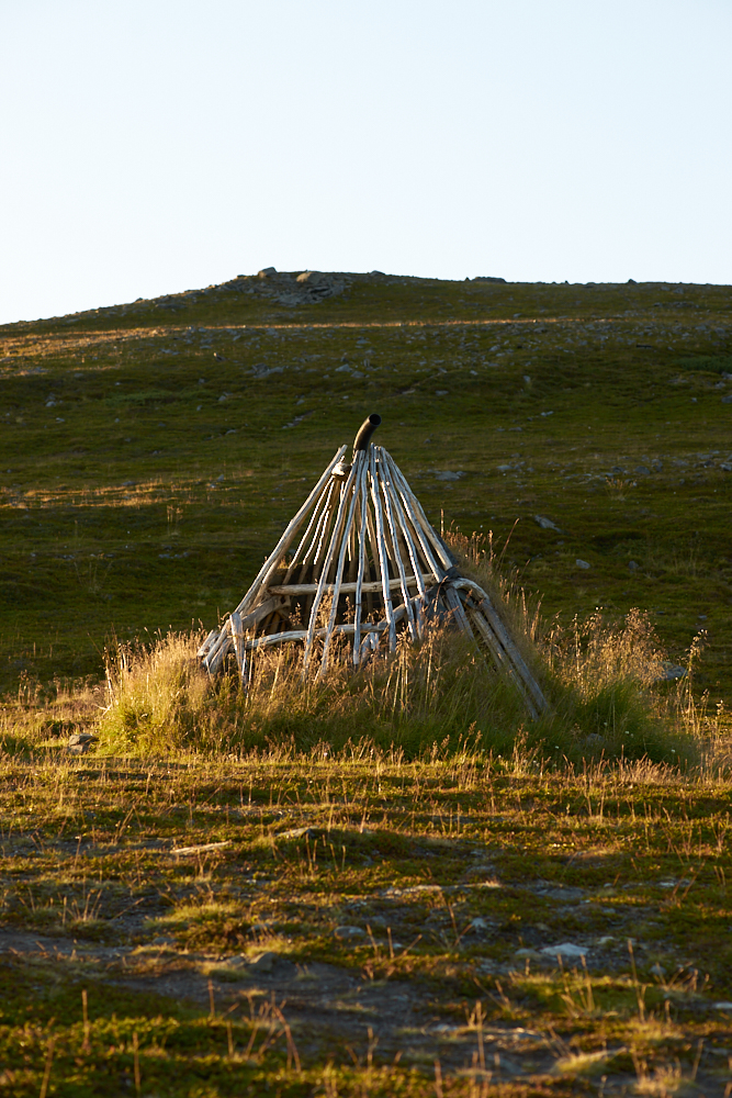
As I already mentioned it is the time of huckleberries, cowberries, cloudberries and mushrooms. Softwood forests in Kareliea, birch woods further north, moory landscapes and marshland all over, bleak and rocky Fjells along and north of the Arctic Road and on Tunturi-Lappi.
The whole territory is home of the european brown bear. In North – Karelia, along the russian border sometimes „visitors“ come along from the other side. We got some interesting informations from locals on the current population: round Suomssalmi 8 bears are around – 40 currently live in the region. In the Pasvik Valley 86 different species were counted this year and the region of Karasjok is home of 60 animals. Also around Hetta a bear is on his way from time to time – they all go to sleep soon…. Although we hiked a lot we were able to spot only one elk, some black grouse, ptarmigans, one wood grouse and two white tailed eagles on the entire trip. Wild animals like bears, wolves or wolverines stay away from human(animals) and they are rare to be spotted. They all find enough food in the wilderness. In Sweden we were able to watch the autumn migration of the geese.
Nice Landscapes, moments & things to see:
The rapids close to Ruuna are a good place to follow or participate in river adventures. The camping is very beautiful set in a open forest. Small restaurant with a good breakfast buffet. Nice hiking trails.
The Fjellandscape on the way to Mehamn.
Visit to Strømeng’s cutlery at Karasjok and Juhl’s Silvergallery at Kautokeino.
The municipal area of Enontekö and Hetta itself is definitely worth a visit without snow as well. Many trails invite one to hike even for a multi-day tour (Hetta-Pallas Trail ca. 54 km) and of course there’s the lake….We can highly recommend the hike to the top of Pyhäkero. Easy to handle even with a good cross-runningshoe . The view is fantastic!
By the way: The Hetta Huskies always enjoy a little adventure during their „ out of season“ time. You can find all summer/autumn activities here: Hetta Huskies
Travel with dogs (pets) :
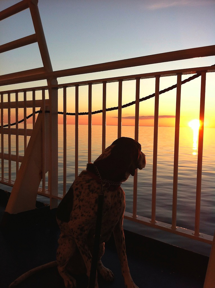
The ferry-crossing with Finnlines from Travemünde to Helsinki is absolutely no problem. They have special cabins for travellers with pets. Dogs are only allowed on this specific deck inside but outside as well. Therefore they provide a quite acceptable „pee-corner“ including a little tree on each side of the outdoor deck. As there is no green space nearby the check-in at Travemünde, I recommend a nice walk before entering the harbour area with your dog.
Finns are totally dogfriendly. We never faced any problem neither on campings nor in hotels. Dogs are not allowed in restaurants (with few exceptions).
Norway has special entry/travel regulations for dogs especially concerning tapeworm prevention. Check the news early – information.
Travel with dogs in Norway is a bit more complicated in general. Particularly if you plan to stay in smaller hotels or rent a cabin. Often dogs are not allowed with the following explanatory statements: allergies of other guests or to much work to clean up….
Dogfriendly and otherwise good hosts:
- Kuusamo Holiday Village (Jade was allowed to join us to the Pub)
- Thon Hotel, Kirkenes
- Adventure Center Mehamn – not because they are dogfriendly but they have cosy cabins. In fact, dogs are not allowed but I guess the good guy hat pity on us because of the storm so Jade was allowed to sleep in the entrance of the cabin.
- North Cape Camping at Skipsfjorden.
- Karasjok Camping
- Galdotieva Camping – they are used to dogs, especially in winter 😉
- Hotel Hetan Majatalo at Hetta – family business, good food, dog friendly
- Söderköpings Brunn at Söderköping – historic hotel and former spa. Late arrival, „ dog rooms“ were booked out but they prepared a cosy room with extra doggie bed and water bowl. Very good food.
- Camping Møns Klint – very dogfriendly, dogshowers and dog forrest trails.
Conclusion:
On the „ other side“ of the polar circle, life seems to be somehow calm – exactly the way we like it. Only we have underestimated temperatures in autumn and had therefore a lack of warm layers in our luggage. Several times we had to decide between the park heating all night or rent a cabin. When temperatures dropped below 0°C we rent the cabin (for the wellbeing of Jade).
We have experienced the limit of our roof tent and therefore the limit of space inside the Defender 110 when traveling with the dog in polar regions. Storms and winter in summer has to be considered when planning a trip above the polar circle at any time of the year. Nevertheless our Landi has improved one more time especially on „pampa-roads“.
click on the pic


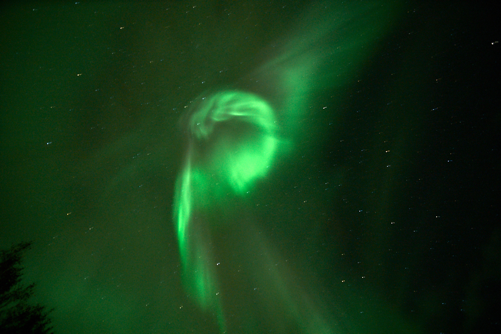


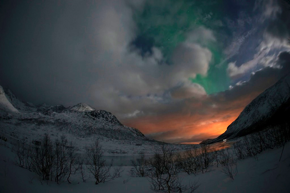
Northern Lights
Chasing Northern Lights
The first trip this year took us to Norway. Aurora borealis or northern lights, name of the phenomenon caused by solar winds that can be seen in clear winter nights north of the arctic circle.
That is, what we wanted to experience.
Well, Jade and the Land Rover had to stay home therefore Manuel joined us for this tour.
We all wanted to learn how to capture these lights with our cameras so we decided to book this trip at Dionys Moser‘s photo travel agency – almost all inclusive…
Flight over Copenhagen and Oslo to Tromsø, and a hotel in the city center.
Day 1:
No time to unpack. Well equipped with three 4WD VW-vans, our guides took us out of town for chasing northern lights.
No luck this evening. All we could see was heavy snowfall….
Day 2:
Photo shooting with the reindeers and on the waterside at Skulsfjord.
And in the evening:
2 layers of woolen underwear, a big can with hot soup, spare batteries for the camera and don‘t forget the headlights……It was time to get out of town again, yr.no (weather forecast) announced partly clear sky.
We all (24 participants) were fully motivated to spend the night out in the cold!
I can tell you right away, we missed the „ultimate corona“ – but what we were able to experience this night was just wonderful:
Kattfjordvatnet, the mountains in the light of a barely full moon, passing clouds – driven by stormy winds. And then, there was this feeling of „energy was in the air“.
In fact what only the well trained human eye might be able to realize, can already be seen by the lens of our cameras: Aurora Borealis.
Just a soft glimmering green light that transforms to a stripe before it fades away again, covered from the fast moving clouds.
All that stays behind is the scattered light from the city on one side and the edge of the mountains illuminated by the moonlight on the other side.
And silence – till – moving headlamps! They indicate that it‘s time to go back.
It was a great night!
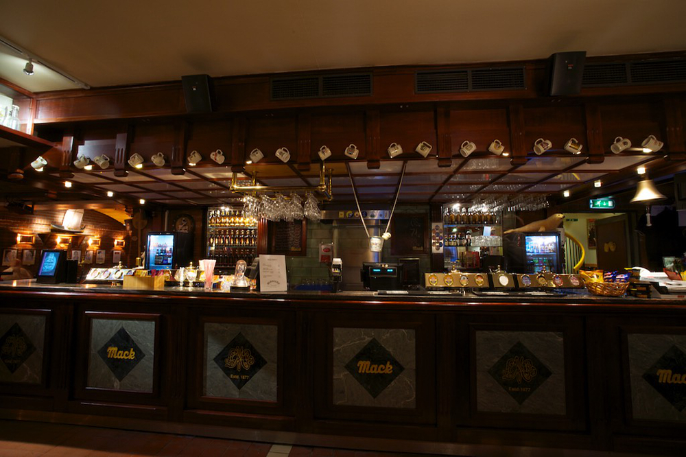
The following days and nights we were forsaken from the weather. But there are nice things to do in Tromsø: Visiting the Mack brewery with its historic „Ølhallen“ for example.
In Skulsfjord we had another short intermezzo with the northern light and that‘s it!
Conclusion:
On the other side of the arctic circle, landscape and nature is beautiful through the whole year.
On the other side of the arctic circle, people are cool and easy.
Northern lights: next time with the Land Rover, and there will be a next time for sure.
Travel in a groups: we keep our „free spirit“…..
Anyway, many thanks to:
Dominik Orth
and his team. They couldn‘t choose the weather but they made the best out of it!
click on the pic


Scotland
Scotland / Alba
Alexander wanted to visit a friend in England . Nicolas, who was a former racing engineer at Courage Compétition and later with Williams F1 started his own business in Yorkshire Dales. Perrinn Ltd. LMP 1 Manufacturer . North Yorkshire is only a few steps from the scotish boarder so it was clear that we would travel to the “Island” with our Land Rover and head further north. It was enough time to comply with all formalities to enter the UK so Jade our dog was able to join us on this trip. Scotland is a great hiking place – let’s say would be…….(more on that later)
In 16 days we made approx. 5’343 km .
Scottish for beginners: Glen = valley , Ben = mountain, Loch = lake, Ale = main drink…..
Day 1: Switzerland – Calais direct on MWY
Day 2:
Ferry ride to Dover ( 90 min.) – stopover in Bussingbourn, Nr Royston at JMC Classic Bikes – MWY direct to the Yorkshire Dales National Park. Camping at Townsend Farm in Malham.
Day 3: Stay with the Perrins – overnight at the Beck Hall, Malham (weather)
Day 4:
Shopping in Settle – via Kendal and A65 to the Lake District – on 952 and 5091 over the Kirkstone Pass – Ullswater – on M6 to Galloway (Scotland). On A47 west and A714 to Wigtown and along B733 to the “Torhouse Stone Circle” then further on to Kirkcowan. We didn’t find the local campground….so A714 north into the Galloway National Forest Park. A short walk without rain above “Loch Trool”. Camping at Glentrool.
Day 5:
Driving in the scottish rain. With a side trip on a Forest Drive to Loch Braday, we drove north through the Galloway Forest till Ardrossan. Ferry to Brodick, Arran ( 50 min.) Roundtrip on the Island to the “Standing Stones of Machrie Moor”, along the west coast and back over “The Ross” to reach the east coast again. Overnight at Middleton’s Camping in Lamlash.
Day 6:
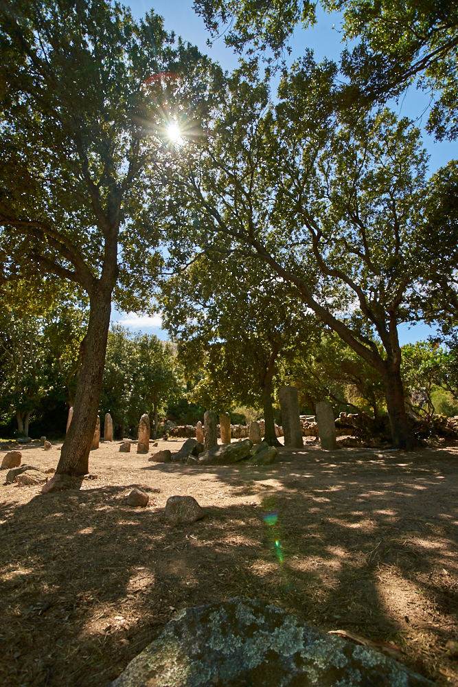
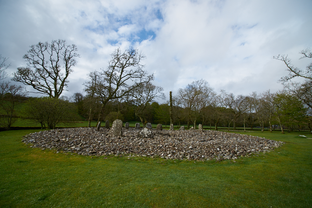
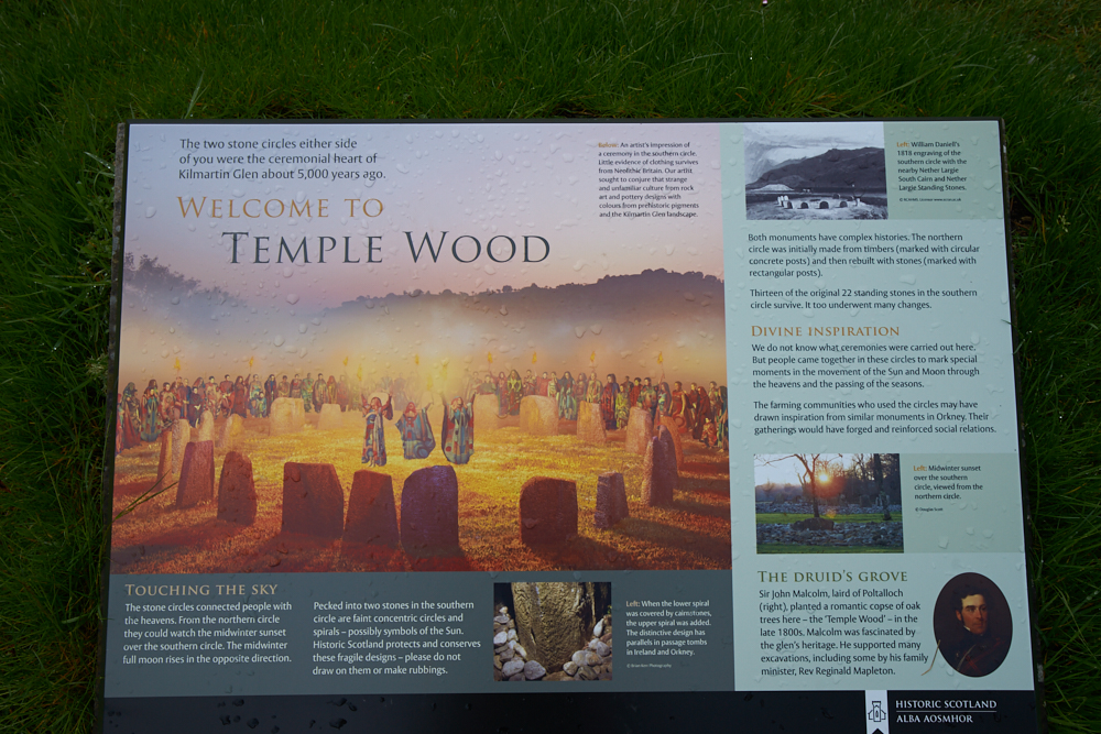
Along the coastal road via Brodick to Lochranza. Short visit of the Arran Distilery. Ferry to Claonaig, Kintyre ( 30 min.) – along B8001 – A83 – B8024 to the realm of the past at Kilmartin and Kilmartin Glen – visit of the Cairns and Standing Stones of “Nether Largie” and ” Temple Wood”. Overnight at the Kilmartin Hotel.
Day 7:
Accompained by rain and hail we drove on B 840 along Loch Awe – Glen Nant – Glen Lonan till Oban. Shopping time: Rainboots for us and a warm coat for Jade….. Ferry to Craignure, Isle of Mull ( 50 min.) – south to the Pennyghael Hotel.
Day 8:
“Round Mull” – visit to the Duart Castle with a walk in its surrounding – A 849 south – we could see egales on the plateau of Glen More – along the Scenic Route B 8035 and B 8073 – where we could watch an otter family playing with birds on the coast. At Fanmore right turn and on a small single trail over a pass to Dervaig – B 8073 to Tobermory and the Western Isles Hotel.
Day 9:
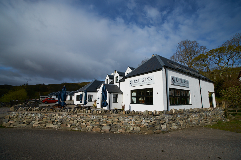
Guided visit of the Distillery – along the main road east to Fishnish – Ferry to Lochaline ( 20 min.) – A 884 north, passing Gleann Geal with sight of herds of red deer – A 861 west – Loch Sunart – to Ardnamuchran along B 8007 to the most westerly point of the british mainland – short walk and coffee break at the lighthouse. We had to drive the same way back – on A 861 to the Glenuig Inn.
Day 10:
Following A 861 north – Loch Ailort – A 830 east direction Fort William – walk along “Neptun’s Staircaise” – a flight of locks of the caledonian canal. Sidetrip to Glen Nevis (bridges in the upper valley are limited to 3t ) – Ben Nevis and the surrounding peaks were still – or again covered with snow – A 82 south- B 863 round Loch Leven back to A 82 – Glen Coe – Rannoch Moor – photostop at Lochan na Stainge – Bridge of Orchy – sidetrip to Loch Tulla. Because there was no camping, we planned to stay at Inveroran Hotel on the Lochside and use our time for a longer walk on the West Highland Trail. Unfortunately the hotel was booked out. The aera is very touristic and Scotts are weatherproofed outdoor people. So further on B 8074 through the very beautiful Glen Orchy – A 85 west – A 819 south – B 840 along the other side of Loch Awe and back to Kilmartin’s nice warm Pub/Hotel again.
Day 11:
Following A 83 north to Loch Fyne and Inveraray – A 814 south along Loch Long till Helensbourgh near Glasgow – visit of the “Hill House” designed by Charles Rennie Mackintosh. For once the weather was friendly so we looked out for a nice campground at Loch Lomond, it was Friday, the aera a destination for tourists and townsmen. “Booked” – “for members only”…. didn’t I see a sign “campsite” further north at the A 83? – so back north. Unfortunately the camping was transformed to a cottage village but the sign was still there….ment, all the way back direction Glasgow and further on M 898 and M 8 south/west. There must be campgrounds along the coast….we only found golf courses, resorts and fully booked Inn’s during 4 hours drive.Finally we’ve found a bed on the side of A 713 in the Galloway Forest Park. Overnight in the little bit fusty Lochinvar Hotel near New Galloway.
Day 12:
Via Dumfries on A 75 to Gretna Green – M 6 south to Penrith following A 66 to Keswick, the Lake District National Park and the Cumbrian Mountains – accompaigned again by heavy rain! Many aeras in UK were flooded and roads were closed on this day. We had good luck! After a short break in lovely Grasmere we were able to continue our drive on the planned route. A 593 to Skelwith Bridge – B 5343 till Great Langdale – further on the small single trail over Wrynose Pass and Hardknott Pass to Eskdale Green – Santon Bridge – along the Wast Water to the Wasdale Head Camping.
Day 13:
DirectionRavenglass – A 595 – just before Waberthwaite turned east on a small Single Trail over Corney Fell – A 5092 – A 592 – B5284 – via Kirby Lonsdale and Settle, back to Airton in Yorksire Dales NP to see our friends again. It was the only day on the whole trip without rain and it was Sunday. Everyone was outside, also a local group who performed the Moorish Dance. We used the day for a walk and photoshooting at Malham Cave and spent another night on the Farm Camping in Malham.
Day 14:
Straight on M 1 to Castle Donington and the flat of the legendary Norton Bikes. We had a very warm welcome and an unexpected almost private visit of the whole production. Following M 1 south to Odsey near Royston where we spent the nigth in a small Inn.
Day15:
Another stopover at JMC Classics – they had a Norvin for maintenance ( Norton Manx Frame with Vincent engine) – we had to see this bike! Ferry to Calais later in the afternoon.
Tag 16: MWY back home
Road Maps & Single Track Roads
AA Road Atlas 2012 Great Britain and Ireland 4 miles to 1 inch scale. This map is pretty good on roads but the Tourist Informations (Campgrounds etc.) are not always up to date.
I can describe Single Track Roads in Scotland shown in the above mentioned map as follows: Red = relatively clear overview, our ∅ speed was approx. 50-60 km/h Yellow = narrow, blind bends, lorries on the way, our ∅ was approx. 40 km/h White = very narrow, often rough surface, bridges are often narrow and limited to 3t, or one has to find out ;-), our ∅ was approx. 30 km/h
White in England = very narrow Single Tracks often with dry stone walls on both sides and therefore with blind bends.
Exept of the “Forest Drives” all roads are tarmac roads. Unfortunately there are very few possibilities to park along the roads and I don’t recommend to park on the field – marshland says hello….
Travel season and weather
I cannot give a clear comment on this because we had extreamly bad weather conditions with only one single day without rain. Even scottish people complained about. It was so wet that the water had no place to go. Strong wind, rain and snow on the peaks round Ben Navis and even on top of Ben More at Isle of Mull. This is the reason why we spent only few nights on campgrounds.
Landscape, Wildlife & what to see
- Yorkshire Dales National Park and Malham Cove
- Wrynose- and Hardknott Pass in the Cumbrian Mountains – very narrow tracks with 30% of inclination.
- Kilmartin Glen with its archaeological sites.
- Isle of Mull – Golden- and Sea eagles can be seen near Glen More
- Gleann Geal (high stock of wildlife), Ardnamuchran and the (wild) west coast
Good hosts
- Kilmartin Hotel & Pub: lovely refurbished rooms – good food – local beer
- Glenuig Inn in the same named village – good organic food – local beer
- Riverside Farm Camping, Townshead Farm, Malham – pretty and friendly
Conclusion
You better plan a trip to Scotland. Campgrounds are rare and sleeping in the field quit difficult. There are no off road possibilities without taking the risk of getting stuck in the marsch. Forest drives are operated and lorries are on the way. So there are only the official parkings with the signes forbidden…. Scottish people as well as Brit’s are very friendly to their guests – we always felt welcome so did our dog. On weekends the small Inn’s are often fully booked and if one is not flexible to change the travel route, you better book in advance. We didn’t look for B&B’s because the dog was with us but Hotels were never a problem. Rainboods and all weather gear is a must. We had no mosqitos in these conditions.
click on the pic


Vikings
In the footsteps of the Vikings
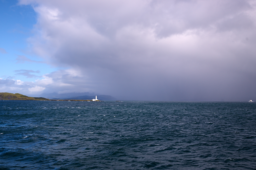
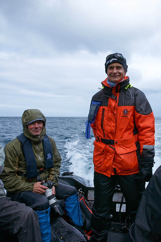
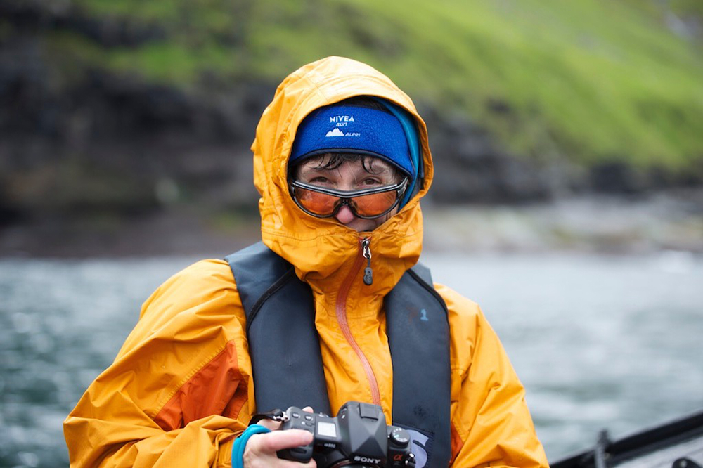
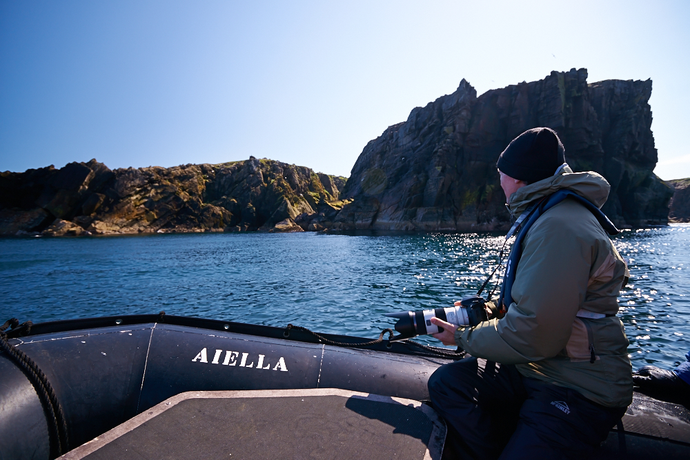
14 days on board the M/V Silver Explorer. Together with Captain Stahlberg and his crew „in the footsteps of the Vikings.“
The M/V Silver Explorer is a comfortable expedition vessel with ice classification 1A. During winter on tour around Antarctica, during summer in the arctic regions.
Route:
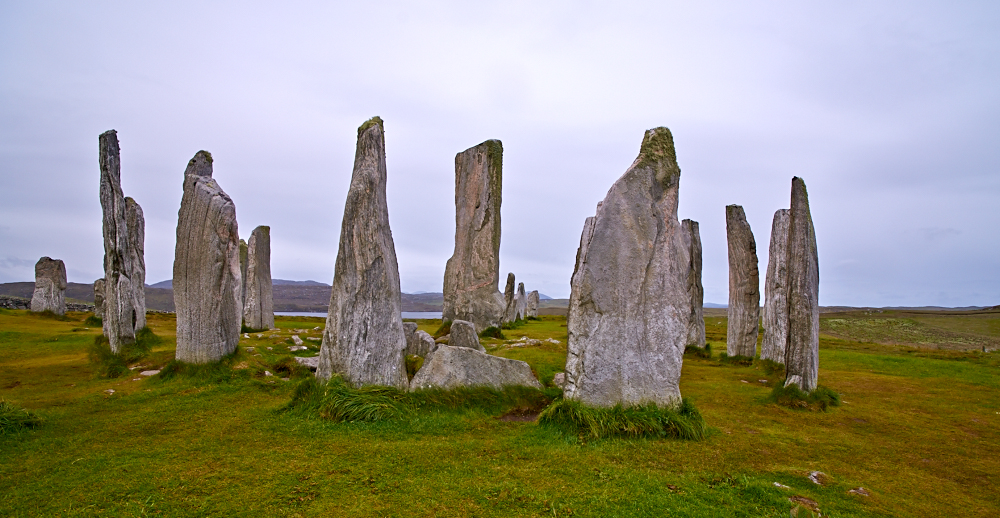
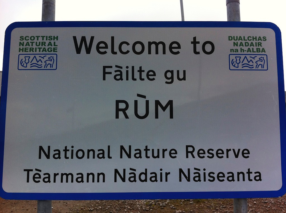
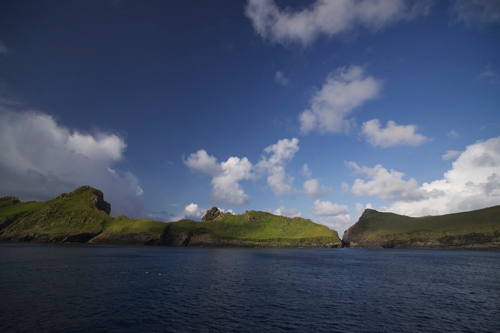
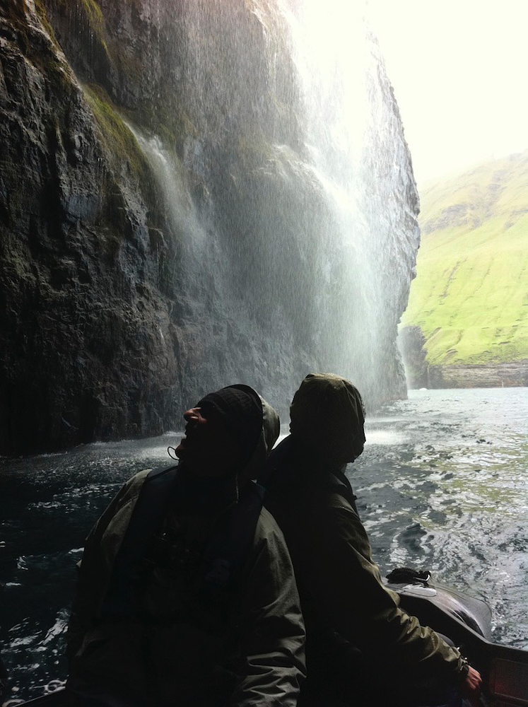
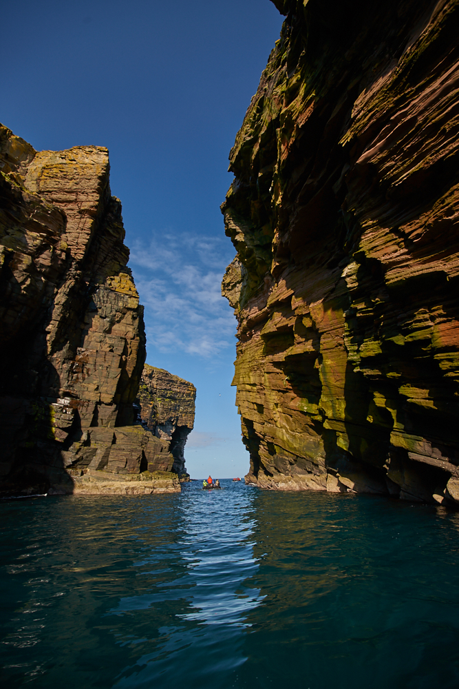
Leith (Edinburgh) – Orkney Islands – Isle of Lewis – Isle of Rum – Isle of Mull – St. Kilda (Scotland) – Faeroe Islands – Lerwick (Shetland Islands) – Isle of Noss – Bergen – Helsingør – Bornholm – Lübeck
Weather:
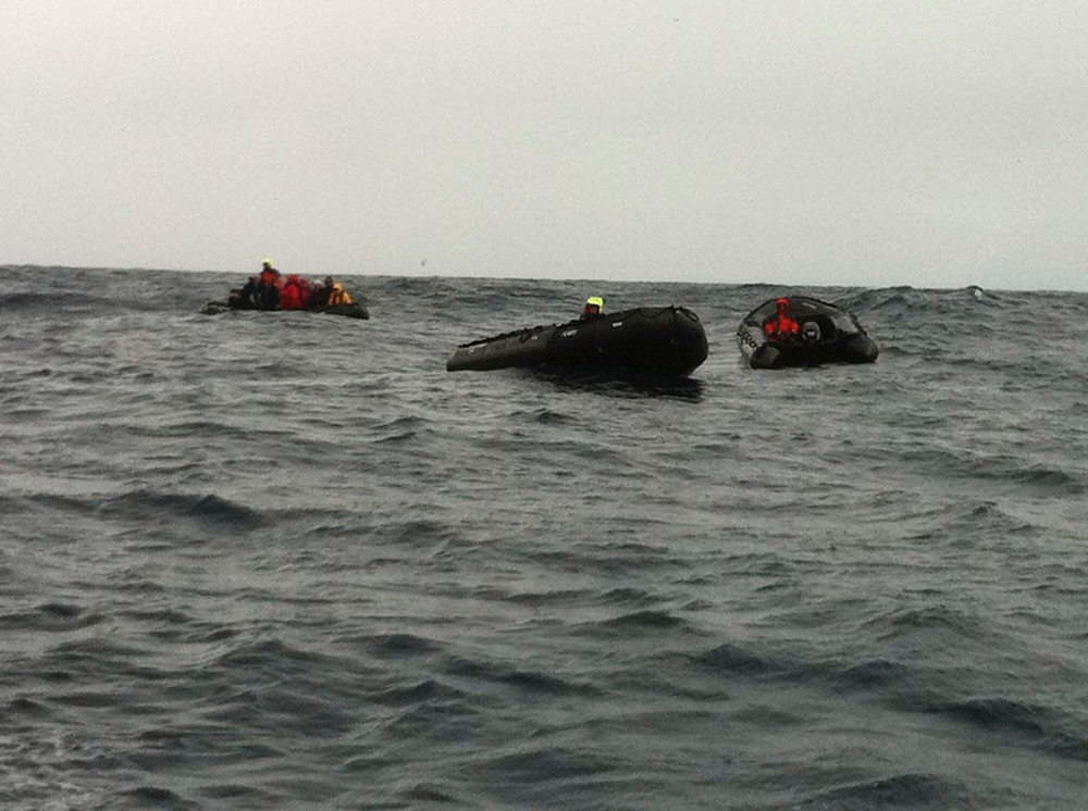
Spring storms – our true companions….. providing us not only fantastic weather scenery but also great zodiac experience – just fun…
Places of interest:
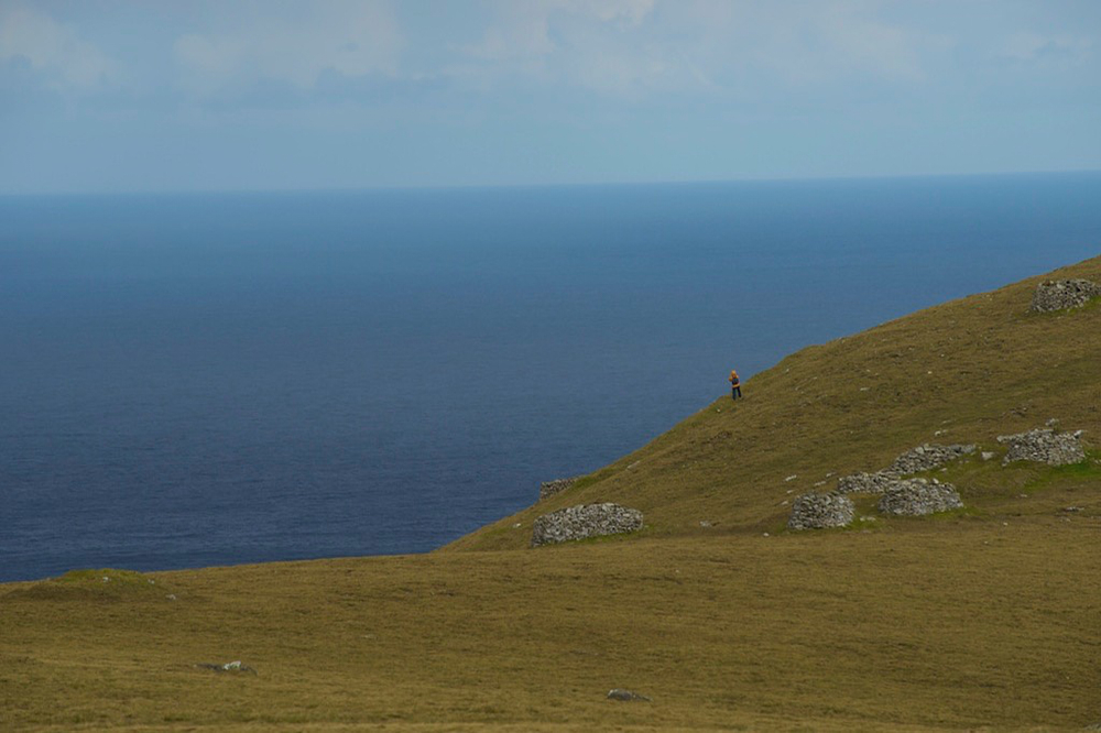
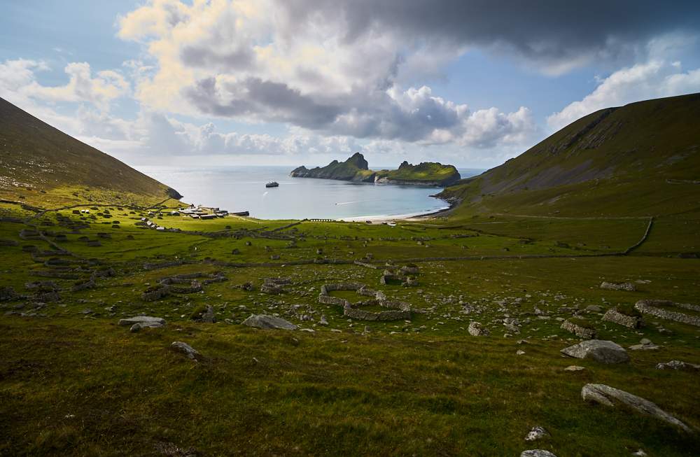
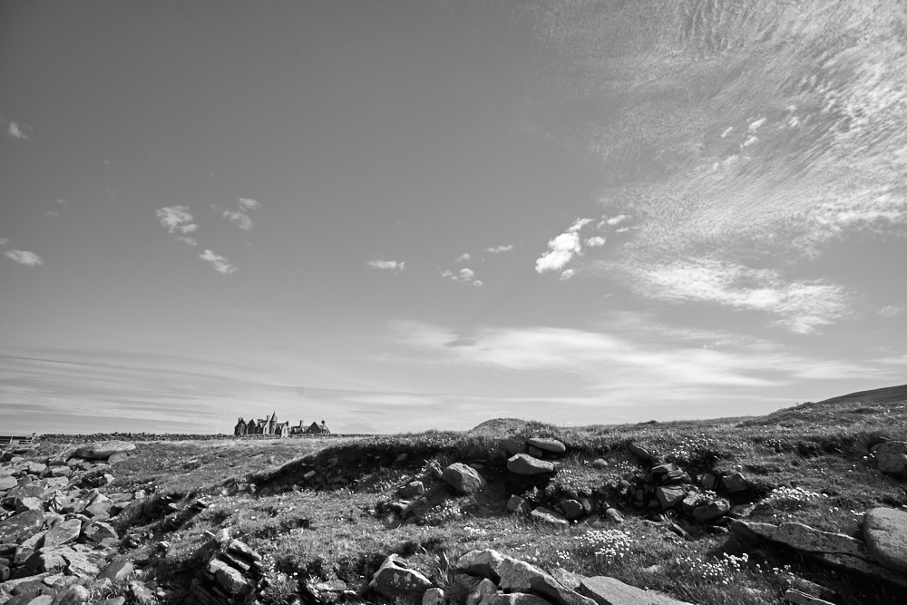
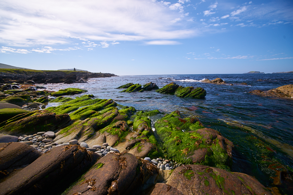
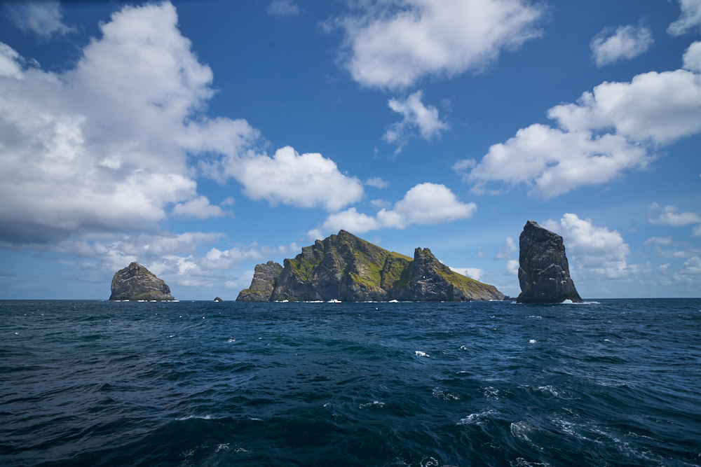
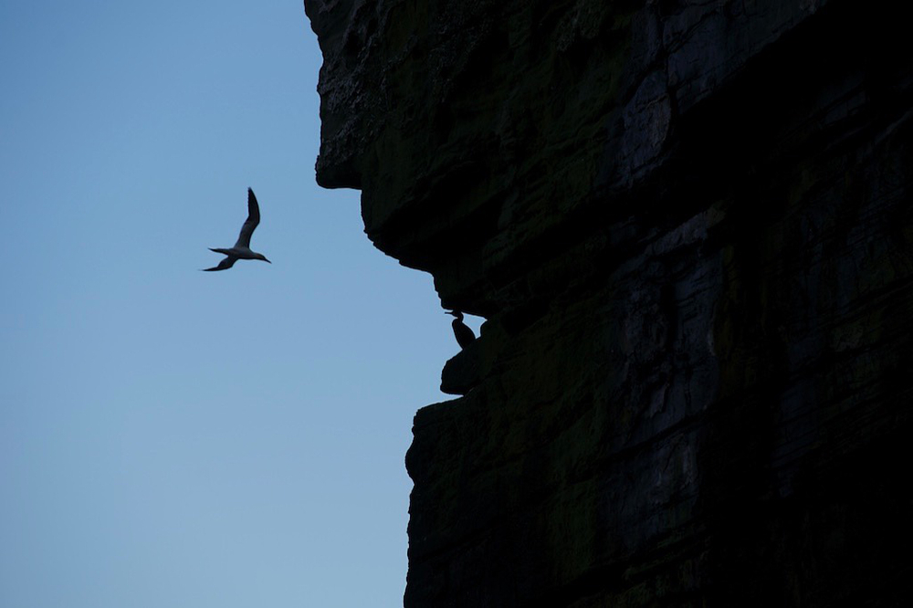
Orkney Islands and their beautiful dry stone walls. Standing Stones from „Callanish“ on Isle of Lewis. St.Kilda, can be reached only by boat. The Bird cliffs from Isle of Noss.
After this boat trip, Scotland is on top of the list to visit with our „Landi“….
click on the pic


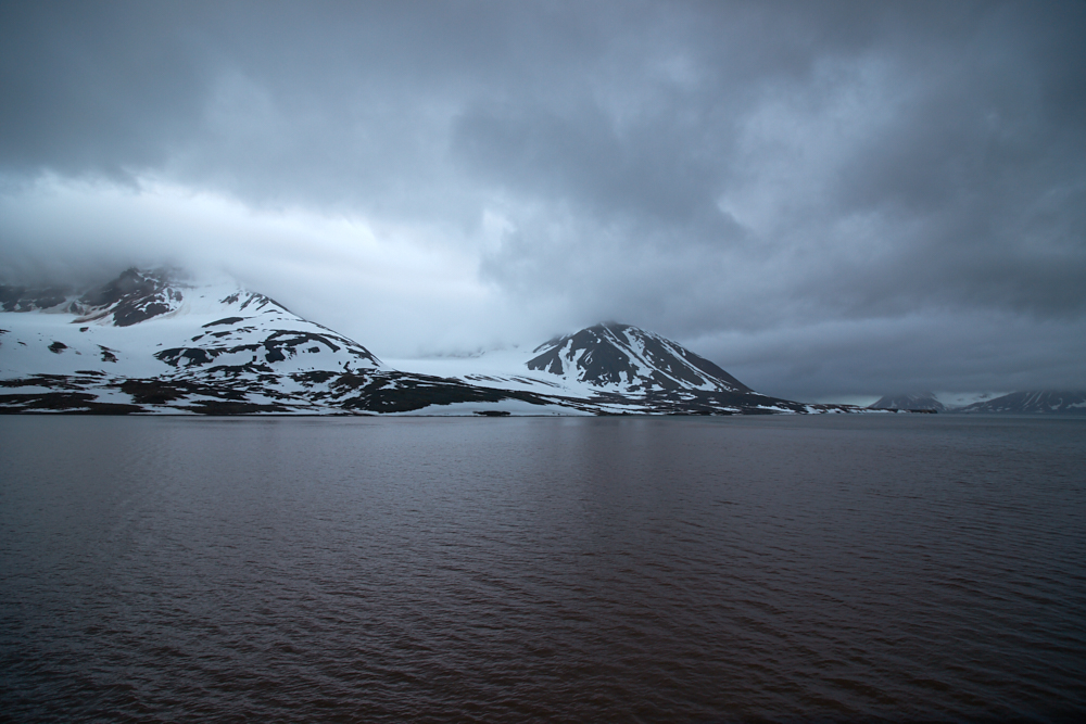
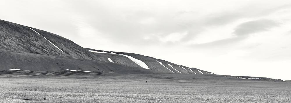
Svalbard EN
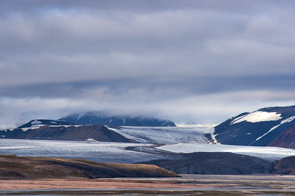
Svalbard / Spitzbergen
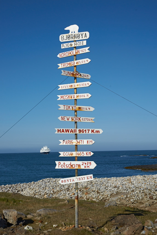
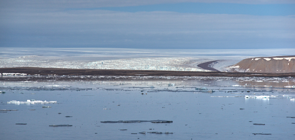
One more tour aboard M/V Silver Explorer, but this time further north into the Arctic to Svalbard. The group of islands belongs to Norway and is positioned between 74° und 81° north and east of Greenland.
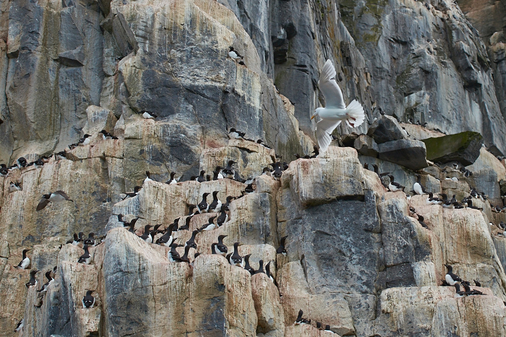
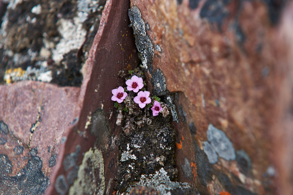
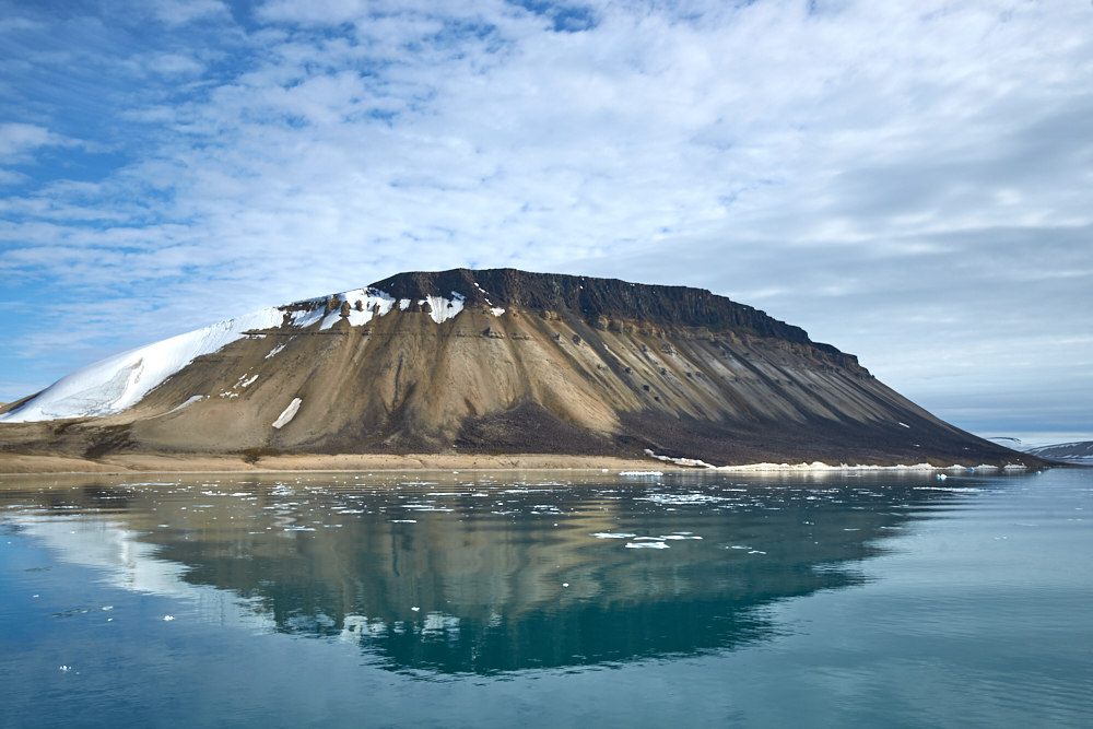
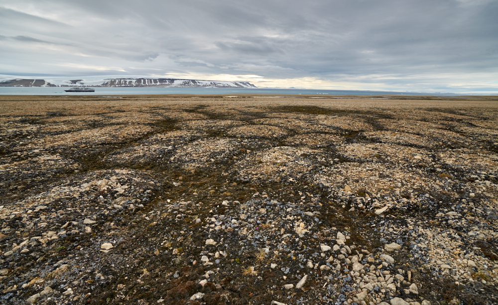
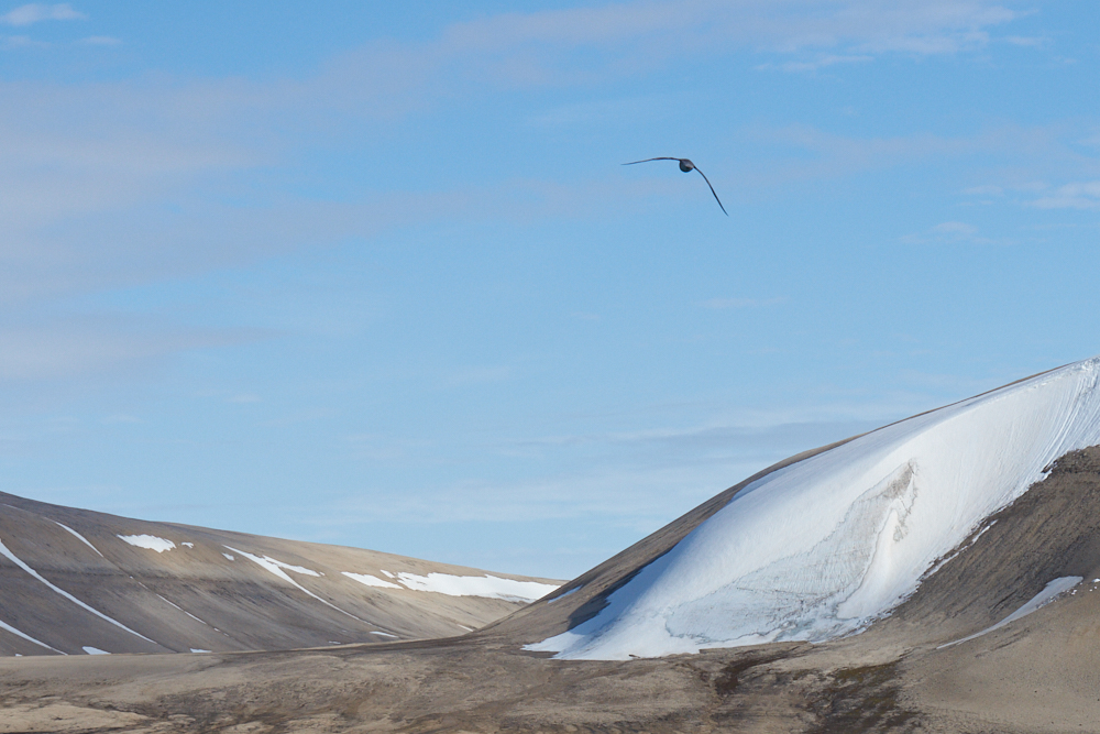
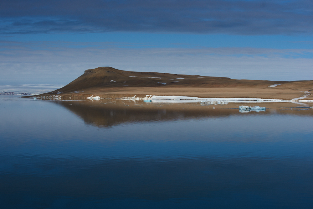
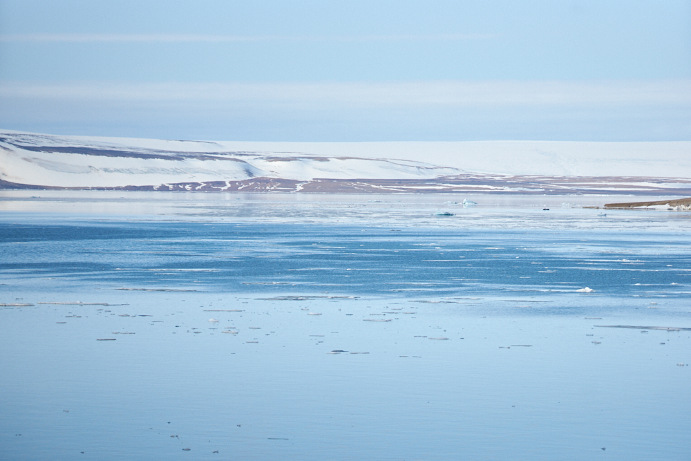
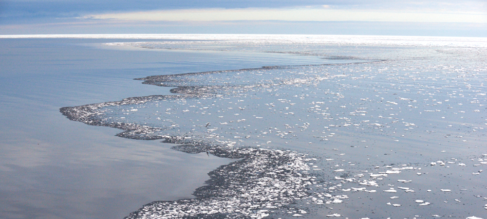
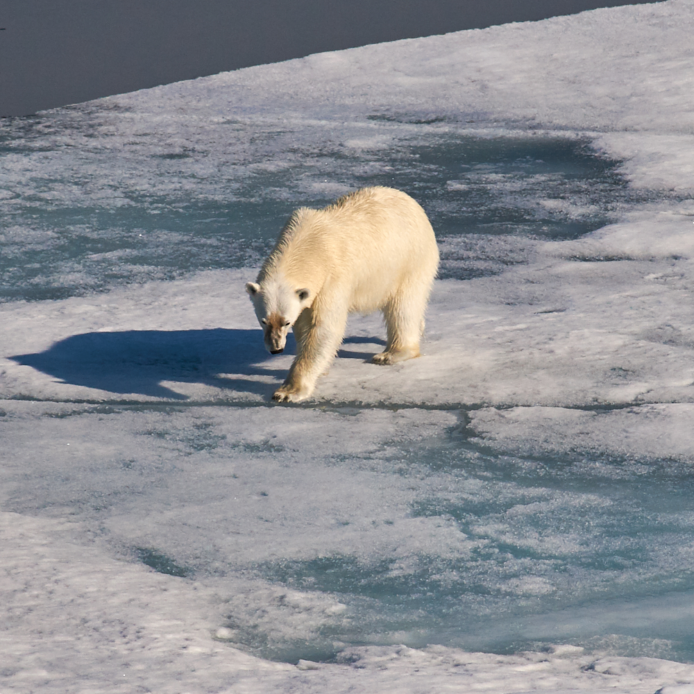
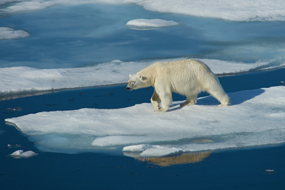
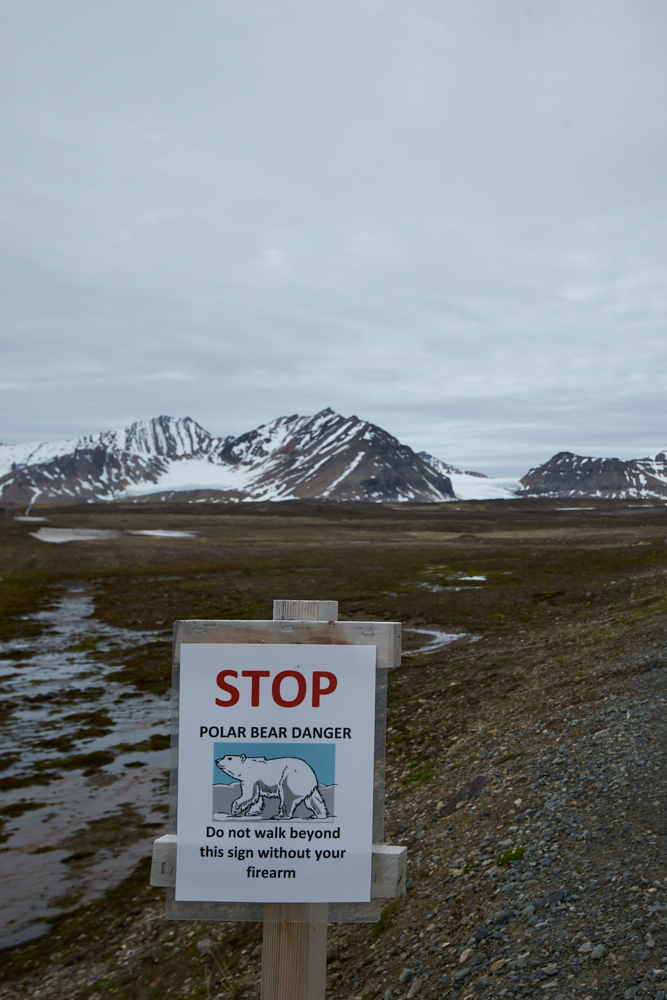
Within a more or less small range, one can experience the whole beauty of the Arctic. Rough mountain landscape, glaciers that run down into the sea or fjords, plateaus with sparse vegetation, arctic desert and of course the sea and pack ice. Bird cliffs that are very busy during breeding season, reindeers, arctic fox, seals, walrus, depending on time of the year different species of whales and most important – the “king of the Arctic” – the polar bear. One cannot explore Svalbard by car. There are no roads or tracks and only few settlements mostly research stations, outside the main village Longyearbyen. The ones that are on tour by trekking, boat, husky sled or ski have to sign in (and out), apply for authorization, carry a weapon or even better travel with a guide. Not only the polar bears are protected but also wide parts of the land- and seascapes are nature reserves and approach is very restricted.
On our 10-day cruise we were accompaigned by 3 bear guards.
Route:
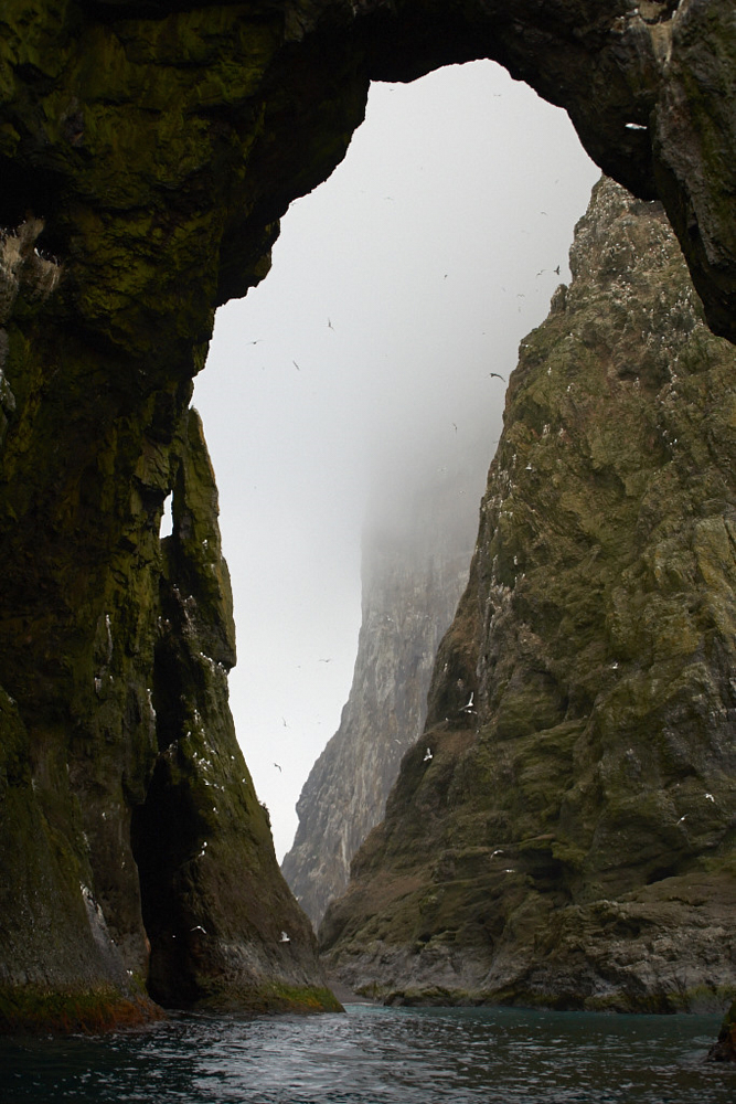
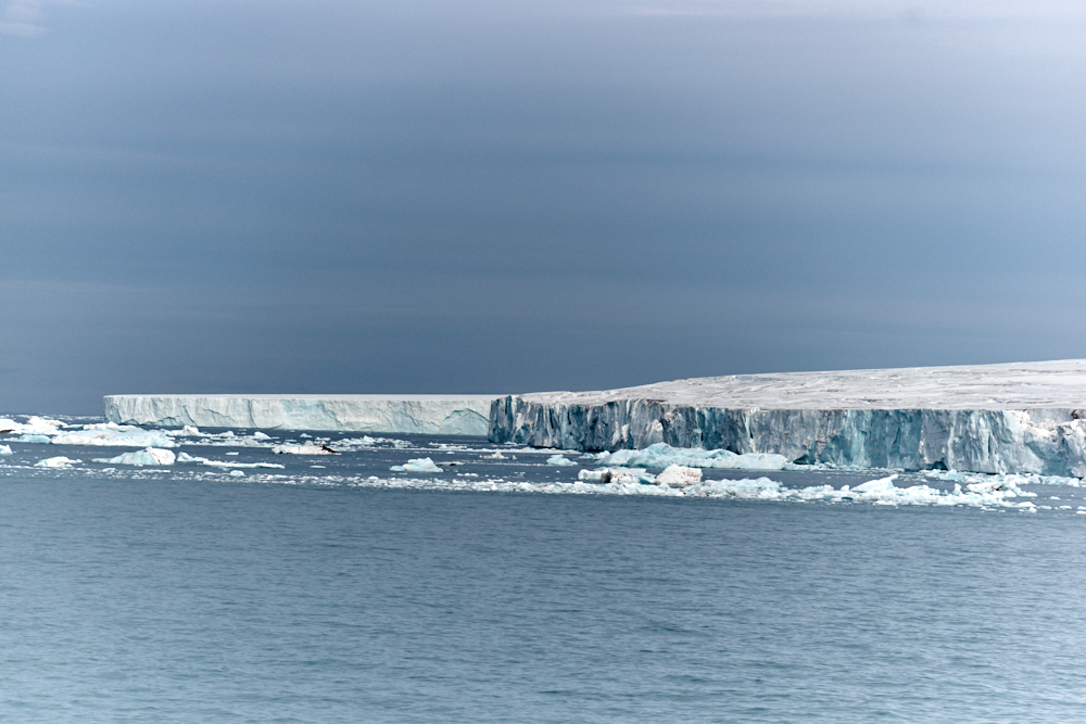
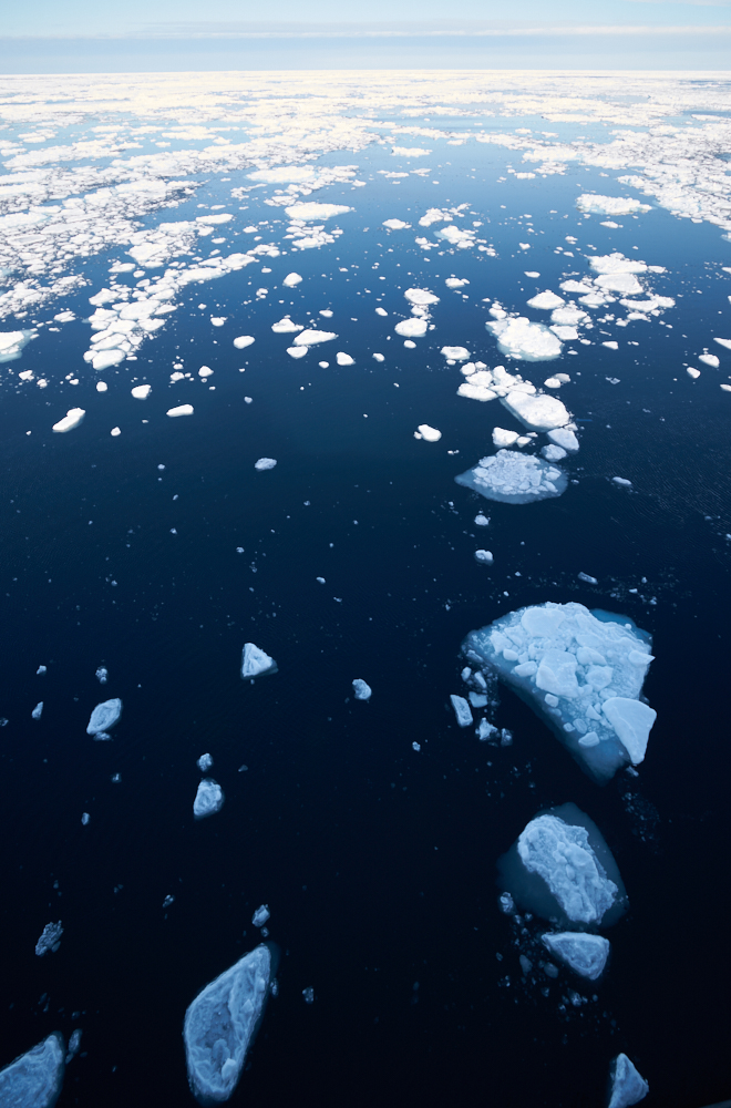
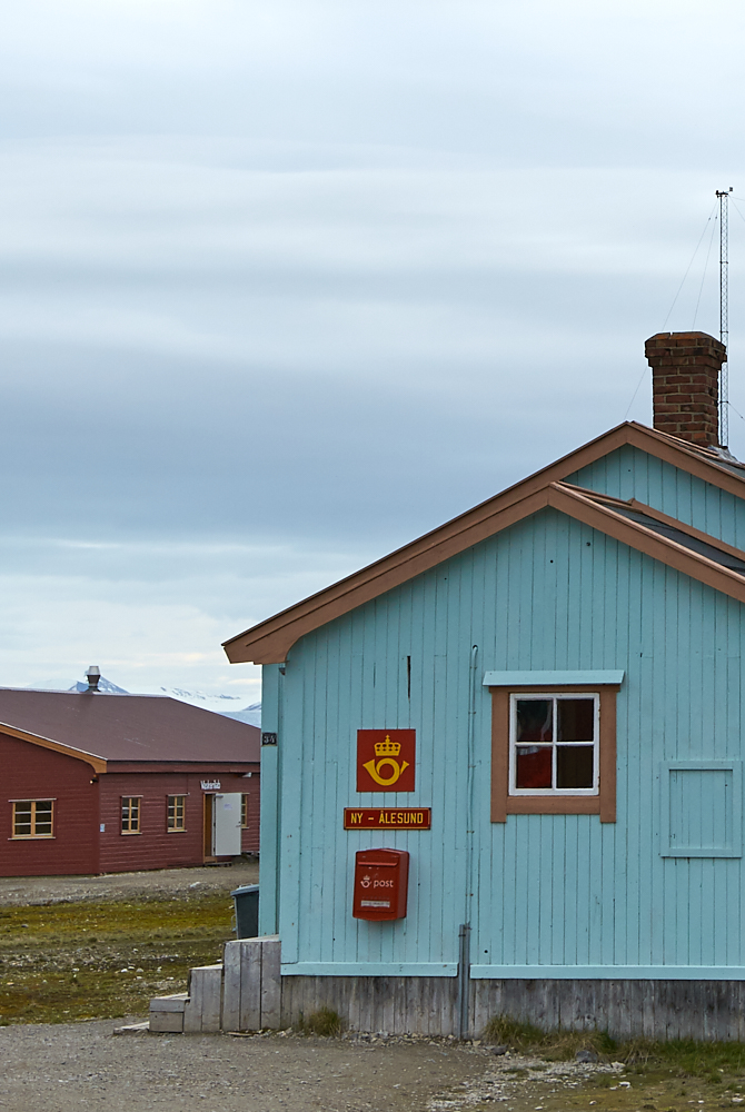
Tromsø – day on sea – Bjørnøya (Bearisland) – Hornsund, Burgerbukta and Gnålodden – the island Edgeøya, Kapp Lee and Diskobukta – Freemansundet – Olgastretet – along the edge of Bråsvelbreem – Wilhelmøya – Bjørnsundet – Hinlopenstretet – Birdcliffs Alkefjellet – Faksevågen in the Lomfjord – Zeipelodden (Wahlenbergfjord) and Palanderbukta at Nordaustlandet – 80°28’N 17°19’E we have reached the pack ice – Ny Ålesund – Fjortende Julibukta at Krossfjord – St. Jonsfjord – Poolepynten – Longyearbyen
Total distance of 1324 nautical miles
Shortest distance between vessel and North Pole: approx. 620 miles (not nautical)
Landscape and sights of wildlife:
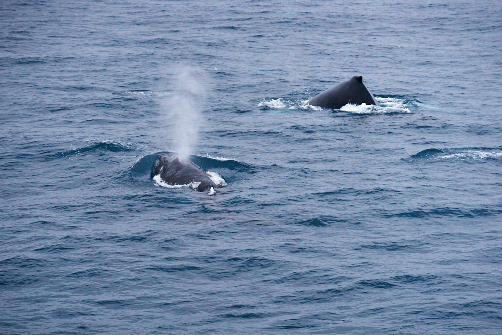
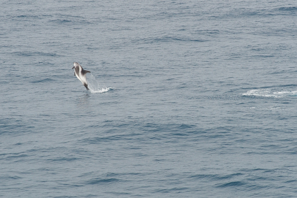
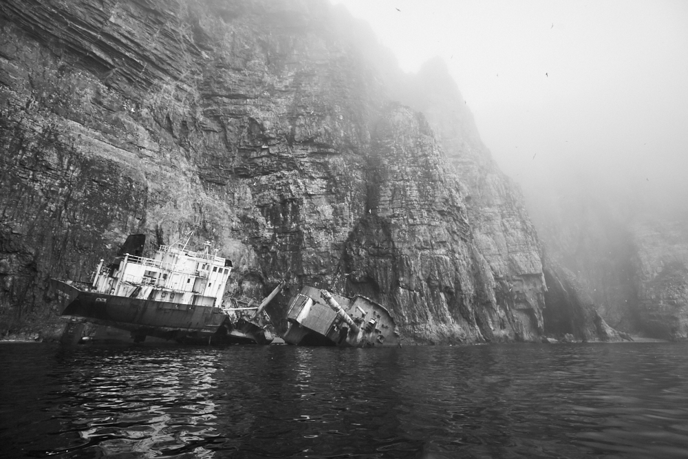
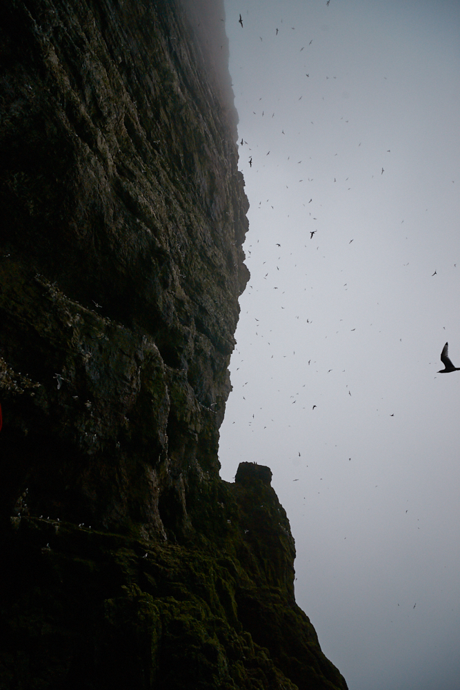
- White-beaked Dolphins and a Humpback whale with baby, seen on the way to Bjørnøya
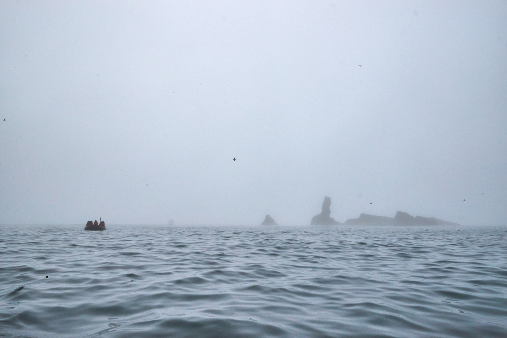
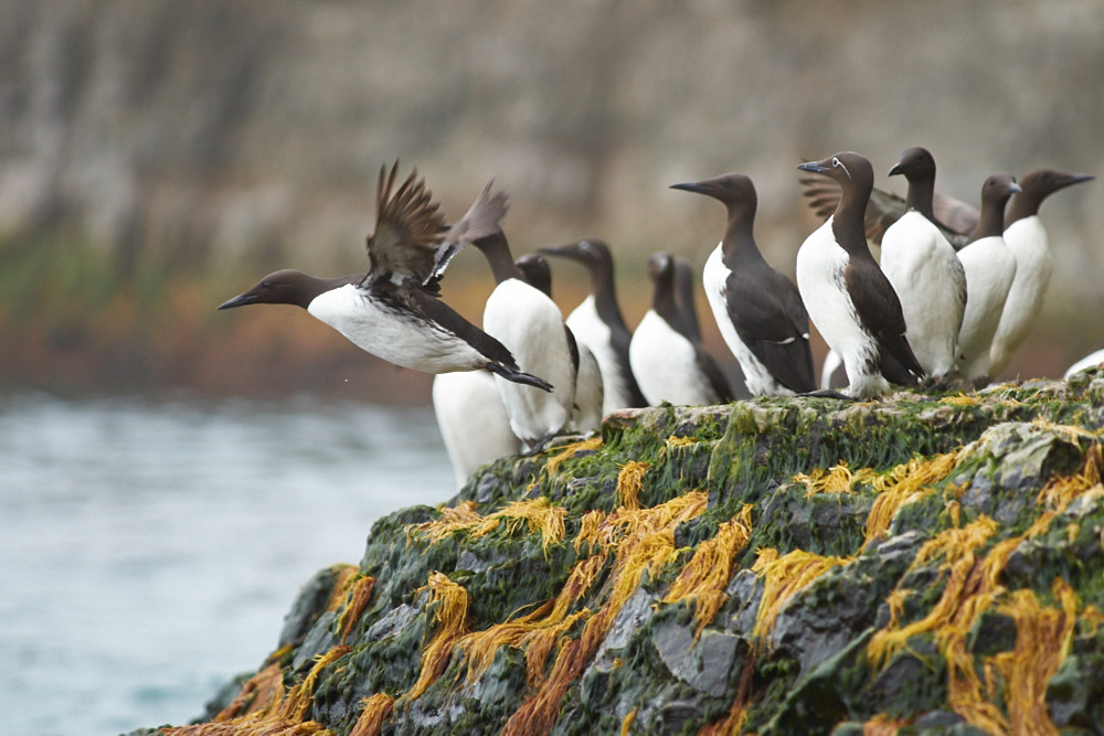
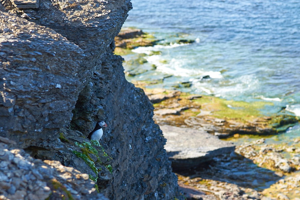
- Birdcliffs along Bjørnøja (u.A. Puffins )
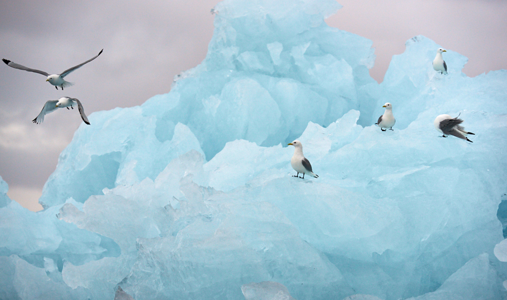
- Floating ice and Icebergs at Burgerbukta near Muehlbacherbreen (video )
- Walrus at Kapp Lee
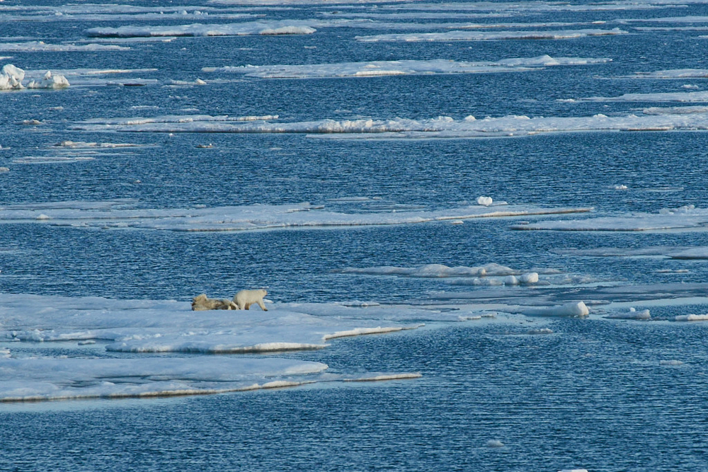
- Sleeping polar bear at Diskobukta ( the reason why there was no landing…..)
- Polar bear (female) with cub at Olgastretet
- Birdcliffs at Alkefjellet
- The never ending edge of Bråsvelbreen (approx. 112 miles)
- Arctic desert and stone rings near Zeipelodden
- Crusing the pack ice under blue sky ( the vessel has scandinavian ice break classification 1A ) and the propably most spectacular experience with a female polar bear ( video )
- Hike onto the quite active calving Fjortende Juli glacier
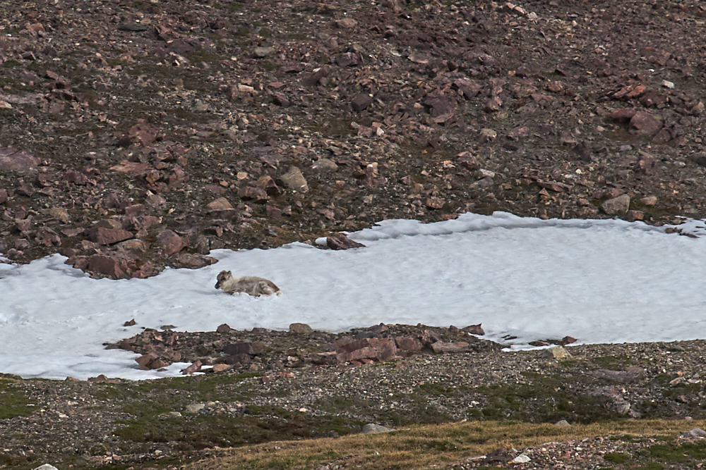
- Reindeers on a hike near St. Jonsfjord. Reindeers at Svalbard are wild animals and have no natural predators
- Several sights of seals, mostly bearded seals
Conclusion:
Svalbard and the Arctic in general has left a deep impact to us. Excitement about the wonderful nature, the rough landscapes, the silence. But Svalbard makes one thinking: We had temperatures up to 50° F ! As we were told by the bear guard Peter, the Hinlopenstreet is usualy not passable before August. Our Captain has found the pack ice quite a way further north and he has spent some time on searching for it. Polar bears that didn’t make their way to the ice will face a very tough summer with poor amount of food or even longer periods of fasting. Especially females with their cubs have to suffer a lot on this. Anyway it was a privilege for having the possibility to experience all this – let the fotos and movies speak……
click on the pic